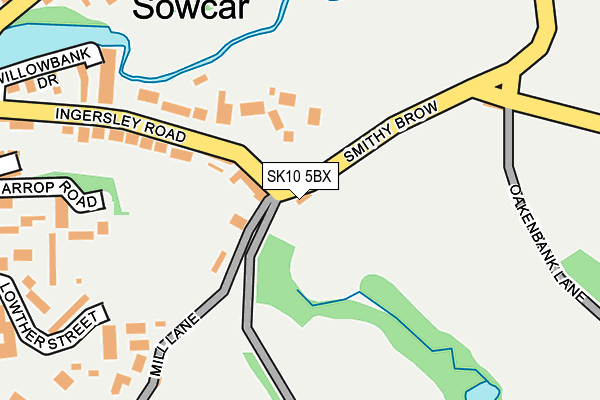
SK10 5BX is located in the Sutton electoral ward, within the unitary authority of Cheshire East and the English Parliamentary constituency of Macclesfield. The Sub Integrated Care Board (ICB) Location is NHS Cheshire and Merseyside ICB - 27D and the police force is Cheshire. This postcode has been in use since January 1980.


GetTheData
Source: OS OpenMap – Local (Ordnance Survey)
Source: OS VectorMap District (Ordnance Survey)
Licence: Open Government Licence (requires attribution)
| Easting | 394289 |
| Northing | 377857 |
| Latitude | 53.297653 |
| Longitude | -2.087146 |
GetTheData
Source: Open Postcode Geo
Licence: Open Government Licence
| Country | England |
| Postcode District | SK10 |
| ➜ SK10 open data dashboard ➜ See where SK10 is on a map ➜ Where is Bollington? | |
GetTheData
Source: Land Registry Price Paid Data
Licence: Open Government Licence
Elevation or altitude of SK10 5BX as distance above sea level:
| Metres | Feet | |
|---|---|---|
| Elevation | 170m | 558ft |
Elevation is measured from the approximate centre of the postcode, to the nearest point on an OS contour line from OS Terrain 50, which has contour spacing of ten vertical metres.
➜ How high above sea level am I? Find the elevation of your current position using your device's GPS.
GetTheData
Source: Open Postcode Elevation
Licence: Open Government Licence
| Ward | Sutton |
| Constituency | Macclesfield |
GetTheData
Source: ONS Postcode Database
Licence: Open Government Licence
| December 2023 | Violence and sexual offences | On or near Hamson Drive | 493m |
| September 2023 | Anti-social behaviour | On or near Hamson Drive | 493m |
| February 2023 | Other crime | On or near Hamson Drive | 493m |
| ➜ Get more crime data in our Crime section | |||
GetTheData
Source: data.police.uk
Licence: Open Government Licence
| Beeston Mount (Shrigley Road) | Bollington | 347m |
| Cotton Tree (Ingersley Road) | Bollington | 360m |
| Beeston Mount (Shrigley Road) | Bollington | 361m |
| Cotton Tree (Palmerston Street) | Bollington | 366m |
| Cotton Tree (Palmerston Street) | Bollington | 387m |
| Prestbury Station | 3.9km |
| Adlington (Cheshire) Station | 3.9km |
| Macclesfield Station | 4.9km |
GetTheData
Source: NaPTAN
Licence: Open Government Licence
| Percentage of properties with Next Generation Access | 100.0% |
| Percentage of properties with Superfast Broadband | 100.0% |
| Percentage of properties with Ultrafast Broadband | 50.0% |
| Percentage of properties with Full Fibre Broadband | 0.0% |
Superfast Broadband is between 30Mbps and 300Mbps
Ultrafast Broadband is > 300Mbps
| Percentage of properties unable to receive 2Mbps | 0.0% |
| Percentage of properties unable to receive 5Mbps | 0.0% |
| Percentage of properties unable to receive 10Mbps | 0.0% |
| Percentage of properties unable to receive 30Mbps | 0.0% |
GetTheData
Source: Ofcom
Licence: Ofcom Terms of Use (requires attribution)
GetTheData
Source: ONS Postcode Database
Licence: Open Government Licence


➜ Get more ratings from the Food Standards Agency
GetTheData
Source: Food Standards Agency
Licence: FSA terms & conditions
| Last Collection | |||
|---|---|---|---|
| Location | Mon-Fri | Sat | Distance |
| Orme Smithy Rainow | 17:15 | 07:30 | 254m |
| Shrigley Road | 18:00 | 11:30 | 322m |
| Lord Street | 17:45 | 11:30 | 503m |
GetTheData
Source: Dracos
Licence: Creative Commons Attribution-ShareAlike
| Facility | Distance |
|---|---|
| Bollington St John's Ce Primary School Grimshaw Lane, Bollington, Macclesfield Grass Pitches | 1km |
| Bollington Recreation Ground Adlington Road, Bollington Grass Pitches, Outdoor Tennis Courts | 1.1km |
| Aw Muscle And Fitness Grimshaw Lane, Bollington, Macclesfield Health and Fitness Gym, Studio | 1.5km |
GetTheData
Source: Active Places
Licence: Open Government Licence
| School | Phase of Education | Distance |
|---|---|---|
| Bollington St John's CofE Primary School Grimshaw Lane, Bollington, Macclesfield, SK10 5LY | Primary | 1km |
| Arnfield Independent School C/O Arnfield Care Ltd, Manchester Road, Tintwistle, Glossop, SK13 1NE | Not applicable | 1.2km |
| Pott Shrigley Church School Shrigley Road, Pott Shrigley, Macclesfield, SK10 5RT | Primary | 1.4km |
GetTheData
Source: Edubase
Licence: Open Government Licence
The below table lists the International Territorial Level (ITL) codes (formerly Nomenclature of Territorial Units for Statistics (NUTS) codes) and Local Administrative Units (LAU) codes for SK10 5BX:
| ITL 1 Code | Name |
|---|---|
| TLD | North West (England) |
| ITL 2 Code | Name |
| TLD6 | Cheshire |
| ITL 3 Code | Name |
| TLD62 | Cheshire East |
| LAU 1 Code | Name |
| E06000049 | Cheshire East |
GetTheData
Source: ONS Postcode Directory
Licence: Open Government Licence
The below table lists the Census Output Area (OA), Lower Layer Super Output Area (LSOA), and Middle Layer Super Output Area (MSOA) for SK10 5BX:
| Code | Name | |
|---|---|---|
| OA | E00094229 | |
| LSOA | E01018669 | Cheshire East 020C |
| MSOA | E02003872 | Cheshire East 020 |
GetTheData
Source: ONS Postcode Directory
Licence: Open Government Licence
| SK10 5RF | Ingersley Road | 160m |
| SK10 5RE | Ingersley Road | 195m |
| SK10 5BU | Mill Lane | 210m |
| SK10 5DH | Foxglove Close | 222m |
| SK10 5QS | Harrop Road | 247m |
| SK10 5QW | Sowcar Way | 258m |
| SK10 5DG | Willow Bank Drive | 277m |
| SK10 5QP | Rainow View | 279m |
| SK10 5QQ | Lowther Street | 284m |
| SK10 5QR | Shrigley Rise | 285m |
GetTheData
Source: Open Postcode Geo; Land Registry Price Paid Data
Licence: Open Government Licence