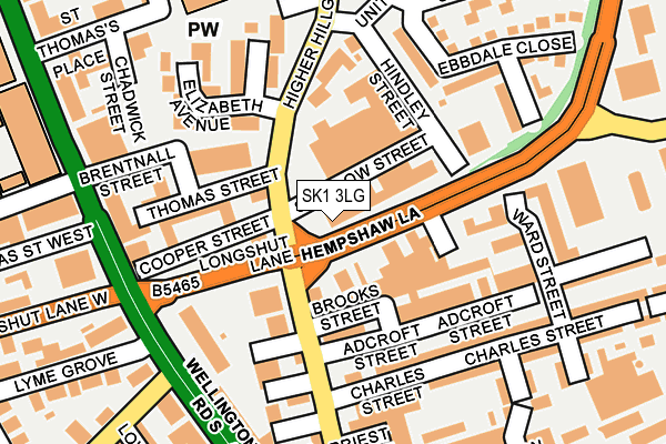
SK1 3LG is located in the Brinnington & Stockport Central electoral ward, within the metropolitan district of Stockport and the English Parliamentary constituency of Stockport. The Sub Integrated Care Board (ICB) Location is NHS Greater Manchester ICB - 01W and the police force is Greater Manchester. This postcode has been in use since June 1981.


GetTheData
Source: OS OpenMap – Local (Ordnance Survey)
Source: OS VectorMap District (Ordnance Survey)
Licence: Open Government Licence (requires attribution)
| Easting | 389910 |
| Northing | 389443 |
| Latitude | 53.401712 |
| Longitude | -2.153222 |
GetTheData
Source: Open Postcode Geo
Licence: Open Government Licence
| Country | England |
| Postcode District | SK1 |
| ➜ SK1 open data dashboard ➜ See where SK1 is on a map ➜ Where is Stockport? | |
GetTheData
Source: Land Registry Price Paid Data
Licence: Open Government Licence
Elevation or altitude of SK1 3LG as distance above sea level:
| Metres | Feet | |
|---|---|---|
| Elevation | 70m | 230ft |
Elevation is measured from the approximate centre of the postcode, to the nearest point on an OS contour line from OS Terrain 50, which has contour spacing of ten vertical metres.
➜ How high above sea level am I? Find the elevation of your current position using your device's GPS.
GetTheData
Source: Open Postcode Elevation
Licence: Open Government Licence
| Ward | Brinnington & Stockport Central |
| Constituency | Stockport |
GetTheData
Source: ONS Postcode Database
Licence: Open Government Licence
| June 2022 | Violence and sexual offences | On or near Cale Street | 496m |
| April 2022 | Violence and sexual offences | On or near Brookfield Avenue | 489m |
| February 2022 | Violence and sexual offences | On or near Longshut Lane | 403m |
| ➜ Get more crime data in our Crime section | |||
GetTheData
Source: data.police.uk
Licence: Open Government Licence
| Higher Hillgate/Elizabeth Ave (Higher Hillgate) | Stockport | 78m |
| Higher Hillgate/Hempshaw Ln (Higher Hillgate) | Heaviley | 82m |
| Longshut Ln/Wellington Rd South (Longshut Lane) | Heaviley | 95m |
| Hempshaw Ln/St Mary's Way (Hempshaw Ln) | Heaviley | 117m |
| Longshut Ln/Wellington Rd South (Longshut Lane) | Heaviley | 141m |
| Stockport Station | 0.8km |
| Davenport Station | 1.2km |
| Woodsmoor Station | 1.9km |
GetTheData
Source: NaPTAN
Licence: Open Government Licence
GetTheData
Source: ONS Postcode Database
Licence: Open Government Licence


➜ Get more ratings from the Food Standards Agency
GetTheData
Source: Food Standards Agency
Licence: FSA terms & conditions
| Last Collection | |||
|---|---|---|---|
| Location | Mon-Fri | Sat | Distance |
| Hillgate | 18:30 | 11:45 | 171m |
| Ward Street | 17:30 | 12:15 | 204m |
| Wellington Grove | 17:30 | 12:30 | 247m |
GetTheData
Source: Dracos
Licence: Creative Commons Attribution-ShareAlike
| Facility | Distance |
|---|---|
| St Thomas C Of E Primary School Marriott Street, Stockport Sports Hall, Artificial Grass Pitch | 302m |
| Puregym (Stockport South) Hempshaw Lane, Stockport Health and Fitness Gym, Studio | 304m |
| Workhouse Gym (Closed) Shaw Heath, Stockport Health and Fitness Gym | 434m |
GetTheData
Source: Active Places
Licence: Open Government Licence
| School | Phase of Education | Distance |
|---|---|---|
| St Thomas' Church of England Primary School Stockport Marriott Street, Stockport, SK1 3PJ | Primary | 302m |
| St George's Church of England Primary School Buxton Road, Heaviley, Stockport, SK2 6NX | Primary | 564m |
| Cale Green Primary School Shaw Road South, Shaw Heath, Stockport, SK3 8JG | Primary | 579m |
GetTheData
Source: Edubase
Licence: Open Government Licence
The below table lists the International Territorial Level (ITL) codes (formerly Nomenclature of Territorial Units for Statistics (NUTS) codes) and Local Administrative Units (LAU) codes for SK1 3LG:
| ITL 1 Code | Name |
|---|---|
| TLD | North West (England) |
| ITL 2 Code | Name |
| TLD3 | Greater Manchester |
| ITL 3 Code | Name |
| TLD35 | Greater Manchester South East |
| LAU 1 Code | Name |
| E08000007 | Stockport |
GetTheData
Source: ONS Postcode Directory
Licence: Open Government Licence
The below table lists the Census Output Area (OA), Lower Layer Super Output Area (LSOA), and Middle Layer Super Output Area (MSOA) for SK1 3LG:
| Code | Name | |
|---|---|---|
| OA | E00029738 | |
| LSOA | E01005874 | Stockport 019C |
| MSOA | E02001205 | Stockport 019 |
GetTheData
Source: ONS Postcode Directory
Licence: Open Government Licence
| SK1 3HJ | Swallow Street | 35m |
| SK1 3HS | Brooks Street | 74m |
| SK1 3HZ | Adcroft Street | 110m |
| SK1 3QL | Cooper Street | 120m |
| SK1 3JA | Ward Street | 144m |
| SK1 3JB | Ward Street | 150m |
| SK1 3JR | Charles Street | 166m |
| SK2 6NG | Wellington Road South | 189m |
| SK1 3JD | Ward Street | 192m |
| SK1 3LP | Ebbdale Close | 194m |
GetTheData
Source: Open Postcode Geo; Land Registry Price Paid Data
Licence: Open Government Licence