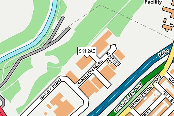
SK1 2AE lies on Hamilton Road in Stockport. SK1 2AE is located in the Brinnington & Stockport Central electoral ward, within the metropolitan district of Stockport and the English Parliamentary constituency of Stockport. The Sub Integrated Care Board (ICB) Location is NHS Greater Manchester ICB - 01W and the police force is Greater Manchester. This postcode has been in use since April 2013.


GetTheData
Source: OS OpenMap – Local (Ordnance Survey)
Source: OS VectorMap District (Ordnance Survey)
Licence: Open Government Licence (requires attribution)
| Easting | 390384 |
| Northing | 391417 |
| Latitude | 53.419464 |
| Longitude | -2.146154 |
GetTheData
Source: Open Postcode Geo
Licence: Open Government Licence
| Street | Hamilton Road |
| Town/City | Stockport |
| Country | England |
| Postcode District | SK1 |
| ➜ SK1 open data dashboard ➜ See where SK1 is on a map ➜ Where is Stockport? | |
GetTheData
Source: Land Registry Price Paid Data
Licence: Open Government Licence
Elevation or altitude of SK1 2AE as distance above sea level:
| Metres | Feet | |
|---|---|---|
| Elevation | 60m | 197ft |
Elevation is measured from the approximate centre of the postcode, to the nearest point on an OS contour line from OS Terrain 50, which has contour spacing of ten vertical metres.
➜ How high above sea level am I? Find the elevation of your current position using your device's GPS.
GetTheData
Source: Open Postcode Elevation
Licence: Open Government Licence
| Ward | Brinnington & Stockport Central |
| Constituency | Stockport |
GetTheData
Source: ONS Postcode Database
Licence: Open Government Licence
| Brinnington Rd/St Paul's St (Brinnington Rd) | Stockport | 232m |
| Brinnington Rd/Gill St (Brinnington Rd) | Stockport | 232m |
| Brinnington Rd/Gill St (Brinnington Rd) | Stockport | 245m |
| Brinnington Rd/St Pauls St (Brinnington Rd) | Stockport | 284m |
| Carrington Rd/St Pauls St (Carrington Rd) | Stockport | 364m |
| Brinnington Station | 1.6km |
| Stockport Station | 1.9km |
| Reddish South Station | 2km |
GetTheData
Source: NaPTAN
Licence: Open Government Licence
| Median download speed | 6.8Mbps |
| Average download speed | 22.6Mbps |
| Maximum download speed | 54.45Mbps |
| Median upload speed | 0.7Mbps |
| Average upload speed | 4.0Mbps |
| Maximum upload speed | 9.08Mbps |
GetTheData
Source: Ofcom
Licence: Ofcom Terms of Use (requires attribution)
Estimated total energy consumption in SK1 2AE by fuel type, 2015.
| Consumption (kWh) | 246,149 |
|---|---|
| Meter count | 8 |
| Mean (kWh/meter) | 30,769 |
| Median (kWh/meter) | 30,970 |
GetTheData
Source: Postcode level gas estimates: 2015 (experimental)
Source: Postcode level electricity estimates: 2015 (experimental)
Licence: Open Government Licence
GetTheData
Source: ONS Postcode Database
Licence: Open Government Licence


➜ Get more ratings from the Food Standards Agency
GetTheData
Source: Food Standards Agency
Licence: FSA terms & conditions
| Last Collection | |||
|---|---|---|---|
| Location | Mon-Fri | Sat | Distance |
| Dawson Street | 18:30 | 12:15 | 226m |
| Mersey Street | 18:30 | 12:00 | 400m |
| Great Portwood Street | 18:30 | 11:15 | 575m |
GetTheData
Source: Dracos
Licence: Creative Commons Attribution-ShareAlike
| Facility | Distance |
|---|---|
| Warth Meadow Playing Fields Welkin Road, Bredbury, Stockport Grass Pitches | 608m |
| St Bernadettes Catholic Primary School Gorseway, Stockport Grass Pitches | 663m |
| New Zealand Road Playing Fields (Closed) New Zealand Road, Stockport Grass Pitches | 674m |
GetTheData
Source: Active Places
Licence: Open Government Licence
| School | Phase of Education | Distance |
|---|---|---|
| St Paul's Church of England Primary School Brinnington Brinnington Rise, Stockport, SK5 8AA | Primary | 329m |
| St Bernadette's Catholic Primary School Foliage Road, Brinnington, Stockport, SK5 8AR | Primary | 663m |
| Penarth Group School 128 Reddish Road, South Reddish, Stockport, Cheshire, SK5 7JG | Not applicable | 743m |
GetTheData
Source: Edubase
Licence: Open Government Licence
The below table lists the International Territorial Level (ITL) codes (formerly Nomenclature of Territorial Units for Statistics (NUTS) codes) and Local Administrative Units (LAU) codes for SK1 2AE:
| ITL 1 Code | Name |
|---|---|
| TLD | North West (England) |
| ITL 2 Code | Name |
| TLD3 | Greater Manchester |
| ITL 3 Code | Name |
| TLD35 | Greater Manchester South East |
| LAU 1 Code | Name |
| E08000007 | Stockport |
GetTheData
Source: ONS Postcode Directory
Licence: Open Government Licence
The below table lists the Census Output Area (OA), Lower Layer Super Output Area (LSOA), and Middle Layer Super Output Area (MSOA) for SK1 2AE:
| Code | Name | |
|---|---|---|
| OA | E00029151 | |
| LSOA | E01005757 | Stockport 014A |
| MSOA | E02001200 | Stockport 014 |
GetTheData
Source: ONS Postcode Directory
Licence: Open Government Licence
| SK1 2AF | Martel Court | 85m |
| SK1 2EX | Brinnington Road | 253m |
| SK1 2HB | Brinnington Road | 257m |
| SK1 2LH | Yates Street | 298m |
| SK1 2LJ | Yates Street | 302m |
| SK1 2LG | Caistor Street | 314m |
| SK1 2LF | Caistor Street | 320m |
| SK1 2EZ | Goyt Road | 335m |
| SK1 2LE | St Pauls Street | 344m |
| SK1 2LQ | Gill Street | 346m |
GetTheData
Source: Open Postcode Geo; Land Registry Price Paid Data
Licence: Open Government Licence