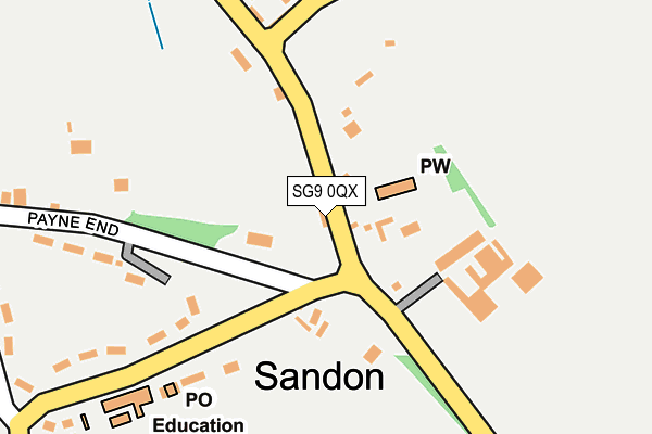
SG9 0QX is in Sandon, Buntingford. SG9 0QX is located in the Weston and Sandon electoral ward, within the local authority district of North Hertfordshire and the English Parliamentary constituency of North East Hertfordshire. The Sub Integrated Care Board (ICB) Location is NHS Hertfordshire and West Essex ICB - 06K and the police force is Hertfordshire. This postcode has been in use since January 1980.


GetTheData
Source: OS OpenMap – Local (Ordnance Survey)
Source: OS VectorMap District (Ordnance Survey)
Licence: Open Government Licence (requires attribution)
| Easting | 532197 |
| Northing | 234490 |
| Latitude | 51.993141 |
| Longitude | -0.075995 |
GetTheData
Source: Open Postcode Geo
Licence: Open Government Licence
| Locality | Sandon |
| Town/City | Buntingford |
| Country | England |
| Postcode District | SG9 |
| ➜ SG9 open data dashboard ➜ See where SG9 is on a map ➜ Where is Sandon? | |
GetTheData
Source: Land Registry Price Paid Data
Licence: Open Government Licence
Elevation or altitude of SG9 0QX as distance above sea level:
| Metres | Feet | |
|---|---|---|
| Elevation | 150m | 492ft |
Elevation is measured from the approximate centre of the postcode, to the nearest point on an OS contour line from OS Terrain 50, which has contour spacing of ten vertical metres.
➜ How high above sea level am I? Find the elevation of your current position using your device's GPS.
GetTheData
Source: Open Postcode Elevation
Licence: Open Government Licence
| Ward | Weston And Sandon |
| Constituency | North East Hertfordshire |
GetTheData
Source: ONS Postcode Database
Licence: Open Government Licence
| June 2022 | Burglary | On or near Payne End | 198m |
| March 2022 | Burglary | On or near Payne End | 198m |
| March 2022 | Anti-social behaviour | On or near Dark Lane | 353m |
| ➜ Get more crime data in our Crime section | |||
GetTheData
Source: data.police.uk
Licence: Open Government Licence
| Rushden Road | Sandon | 20m |
| School (Rushden Road) | Sandon | 121m |
| School (Rushden Road) | Sandon | 123m |
| Rushden Road | Sandon | 142m |
| Hill Side (Rushden Road) | Sandon | 431m |
| Ashwell & Morden Station | 4.8km |
GetTheData
Source: NaPTAN
Licence: Open Government Licence
| Percentage of properties with Next Generation Access | 100.0% |
| Percentage of properties with Superfast Broadband | 100.0% |
| Percentage of properties with Ultrafast Broadband | 0.0% |
| Percentage of properties with Full Fibre Broadband | 0.0% |
Superfast Broadband is between 30Mbps and 300Mbps
Ultrafast Broadband is > 300Mbps
| Percentage of properties unable to receive 2Mbps | 0.0% |
| Percentage of properties unable to receive 5Mbps | 0.0% |
| Percentage of properties unable to receive 10Mbps | 0.0% |
| Percentage of properties unable to receive 30Mbps | 0.0% |
GetTheData
Source: Ofcom
Licence: Ofcom Terms of Use (requires attribution)
GetTheData
Source: ONS Postcode Database
Licence: Open Government Licence


➜ Get more ratings from the Food Standards Agency
GetTheData
Source: Food Standards Agency
Licence: FSA terms & conditions
| Last Collection | |||
|---|---|---|---|
| Location | Mon-Fri | Sat | Distance |
| Sandon Post Office | 16:00 | 09:30 | 72m |
| Roe Green | 17:30 | 08:00 | 998m |
| Kelshall | 17:00 | 10:45 | 2,085m |
GetTheData
Source: Dracos
Licence: Creative Commons Attribution-ShareAlike
| Facility | Distance |
|---|---|
| Therfield Recreation Ground The Grange, Therfield, Royston Grass Pitches | 3km |
| Reed Cricket Club Blacksmiths Lane, Reed, Royston Grass Pitches | 4.1km |
| Freman College Bowling Green Lane, Buntingford Grass Pitches, Sports Hall, Outdoor Tennis Courts | 5.7km |
GetTheData
Source: Active Places
Licence: Open Government Licence
| School | Phase of Education | Distance |
|---|---|---|
| Sandon Junior Mixed and Infant School Sandon, Nr Buntingford, SG9 0QS | Primary | 244m |
| Therfield First School The Causeway, Therfield, Royston, SG8 9PP | Primary | 3.1km |
| Reed First School Jacksons Lane, Reed, Royston, SG8 8AB | Primary | 4.5km |
GetTheData
Source: Edubase
Licence: Open Government Licence
The below table lists the International Territorial Level (ITL) codes (formerly Nomenclature of Territorial Units for Statistics (NUTS) codes) and Local Administrative Units (LAU) codes for SG9 0QX:
| ITL 1 Code | Name |
|---|---|
| TLH | East |
| ITL 2 Code | Name |
| TLH2 | Bedfordshire and Hertfordshire |
| ITL 3 Code | Name |
| TLH23 | Hertfordshire CC |
| LAU 1 Code | Name |
| E07000099 | North Hertfordshire |
GetTheData
Source: ONS Postcode Directory
Licence: Open Government Licence
The below table lists the Census Output Area (OA), Lower Layer Super Output Area (LSOA), and Middle Layer Super Output Area (MSOA) for SG9 0QX:
| Code | Name | |
|---|---|---|
| OA | E00120173 | |
| LSOA | E01023663 | North Hertfordshire 005G |
| MSOA | E02004913 | North Hertfordshire 005 |
GetTheData
Source: ONS Postcode Directory
Licence: Open Government Licence
| SG9 0QS | Rushden Road | 207m |
| SG9 0RA | 210m | |
| SG9 0QR | Rushden Road | 239m |
| SG9 0QU | Payne End | 262m |
| SG9 0QT | Dark Lane | 378m |
| SG9 0QN | Rushden Road | 514m |
| SG9 0QZ | 674m | |
| SG9 0QL | Sayfield Cottages | 678m |
| SG9 0QJ | Roe Green | 900m |
| SG9 0QG | Roe Green | 915m |
GetTheData
Source: Open Postcode Geo; Land Registry Price Paid Data
Licence: Open Government Licence