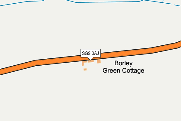
SG9 0AJ lies on Borley Green in Brent Pelham, Buntingford. SG9 0AJ is located in the Little Hadham & The Pelhams electoral ward, within the local authority district of East Hertfordshire and the English Parliamentary constituency of North East Hertfordshire. The Sub Integrated Care Board (ICB) Location is NHS Hertfordshire and West Essex ICB - 06K and the police force is Hertfordshire. This postcode has been in use since January 1980.


GetTheData
Source: OS OpenMap – Local (Ordnance Survey)
Source: OS VectorMap District (Ordnance Survey)
Licence: Open Government Licence (requires attribution)
| Easting | 542590 |
| Northing | 230577 |
| Latitude | 51.955415 |
| Longitude | 0.073648 |
GetTheData
Source: Open Postcode Geo
Licence: Open Government Licence
| Street | Borley Green |
| Locality | Brent Pelham |
| Town/City | Buntingford |
| Country | England |
| Postcode District | SG9 |
| ➜ SG9 open data dashboard ➜ See where SG9 is on a map | |
GetTheData
Source: Land Registry Price Paid Data
Licence: Open Government Licence
Elevation or altitude of SG9 0AJ as distance above sea level:
| Metres | Feet | |
|---|---|---|
| Elevation | 120m | 394ft |
Elevation is measured from the approximate centre of the postcode, to the nearest point on an OS contour line from OS Terrain 50, which has contour spacing of ten vertical metres.
➜ How high above sea level am I? Find the elevation of your current position using your device's GPS.
GetTheData
Source: Open Postcode Elevation
Licence: Open Government Licence
| Ward | Little Hadham & The Pelhams |
| Constituency | North East Hertfordshire |
GetTheData
Source: ONS Postcode Database
Licence: Open Government Licence
| St Mary's Church (Hormead Road) | Brent Pelham | 813m |
| St Mary's Church (Pump Hill) | Brent Pelham | 828m |
| St Mary's Church (Pump Hill) | Brent Pelham | 846m |
GetTheData
Source: NaPTAN
Licence: Open Government Licence
| Percentage of properties with Next Generation Access | 100.0% |
| Percentage of properties with Superfast Broadband | 100.0% |
| Percentage of properties with Ultrafast Broadband | 0.0% |
| Percentage of properties with Full Fibre Broadband | 0.0% |
Superfast Broadband is between 30Mbps and 300Mbps
Ultrafast Broadband is > 300Mbps
| Percentage of properties unable to receive 2Mbps | 0.0% |
| Percentage of properties unable to receive 5Mbps | 0.0% |
| Percentage of properties unable to receive 10Mbps | 0.0% |
| Percentage of properties unable to receive 30Mbps | 0.0% |
GetTheData
Source: Ofcom
Licence: Ofcom Terms of Use (requires attribution)
GetTheData
Source: ONS Postcode Database
Licence: Open Government Licence


➜ Get more ratings from the Food Standards Agency
GetTheData
Source: Food Standards Agency
Licence: FSA terms & conditions
| Last Collection | |||
|---|---|---|---|
| Location | Mon-Fri | Sat | Distance |
| Washall Green | 17:00 | 11:00 | 1,744m |
| Great Hormead | 16:00 | 11:30 | 2,484m |
| Furneaux Pelham Church | 16:15 | 09:00 | 2,728m |
GetTheData
Source: Dracos
Licence: Creative Commons Attribution-ShareAlike
| Facility | Distance |
|---|---|
| Brewery Field Furneux Pelham, Buntingford Grass Pitches | 3.3km |
| The Meads (Upper Field) Hare Street, Buntingford Grass Pitches | 3.5km |
| The Meads (Lower Field) Hare Street, Buntingford Grass Pitches | 3.6km |
GetTheData
Source: Active Places
Licence: Open Government Licence
| School | Phase of Education | Distance |
|---|---|---|
| Furneux Pelham Church of England School Furneux Pelham School, Furneux Pelham, SG9 0LH | Primary | 2.8km |
| Hormead Church of England (VA) First School Great Hormead, Buntingford, SG9 0NR | Primary | 2.9km |
| Anstey First School Anstey, Buntingford, SG9 0BY | Primary | 3.1km |
GetTheData
Source: Edubase
Licence: Open Government Licence
The below table lists the International Territorial Level (ITL) codes (formerly Nomenclature of Territorial Units for Statistics (NUTS) codes) and Local Administrative Units (LAU) codes for SG9 0AJ:
| ITL 1 Code | Name |
|---|---|
| TLH | East |
| ITL 2 Code | Name |
| TLH2 | Bedfordshire and Hertfordshire |
| ITL 3 Code | Name |
| TLH23 | Hertfordshire CC |
| LAU 1 Code | Name |
| E07000242 | East Hertfordshire |
GetTheData
Source: ONS Postcode Directory
Licence: Open Government Licence
The below table lists the Census Output Area (OA), Lower Layer Super Output Area (LSOA), and Middle Layer Super Output Area (MSOA) for SG9 0AJ:
| Code | Name | |
|---|---|---|
| OA | E00119171 | |
| LSOA | E01023462 | East Hertfordshire 001A |
| MSOA | E02004878 | East Hertfordshire 001 |
GetTheData
Source: ONS Postcode Directory
Licence: Open Government Licence
| SG9 0AL | 571m | |
| SG9 0HE | 760m | |
| SG9 0AN | 761m | |
| SG9 0AR | 763m | |
| SG9 0AW | 787m | |
| SG9 0AP | 845m | |
| SG9 0HF | 882m | |
| SG9 0HQ | 920m | |
| SG9 0HW | The Causeway | 939m |
| SG9 0HN | Lower Cottages | 960m |
GetTheData
Source: Open Postcode Geo; Land Registry Price Paid Data
Licence: Open Government Licence