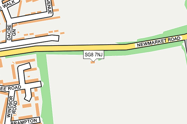
SG8 7NJ is located in the Royston Meridian electoral ward, within the local authority district of North Hertfordshire and the English Parliamentary constituency of North East Hertfordshire. The Sub Integrated Care Board (ICB) Location is NHS Cambridgeshire and Peterborough ICB - 06H and the police force is Hertfordshire. This postcode has been in use since January 1980.


GetTheData
Source: OS OpenMap – Local (Ordnance Survey)
Source: OS VectorMap District (Ordnance Survey)
Licence: Open Government Licence (requires attribution)
| Easting | 536833 |
| Northing | 240779 |
| Latitude | 52.048529 |
| Longitude | -0.006005 |
GetTheData
Source: Open Postcode Geo
Licence: Open Government Licence
| Country | England |
| Postcode District | SG8 |
| ➜ SG8 open data dashboard ➜ See where SG8 is on a map | |
GetTheData
Source: Land Registry Price Paid Data
Licence: Open Government Licence
Elevation or altitude of SG8 7NJ as distance above sea level:
| Metres | Feet | |
|---|---|---|
| Elevation | 80m | 262ft |
Elevation is measured from the approximate centre of the postcode, to the nearest point on an OS contour line from OS Terrain 50, which has contour spacing of ten vertical metres.
➜ How high above sea level am I? Find the elevation of your current position using your device's GPS.
GetTheData
Source: Open Postcode Elevation
Licence: Open Government Licence
| Ward | Royston Meridian |
| Constituency | North East Hertfordshire |
GetTheData
Source: ONS Postcode Database
Licence: Open Government Licence
| October 2023 | Burglary | On or near Newman Avenue | 281m |
| October 2023 | Burglary | On or near Newman Avenue | 281m |
| October 2023 | Criminal damage and arson | On or near Field Crescent | 402m |
| ➜ Get more crime data in our Crime section | |||
GetTheData
Source: data.police.uk
Licence: Open Government Licence
| Dacre Green (Icknield Walk) | Royston | 337m |
| Newmarket Road (Icknield Walk) | Royston | 345m |
| Clydesdale Road (Valley Rise) | Royston | 398m |
| Betony Vale (Valley Rise) | Royston | 450m |
| The Close (Icknield Walk) | Royston | 450m |
| Royston Station | 1.5km |
| Meldreth Station | 4.8km |
GetTheData
Source: NaPTAN
Licence: Open Government Licence
| Percentage of properties with Next Generation Access | 100.0% |
| Percentage of properties with Superfast Broadband | 100.0% |
| Percentage of properties with Ultrafast Broadband | 0.0% |
| Percentage of properties with Full Fibre Broadband | 0.0% |
Superfast Broadband is between 30Mbps and 300Mbps
Ultrafast Broadband is > 300Mbps
| Percentage of properties unable to receive 2Mbps | 0.0% |
| Percentage of properties unable to receive 5Mbps | 0.0% |
| Percentage of properties unable to receive 10Mbps | 0.0% |
| Percentage of properties unable to receive 30Mbps | 0.0% |
GetTheData
Source: Ofcom
Licence: Ofcom Terms of Use (requires attribution)
GetTheData
Source: ONS Postcode Database
Licence: Open Government Licence


➜ Get more ratings from the Food Standards Agency
GetTheData
Source: Food Standards Agency
Licence: FSA terms & conditions
| Last Collection | |||
|---|---|---|---|
| Location | Mon-Fri | Sat | Distance |
| Valley Rise | 18:00 | 11:45 | 355m |
| Icknield Walk | 18:00 | 11:45 | 449m |
| Eastfield Road | 18:00 | 11:00 | 612m |
GetTheData
Source: Dracos
Licence: Creative Commons Attribution-ShareAlike
| Facility | Distance |
|---|---|
| Newmarket Road Playing Fields Newman Avenue, Royston Grass Pitches | 145m |
| Icknield Walk School Poplar Close, Royston Grass Pitches | 477m |
| Studlands Rise First School Studlands Rise, Studlands Rise, Royston Grass Pitches | 647m |
GetTheData
Source: Active Places
Licence: Open Government Licence
| School | Phase of Education | Distance |
|---|---|---|
| Icknield Walk First School Poplar Drive, Royston, SG8 7EZ | Primary | 504m |
| Studlands Rise First School Studlands Rise, Royston, SG8 9HB | Primary | 653m |
| King James Academy Royston Garden Walk, Royston, SG8 7JH | All-through | 748m |
GetTheData
Source: Edubase
Licence: Open Government Licence
The below table lists the International Territorial Level (ITL) codes (formerly Nomenclature of Territorial Units for Statistics (NUTS) codes) and Local Administrative Units (LAU) codes for SG8 7NJ:
| ITL 1 Code | Name |
|---|---|
| TLH | East |
| ITL 2 Code | Name |
| TLH2 | Bedfordshire and Hertfordshire |
| ITL 3 Code | Name |
| TLH23 | Hertfordshire CC |
| LAU 1 Code | Name |
| E07000099 | North Hertfordshire |
GetTheData
Source: ONS Postcode Directory
Licence: Open Government Licence
The below table lists the Census Output Area (OA), Lower Layer Super Output Area (LSOA), and Middle Layer Super Output Area (MSOA) for SG8 7NJ:
| Code | Name | |
|---|---|---|
| OA | E00120145 | |
| LSOA | E01023658 | North Hertfordshire 002E |
| MSOA | E02004910 | North Hertfordshire 002 |
GetTheData
Source: ONS Postcode Directory
Licence: Open Government Licence
| SG8 9TG | Aintree Road | 208m |
| SG8 9TE | Bury Plantation | 214m |
| SG8 9TF | Goodwood Road | 222m |
| SG8 7HA | Newmarket Road | 225m |
| SG8 9TD | Haydock Road | 239m |
| SG8 9TB | Aintree Road | 241m |
| SG8 7LE | Newman Avenue | 266m |
| SG8 7LH | Dacre Green | 283m |
| SG8 9GH | Valley Rise | 291m |
| SG8 9JE | Aintree Road | 294m |
GetTheData
Source: Open Postcode Geo; Land Registry Price Paid Data
Licence: Open Government Licence