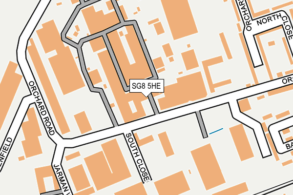
SG8 5HE is located in the Royston Heath electoral ward, within the local authority district of North Hertfordshire and the English Parliamentary constituency of North East Hertfordshire. The Sub Integrated Care Board (ICB) Location is NHS Cambridgeshire and Peterborough ICB - 06H and the police force is Hertfordshire. This postcode has been in use since January 1980.


GetTheData
Source: OS OpenMap – Local (Ordnance Survey)
Source: OS VectorMap District (Ordnance Survey)
Licence: Open Government Licence (requires attribution)
| Easting | 534848 |
| Northing | 241345 |
| Latitude | 52.054090 |
| Longitude | -0.034739 |
GetTheData
Source: Open Postcode Geo
Licence: Open Government Licence
| Country | England |
| Postcode District | SG8 |
| ➜ SG8 open data dashboard ➜ See where SG8 is on a map ➜ Where is Royston? | |
GetTheData
Source: Land Registry Price Paid Data
Licence: Open Government Licence
Elevation or altitude of SG8 5HE as distance above sea level:
| Metres | Feet | |
|---|---|---|
| Elevation | 50m | 164ft |
Elevation is measured from the approximate centre of the postcode, to the nearest point on an OS contour line from OS Terrain 50, which has contour spacing of ten vertical metres.
➜ How high above sea level am I? Find the elevation of your current position using your device's GPS.
GetTheData
Source: Open Postcode Elevation
Licence: Open Government Licence
| Ward | Royston Heath |
| Constituency | North East Hertfordshire |
GetTheData
Source: ONS Postcode Database
Licence: Open Government Licence
| January 2024 | Violence and sexual offences | On or near Parking Area | 487m |
| December 2023 | Anti-social behaviour | On or near Parking Area | 438m |
| December 2023 | Anti-social behaviour | On or near Parking Area | 438m |
| ➜ Get more crime data in our Crime section | |||
GetTheData
Source: data.police.uk
Licence: Open Government Licence
| South Close (Orchard Road) | Royston | 56m |
| Greenfield (Orchard Road) | Royston | 223m |
| Greenfield (Orchard Road) | Royston | 228m |
| Beverley Close (York Way) | Royston | 376m |
| Orchard Road (Old North Road) | Royston | 529m |
| Royston Station | 0.5km |
| Meldreth Station | 5.1km |
GetTheData
Source: NaPTAN
Licence: Open Government Licence
GetTheData
Source: ONS Postcode Database
Licence: Open Government Licence


➜ Get more ratings from the Food Standards Agency
GetTheData
Source: Food Standards Agency
Licence: FSA terms & conditions
| Last Collection | |||
|---|---|---|---|
| Location | Mon-Fri | Sat | Distance |
| North Close | 18:00 | 12:00 | 319m |
| Royston Delivery Office | 18:30 | 11:45 | 463m |
| Old North Road | 17:00 | 11:45 | 548m |
GetTheData
Source: Dracos
Licence: Creative Commons Attribution-ShareAlike
| Facility | Distance |
|---|---|
| Johnson Mathey Plc Sports & Social Club (Closed) Orchard Road, Royston Grass Pitches | 0m |
| Tannery Drift First School Tannery Drift, Royston Grass Pitches, Outdoor Tennis Courts | 615m |
| Wilmotts Gym Newark Close, Royston Health and Fitness Gym, Studio | 627m |
GetTheData
Source: Active Places
Licence: Open Government Licence
| School | Phase of Education | Distance |
|---|---|---|
| Tannery Drift School Tannery Drift, Royston, SG8 5DE | Primary | 614m |
| Roman Way Academy Burns Road, Royston, SG8 5EQ | Primary | 941m |
| St Mary Roman Catholic Primary School Melbourn Road, Royston, SG8 7DB | Primary | 1.1km |
GetTheData
Source: Edubase
Licence: Open Government Licence
The below table lists the International Territorial Level (ITL) codes (formerly Nomenclature of Territorial Units for Statistics (NUTS) codes) and Local Administrative Units (LAU) codes for SG8 5HE:
| ITL 1 Code | Name |
|---|---|
| TLH | East |
| ITL 2 Code | Name |
| TLH2 | Bedfordshire and Hertfordshire |
| ITL 3 Code | Name |
| TLH23 | Hertfordshire CC |
| LAU 1 Code | Name |
| E07000099 | North Hertfordshire |
GetTheData
Source: ONS Postcode Directory
Licence: Open Government Licence
The below table lists the Census Output Area (OA), Lower Layer Super Output Area (LSOA), and Middle Layer Super Output Area (MSOA) for SG8 5HE:
| Code | Name | |
|---|---|---|
| OA | E00120134 | |
| LSOA | E01023656 | North Hertfordshire 002C |
| MSOA | E02004910 | North Hertfordshire 002 |
GetTheData
Source: ONS Postcode Directory
Licence: Open Government Licence
| SG8 5HD | Orchard Road | 206m |
| SG8 5HA | Orchard Road | 249m |
| SG8 5HW | Jarman Way | 250m |
| SG8 5EY | Orchard Way | 252m |
| SG8 5HN | Greenfield | 260m |
| SG8 5LY | Braeburn Walk | 264m |
| SG8 5TT | Stephenson Close | 295m |
| SG8 5EZ | North Close | 303m |
| SG8 5EX | Orchard Way | 304m |
| SG8 5HQ | Barnack Grove | 315m |
GetTheData
Source: Open Postcode Geo; Land Registry Price Paid Data
Licence: Open Government Licence