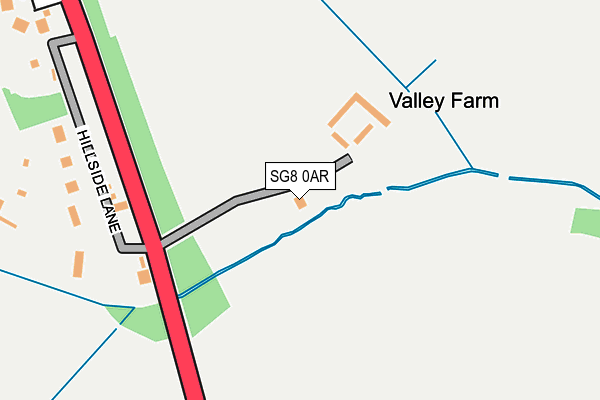
SG8 0AR is located in the Barrington electoral ward, within the local authority district of South Cambridgeshire and the English Parliamentary constituency of South Cambridgeshire. The Sub Integrated Care Board (ICB) Location is NHS Cambridgeshire and Peterborough ICB - 06H and the police force is Cambridgeshire. This postcode has been in use since December 1997.


GetTheData
Source: OS OpenMap – Local (Ordnance Survey)
Source: OS VectorMap District (Ordnance Survey)
Licence: Open Government Licence (requires attribution)
| Easting | 532514 |
| Northing | 251850 |
| Latitude | 52.149045 |
| Longitude | -0.064675 |
GetTheData
Source: Open Postcode Geo
Licence: Open Government Licence
| Country | England |
| Postcode District | SG8 |
| ➜ SG8 open data dashboard ➜ See where SG8 is on a map | |
GetTheData
Source: Land Registry Price Paid Data
Licence: Open Government Licence
Elevation or altitude of SG8 0AR as distance above sea level:
| Metres | Feet | |
|---|---|---|
| Elevation | 50m | 164ft |
Elevation is measured from the approximate centre of the postcode, to the nearest point on an OS contour line from OS Terrain 50, which has contour spacing of ten vertical metres.
➜ How high above sea level am I? Find the elevation of your current position using your device's GPS.
GetTheData
Source: Open Postcode Elevation
Licence: Open Government Licence
| Ward | Barrington |
| Constituency | South Cambridgeshire |
GetTheData
Source: ONS Postcode Database
Licence: Open Government Licence
| February 2022 | Burglary | On or near Shopping Area | 326m |
| October 2021 | Violence and sexual offences | On or near Shopping Area | 326m |
| October 2021 | Violence and sexual offences | On or near Shopping Area | 326m |
| ➜ Get more crime data in our Crime section | |||
GetTheData
Source: data.police.uk
Licence: Open Government Licence
| Wimpole Estate Car Park (Estate Road) | Wimpole | 1,561m |
GetTheData
Source: NaPTAN
Licence: Open Government Licence
GetTheData
Source: ONS Postcode Database
Licence: Open Government Licence

➜ Get more ratings from the Food Standards Agency
GetTheData
Source: Food Standards Agency
Licence: FSA terms & conditions
| Last Collection | |||
|---|---|---|---|
| Location | Mon-Fri | Sat | Distance |
| Arrington Hill | 16:00 | 09:55 | 475m |
| Church Lane | 16:00 | 10:00 | 1,539m |
| Old Wimpole | 16:00 | 07:45 | 1,735m |
GetTheData
Source: Dracos
Licence: Creative Commons Attribution-ShareAlike
| Facility | Distance |
|---|---|
| The Petersfield Ce Primary School Hurdleditch Road, Orwell, Royston Grass Pitches, Swimming Pool | 3.8km |
| Orwell Recreation Ground Town Green Road, Orwell, Royston Grass Pitches, Outdoor Tennis Courts | 3.9km |
| Longstowe Cricket Club Park Lane, Longstowe, Cambridge Grass Pitches | 3.9km |
GetTheData
Source: Active Places
Licence: Open Government Licence
| School | Phase of Education | Distance |
|---|---|---|
| Petersfield CofE Aided Primary School Hurdleditch Road, Orwell, Royston, SG8 5QG | Primary | 3.8km |
| Bourn CofE Primary Academy Riddy Lane, Bourn, Cambridge, CB23 2SP | Primary | 4.7km |
GetTheData
Source: Edubase
Licence: Open Government Licence
The below table lists the International Territorial Level (ITL) codes (formerly Nomenclature of Territorial Units for Statistics (NUTS) codes) and Local Administrative Units (LAU) codes for SG8 0AR:
| ITL 1 Code | Name |
|---|---|
| TLH | East |
| ITL 2 Code | Name |
| TLH1 | East Anglia |
| ITL 3 Code | Name |
| TLH12 | Cambridgeshire CC |
| LAU 1 Code | Name |
| E07000012 | South Cambridgeshire |
GetTheData
Source: ONS Postcode Directory
Licence: Open Government Licence
The below table lists the Census Output Area (OA), Lower Layer Super Output Area (LSOA), and Middle Layer Super Output Area (MSOA) for SG8 0AR:
| Code | Name | |
|---|---|---|
| OA | E00092180 | |
| LSOA | E01018275 | South Cambridgeshire 013D |
| MSOA | E02003787 | South Cambridgeshire 013 |
GetTheData
Source: ONS Postcode Directory
Licence: Open Government Licence
| SG8 0DA | Hill Side Lane | 228m |
| SG8 0AY | Ermine Way | 329m |
| SG8 0BZ | Hill Side Lane | 434m |
| SG8 0AS | Ermine Way | 719m |
| SG8 0AJ | Ermine Way | 888m |
| SG8 0DB | Mill Lane | 899m |
| SG8 0AL | Ermine Way | 1125m |
| SG8 0BX | Old Wimpole Road | 1160m |
| SG8 0AU | Ermine Way | 1290m |
| SG8 0BH | Church End | 1395m |
GetTheData
Source: Open Postcode Geo; Land Registry Price Paid Data
Licence: Open Government Licence