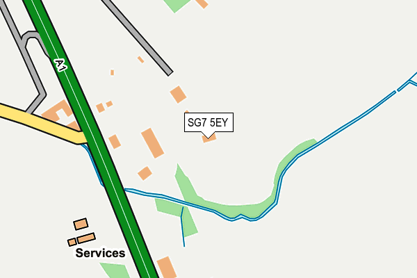
SG7 5EY is located in the Arbury electoral ward, within the local authority district of North Hertfordshire and the English Parliamentary constituency of North East Hertfordshire. The Sub Integrated Care Board (ICB) Location is NHS Hertfordshire and West Essex ICB - 06K and the police force is Hertfordshire. This postcode has been in use since January 1980.


GetTheData
Source: OS OpenMap – Local (Ordnance Survey)
Source: OS VectorMap District (Ordnance Survey)
Licence: Open Government Licence (requires attribution)
| Easting | 522722 |
| Northing | 238334 |
| Latitude | 52.029848 |
| Longitude | -0.212571 |
GetTheData
Source: Open Postcode Geo
Licence: Open Government Licence
| Country | England |
| Postcode District | SG7 |
| ➜ SG7 open data dashboard ➜ See where SG7 is on a map | |
GetTheData
Source: Land Registry Price Paid Data
Licence: Open Government Licence
Elevation or altitude of SG7 5EY as distance above sea level:
| Metres | Feet | |
|---|---|---|
| Elevation | 50m | 164ft |
Elevation is measured from the approximate centre of the postcode, to the nearest point on an OS contour line from OS Terrain 50, which has contour spacing of ten vertical metres.
➜ How high above sea level am I? Find the elevation of your current position using your device's GPS.
GetTheData
Source: Open Postcode Elevation
Licence: Open Government Licence
| Ward | Arbury |
| Constituency | North East Hertfordshire |
GetTheData
Source: ONS Postcode Database
Licence: Open Government Licence
| May 2022 | Vehicle crime | On or near Petrol Station | 221m |
| April 2022 | Other theft | On or near Petrol Station | 221m |
| April 2022 | Other crime | On or near Petrol Station | 221m |
| ➜ Get more crime data in our Crime section | |||
GetTheData
Source: data.police.uk
Licence: Open Government Licence
| Regent Court (The Green) | Stotfold | 1,272m |
| Regent Court (The Green) | Stotfold | 1,273m |
| The Green | Stotfold | 1,391m |
| The Green | Stotfold | 1,404m |
| Home Close (Rook Tree Lane) | Stotfold | 1,496m |
| Arlesey Station | 3.7km |
| Baldock Station | 4.5km |
GetTheData
Source: NaPTAN
Licence: Open Government Licence
GetTheData
Source: ONS Postcode Database
Licence: Open Government Licence


➜ Get more ratings from the Food Standards Agency
GetTheData
Source: Food Standards Agency
Licence: FSA terms & conditions
| Last Collection | |||
|---|---|---|---|
| Location | Mon-Fri | Sat | Distance |
| The Green | 16:30 | 08:00 | 1,238m |
| Astwick | 16:00 | 07:30 | 1,323m |
| One Stop Shop | 17:00 | 08:45 | 1,631m |
GetTheData
Source: Dracos
Licence: Creative Commons Attribution-ShareAlike
| Facility | Distance |
|---|---|
| Riverside Playing Fields Malthouse Lane, Stotfold, Hitchin Grass Pitches | 985m |
| Roker Park (Closed) The Green, Stotfold, Hitchin Grass Pitches | 1.2km |
| The Green (Stotfold) The Green, Stotfold, Hitchin Grass Pitches | 1.3km |
GetTheData
Source: Active Places
Licence: Open Government Licence
| School | Phase of Education | Distance |
|---|---|---|
| St Mary's CofE Academy Stotfold Rook Tree Lane, Stotfold, Hitchin, SG5 4DL | Primary | 1.7km |
| Pix Brook Academy Arlesey Road, Stotfold, SG5 4HB | Middle deemed secondary | 1.9km |
| Roecroft Lower School Buttercup Road, Stotfold, Hitchin, SG5 4PF | Primary | 2.3km |
GetTheData
Source: Edubase
Licence: Open Government Licence
The below table lists the International Territorial Level (ITL) codes (formerly Nomenclature of Territorial Units for Statistics (NUTS) codes) and Local Administrative Units (LAU) codes for SG7 5EY:
| ITL 1 Code | Name |
|---|---|
| TLH | East |
| ITL 2 Code | Name |
| TLH2 | Bedfordshire and Hertfordshire |
| ITL 3 Code | Name |
| TLH23 | Hertfordshire CC |
| LAU 1 Code | Name |
| E07000099 | North Hertfordshire |
GetTheData
Source: ONS Postcode Directory
Licence: Open Government Licence
The below table lists the Census Output Area (OA), Lower Layer Super Output Area (LSOA), and Middle Layer Super Output Area (MSOA) for SG7 5EY:
| Code | Name | |
|---|---|---|
| OA | E00119789 | |
| LSOA | E01023585 | North Hertfordshire 005A |
| MSOA | E02004913 | North Hertfordshire 005 |
GetTheData
Source: ONS Postcode Directory
Licence: Open Government Licence
| SG5 4AZ | Taylors Road | 670m |
| SG5 4RX | Alder Green | 885m |
| SG5 4NR | Wrayfields | 908m |
| SG5 4RU | Juniper Mead | 912m |
| SG5 4RT | Hawthorn Croft | 922m |
| SG5 4BJ | Mill Lane | 932m |
| SG5 4RS | Aspen Gardens | 1004m |
| SG5 4AQ | Taylors Road | 1018m |
| SG5 4AS | Silver Birch Avenue | 1070m |
| SG5 4BB | Silver Birch Avenue | 1111m |
GetTheData
Source: Open Postcode Geo; Land Registry Price Paid Data
Licence: Open Government Licence