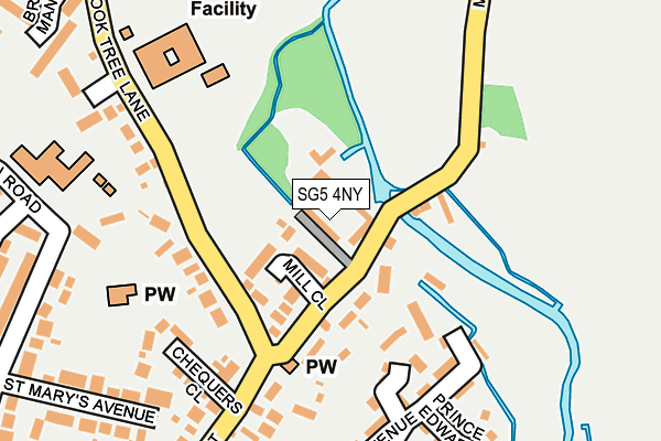
SG5 4NY is located in the Stotfold electoral ward, within the unitary authority of Central Bedfordshire and the English Parliamentary constituency of North East Bedfordshire. The Sub Integrated Care Board (ICB) Location is NHS Bedfordshire, Luton and Milton Keynes ICB - M1J4Y and the police force is Bedfordshire. This postcode has been in use since March 2004.


GetTheData
Source: OS OpenMap – Local (Ordnance Survey)
Source: OS VectorMap District (Ordnance Survey)
Licence: Open Government Licence (requires attribution)
| Easting | 522205 |
| Northing | 236770 |
| Latitude | 52.015917 |
| Longitude | -0.220635 |
GetTheData
Source: Open Postcode Geo
Licence: Open Government Licence
| Country | England |
| Postcode District | SG5 |
| ➜ SG5 open data dashboard ➜ See where SG5 is on a map ➜ Where is Stotfold? | |
GetTheData
Source: Land Registry Price Paid Data
Licence: Open Government Licence
Elevation or altitude of SG5 4NY as distance above sea level:
| Metres | Feet | |
|---|---|---|
| Elevation | 50m | 164ft |
Elevation is measured from the approximate centre of the postcode, to the nearest point on an OS contour line from OS Terrain 50, which has contour spacing of ten vertical metres.
➜ How high above sea level am I? Find the elevation of your current position using your device's GPS.
GetTheData
Source: Open Postcode Elevation
Licence: Open Government Licence
| Ward | Stotfold |
| Constituency | North East Bedfordshire |
GetTheData
Source: ONS Postcode Database
Licence: Open Government Licence
| August 2023 | Violence and sexual offences | On or near Prince Harry Close | 287m |
| December 2022 | Violence and sexual offences | On or near Prince Harry Close | 287m |
| December 2022 | Violence and sexual offences | On or near Prince Harry Close | 287m |
| ➜ Get more crime data in our Crime section | |||
GetTheData
Source: data.police.uk
Licence: Open Government Licence
| Rook Tree Lane | Stotfold | 107m |
| Home Close (Rook Tree Lane) | Stotfold | 319m |
| Baldock Road | Stotfold | 367m |
| Home Close (Rook Tree Lane) | Stotfold | 367m |
| Elizabeth House (High Street) | Stotfold | 370m |
| Arlesey Station | 3.3km |
| Baldock Station | 3.4km |
| Letchworth Station | 4km |
GetTheData
Source: NaPTAN
Licence: Open Government Licence
Estimated total energy consumption in SG5 4NY by fuel type, 2015.
| Consumption (kWh) | 49,398 |
|---|---|
| Meter count | 6 |
| Mean (kWh/meter) | 8,233 |
| Median (kWh/meter) | 3,702 |
GetTheData
Source: Postcode level gas estimates: 2015 (experimental)
Source: Postcode level electricity estimates: 2015 (experimental)
Licence: Open Government Licence
GetTheData
Source: ONS Postcode Database
Licence: Open Government Licence


➜ Get more ratings from the Food Standards Agency
GetTheData
Source: Food Standards Agency
Licence: FSA terms & conditions
| Last Collection | |||
|---|---|---|---|
| Location | Mon-Fri | Sat | Distance |
| Rook Tree Lane | 16:30 | 08:00 | 126m |
| Baldock Road | 17:00 | 08:00 | 377m |
| Stotfold | 17:15 | 11:00 | 519m |
GetTheData
Source: Dracos
Licence: Creative Commons Attribution-ShareAlike
| Facility | Distance |
|---|---|
| St Marys Church Of England Academy Stotfold Rook Tree Lane, Stotfold, Hitchin Grass Pitches | 173m |
| The Green (Stotfold) The Green, Stotfold, Hitchin Grass Pitches | 672m |
| Roker Park (Closed) The Green, Stotfold, Hitchin Grass Pitches | 703m |
GetTheData
Source: Active Places
Licence: Open Government Licence
| School | Phase of Education | Distance |
|---|---|---|
| St Mary's CofE Academy Stotfold Rook Tree Lane, Stotfold, Hitchin, SG5 4DL | Primary | 181m |
| Roecroft Lower School Buttercup Road, Stotfold, Hitchin, SG5 4PF | Primary | 727m |
| Pix Brook Academy Arlesey Road, Stotfold, SG5 4HB | Middle deemed secondary | 900m |
GetTheData
Source: Edubase
Licence: Open Government Licence
The below table lists the International Territorial Level (ITL) codes (formerly Nomenclature of Territorial Units for Statistics (NUTS) codes) and Local Administrative Units (LAU) codes for SG5 4NY:
| ITL 1 Code | Name |
|---|---|
| TLH | East |
| ITL 2 Code | Name |
| TLH2 | Bedfordshire and Hertfordshire |
| ITL 3 Code | Name |
| TLH25 | Central Bedfordshire |
| LAU 1 Code | Name |
| E06000056 | Central Bedfordshire |
GetTheData
Source: ONS Postcode Directory
Licence: Open Government Licence
The below table lists the Census Output Area (OA), Lower Layer Super Output Area (LSOA), and Middle Layer Super Output Area (MSOA) for SG5 4NY:
| Code | Name | |
|---|---|---|
| OA | E00088104 | |
| LSOA | E01017447 | Central Bedfordshire 014B |
| MSOA | E02003612 | Central Bedfordshire 014 |
GetTheData
Source: ONS Postcode Directory
Licence: Open Government Licence
| SG5 4AB | Mill Close | 92m |
| SG5 4NU | Mill Lane | 112m |
| SG5 4PW | Prince Andrew Drive | 176m |
| SG5 4DL | Rook Tree Lane | 181m |
| SG5 4NT | Chequers Close | 204m |
| SG5 4PN | Prince Charles Avenue | 221m |
| SG5 4DN | Rook Tree Close | 230m |
| SG5 4NX | Queen Street | 255m |
| SG5 4NF | St Marys Avenue | 264m |
| SG5 4PR | Prince William Close | 283m |
GetTheData
Source: Open Postcode Geo; Land Registry Price Paid Data
Licence: Open Government Licence