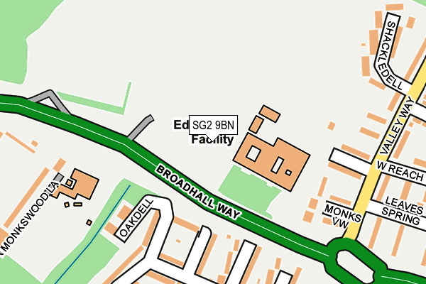
SG2 9BN is located in the Shephall electoral ward, within the local authority district of Stevenage and the English Parliamentary constituency of Stevenage. The Sub Integrated Care Board (ICB) Location is NHS Hertfordshire and West Essex ICB - 06K and the police force is Hertfordshire. This postcode has been in use since February 2010.


GetTheData
Source: OS OpenMap – Local (Ordnance Survey)
Source: OS VectorMap District (Ordnance Survey)
Licence: Open Government Licence (requires attribution)
| Easting | 524798 |
| Northing | 222834 |
| Latitude | 51.890106 |
| Longitude | -0.187928 |
GetTheData
Source: Open Postcode Geo
Licence: Open Government Licence
| Country | England |
| Postcode District | SG2 |
| ➜ SG2 open data dashboard ➜ See where SG2 is on a map ➜ Where is Stevenage? | |
GetTheData
Source: Land Registry Price Paid Data
Licence: Open Government Licence
Elevation or altitude of SG2 9BN as distance above sea level:
| Metres | Feet | |
|---|---|---|
| Elevation | 90m | 295ft |
Elevation is measured from the approximate centre of the postcode, to the nearest point on an OS contour line from OS Terrain 50, which has contour spacing of ten vertical metres.
➜ How high above sea level am I? Find the elevation of your current position using your device's GPS.
GetTheData
Source: Open Postcode Elevation
Licence: Open Government Licence
| Ward | Shephall |
| Constituency | Stevenage |
GetTheData
Source: ONS Postcode Database
Licence: Open Government Licence
| January 2024 | Vehicle crime | On or near Parking Area | 359m |
| December 2023 | Anti-social behaviour | On or near Parking Area | 359m |
| November 2023 | Drugs | On or near Parking Area | 359m |
| ➜ Get more crime data in our Crime section | |||
GetTheData
Source: data.police.uk
Licence: Open Government Licence
| The Valley School (Broadhall Way) | Broadwater | 109m |
| The Valley School (Broadhall Way) | Broadwater | 130m |
| Stevenage Fc (Broadhall Way) | Monk's Wood | 308m |
| Peartree Centre (Hydean Way) | Shephall | 403m |
| Peartree Centre (Valley Way) | Shephall | 438m |
| Stevenage Station | 1.8km |
| Knebworth Station | 2.6km |
| Watton-at-Stone Station | 6km |
GetTheData
Source: NaPTAN
Licence: Open Government Licence
GetTheData
Source: ONS Postcode Database
Licence: Open Government Licence


➜ Get more ratings from the Food Standards Agency
GetTheData
Source: Food Standards Agency
Licence: FSA terms & conditions
| Last Collection | |||
|---|---|---|---|
| Location | Mon-Fri | Sat | Distance |
| Broad Oak Way | 17:30 | 12:30 | 245m |
| Long Leaves | 18:15 | 12:00 | 355m |
| Leaves Spring Post Office | 18:45 | 12:00 | 421m |
GetTheData
Source: Dracos
Licence: Creative Commons Attribution-ShareAlike
| Facility | Distance |
|---|---|
| The Valley School Valley Way, Stevenage Grass Pitches, Sports Hall, Outdoor Tennis Courts | 0m |
| Valley Sports Academy Broadhall Way, Stevenage Artificial Grass Pitch, Grass Pitches | 122m |
| St Margaret Clitherow Roman Catholic Primary School Monkswood Lane, Stevenage Grass Pitches | 284m |
GetTheData
Source: Active Places
Licence: Open Government Licence
| School | Phase of Education | Distance |
|---|---|---|
| The Valley School Broadhall Way, Stevenage, SG2 9BN | Not applicable | 0m |
| Roebuck Academy St Margarets, Stevenage, SG2 8RG | Primary | 267m |
| Peartree Way Nursery School Peartree Way, Stevenage, SG2 9EA | Nursery | 597m |
GetTheData
Source: Edubase
Licence: Open Government Licence
The below table lists the International Territorial Level (ITL) codes (formerly Nomenclature of Territorial Units for Statistics (NUTS) codes) and Local Administrative Units (LAU) codes for SG2 9BN:
| ITL 1 Code | Name |
|---|---|
| TLH | East |
| ITL 2 Code | Name |
| TLH2 | Bedfordshire and Hertfordshire |
| ITL 3 Code | Name |
| TLH23 | Hertfordshire CC |
| LAU 1 Code | Name |
| E07000243 | Stevenage |
GetTheData
Source: ONS Postcode Directory
Licence: Open Government Licence
The below table lists the Census Output Area (OA), Lower Layer Super Output Area (LSOA), and Middle Layer Super Output Area (MSOA) for SG2 9BN:
| Code | Name | |
|---|---|---|
| OA | E00120828 | |
| LSOA | E01023794 | Stevenage 010D |
| MSOA | E02004953 | Stevenage 010 |
GetTheData
Source: ONS Postcode Directory
Licence: Open Government Licence
| SG2 9AA | Monks View | 96m |
| SG2 9AB | Valley Way | 112m |
| SG2 9AD | Valley Way | 150m |
| SG2 8RF | St Margarets | 180m |
| SG2 8RE | St Margarets | 209m |
| SG2 9AS | West Reach | 211m |
| SG2 9AE | Shackledell | 212m |
| SG2 8RD | Broad Oak Way | 215m |
| SG2 9AW | Angle Ways | 216m |
| SG2 9AF | Valley Way | 237m |
GetTheData
Source: Open Postcode Geo; Land Registry Price Paid Data
Licence: Open Government Licence