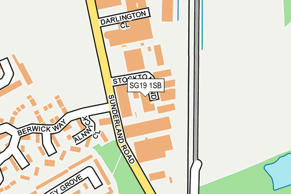
SG19 1SB lies on Stockton End in Sandy. SG19 1SB is located in the Sandy electoral ward, within the unitary authority of Central Bedfordshire and the English Parliamentary constituency of North East Bedfordshire. The Sub Integrated Care Board (ICB) Location is NHS Bedfordshire, Luton and Milton Keynes ICB - M1J4Y and the police force is Bedfordshire. This postcode has been in use since July 1990.


GetTheData
Source: OS OpenMap – Local (Ordnance Survey)
Source: OS VectorMap District (Ordnance Survey)
Licence: Open Government Licence (requires attribution)
| Easting | 517560 |
| Northing | 249913 |
| Latitude | 52.135020 |
| Longitude | -0.283790 |
GetTheData
Source: Open Postcode Geo
Licence: Open Government Licence
| Street | Stockton End |
| Town/City | Sandy |
| Country | England |
| Postcode District | SG19 |
| ➜ SG19 open data dashboard ➜ See where SG19 is on a map ➜ Where is Sandy? | |
GetTheData
Source: Land Registry Price Paid Data
Licence: Open Government Licence
Elevation or altitude of SG19 1SB as distance above sea level:
| Metres | Feet | |
|---|---|---|
| Elevation | 30m | 98ft |
Elevation is measured from the approximate centre of the postcode, to the nearest point on an OS contour line from OS Terrain 50, which has contour spacing of ten vertical metres.
➜ How high above sea level am I? Find the elevation of your current position using your device's GPS.
GetTheData
Source: Open Postcode Elevation
Licence: Open Government Licence
| Ward | Sandy |
| Constituency | North East Bedfordshire |
GetTheData
Source: ONS Postcode Database
Licence: Open Government Licence
| January 2024 | Drugs | On or near College Road | 429m |
| December 2023 | Other theft | On or near Winchester Road | 441m |
| November 2023 | Criminal damage and arson | On or near College Road | 429m |
| ➜ Stockton End crime map and outcomes | |||
GetTheData
Source: data.police.uk
Licence: Open Government Licence
| Stockton End (Sunderland Road) | Fallowfield | 76m |
| Stockton End (Sunderland Road) | Fallowfield | 92m |
| Dapifer Drive (Sunderland Road) | Fallowfield | 478m |
| Dapifer Drive (Sunderland Road) | Fallowfield | 480m |
| Gateshead Close (Sunderland Road) | Fallowfield | 520m |
| Sandy Station | 1.2km |
GetTheData
Source: NaPTAN
Licence: Open Government Licence
GetTheData
Source: ONS Postcode Database
Licence: Open Government Licence


➜ Get more ratings from the Food Standards Agency
GetTheData
Source: Food Standards Agency
Licence: FSA terms & conditions
| Last Collection | |||
|---|---|---|---|
| Location | Mon-Fri | Sat | Distance |
| Sunderland Road | 18:30 | 07:30 | 117m |
| Sunderland Road | 124m | ||
| Dapifer Drive | 18:00 | 08:30 | 440m |
GetTheData
Source: Dracos
Licence: Creative Commons Attribution-ShareAlike
| Facility | Distance |
|---|---|
| Sunderland Road Recreation Ground Sunderland Road, Sandy Grass Pitches | 413m |
| Robert Peel Primary School Dapifer Drive, Sandy Sports Hall, Swimming Pool, Grass Pitches | 441m |
| Sandy Sports Centre Engayne Avenue, Sandy Sports Hall, Health and Fitness Gym, Artificial Grass Pitch, Athletics, Grass Pitches, Studio, Squash Courts, Outdoor Tennis Courts | 616m |
GetTheData
Source: Active Places
Licence: Open Government Licence
| School | Phase of Education | Distance |
|---|---|---|
| Robert Peel Primary School Dapifer Drive, Sandy, SG19 1QJ | Primary | 421m |
| Sandy Secondary School Engayne Avenue, Sandy, SG19 1BL | Secondary | 543m |
| Maple Tree Primary School Hawk Drive, Sandy, SG19 2WA | Primary | 938m |
GetTheData
Source: Edubase
Licence: Open Government Licence
The below table lists the International Territorial Level (ITL) codes (formerly Nomenclature of Territorial Units for Statistics (NUTS) codes) and Local Administrative Units (LAU) codes for SG19 1SB:
| ITL 1 Code | Name |
|---|---|
| TLH | East |
| ITL 2 Code | Name |
| TLH2 | Bedfordshire and Hertfordshire |
| ITL 3 Code | Name |
| TLH25 | Central Bedfordshire |
| LAU 1 Code | Name |
| E06000056 | Central Bedfordshire |
GetTheData
Source: ONS Postcode Directory
Licence: Open Government Licence
The below table lists the Census Output Area (OA), Lower Layer Super Output Area (LSOA), and Middle Layer Super Output Area (MSOA) for SG19 1SB:
| Code | Name | |
|---|---|---|
| OA | E00088041 | |
| LSOA | E01017435 | Central Bedfordshire 002D |
| MSOA | E02003600 | Central Bedfordshire 002 |
GetTheData
Source: ONS Postcode Directory
Licence: Open Government Licence
| SG19 1QY | Sunderland Road | 138m |
| SG19 1UA | Alnwick Close | 146m |
| SG19 1UB | Skipton Close | 208m |
| SG19 1RW | Darlington Close | 213m |
| SG19 1QR | Abbey Grove | 215m |
| SG19 1TS | Pickering Close | 232m |
| SG19 1QU | Friars Walk | 256m |
| SG19 1TZ | Warkworth Close | 270m |
| SG19 1TR | Berwick Way | 274m |
| SG19 1QP | Abbey Grove | 302m |
GetTheData
Source: Open Postcode Geo; Land Registry Price Paid Data
Licence: Open Government Licence