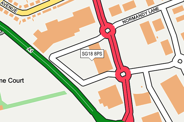
SG18 8PS lies on London Road Trading Estate in Biggleswade. SG18 8PS is located in the Biggleswade West electoral ward, within the unitary authority of Central Bedfordshire and the English Parliamentary constituency of North East Bedfordshire. The Sub Integrated Care Board (ICB) Location is NHS Bedfordshire, Luton and Milton Keynes ICB - M1J4Y and the police force is Bedfordshire. This postcode has been in use since July 1983.


GetTheData
Source: OS OpenMap – Local (Ordnance Survey)
Source: OS VectorMap District (Ordnance Survey)
Licence: Open Government Licence (requires attribution)
| Easting | 520390 |
| Northing | 243140 |
| Latitude | 52.073558 |
| Longitude | -0.244829 |
GetTheData
Source: Open Postcode Geo
Licence: Open Government Licence
| Street | London Road Trading Estate |
| Town/City | Biggleswade |
| Country | England |
| Postcode District | SG18 |
| ➜ SG18 open data dashboard ➜ See where SG18 is on a map ➜ Where is Biggleswade? | |
GetTheData
Source: Land Registry Price Paid Data
Licence: Open Government Licence
Elevation or altitude of SG18 8PS as distance above sea level:
| Metres | Feet | |
|---|---|---|
| Elevation | 40m | 131ft |
Elevation is measured from the approximate centre of the postcode, to the nearest point on an OS contour line from OS Terrain 50, which has contour spacing of ten vertical metres.
➜ How high above sea level am I? Find the elevation of your current position using your device's GPS.
GetTheData
Source: Open Postcode Elevation
Licence: Open Government Licence
| Ward | Biggleswade West |
| Constituency | North East Bedfordshire |
GetTheData
Source: ONS Postcode Database
Licence: Open Government Licence
UNIT 7A, LONDON ROAD TRADING ESTATE, BIGGLESWADE, SG18 8PS 1999 5 MAR £160,000 |
GetTheData
Source: HM Land Registry Price Paid Data
Licence: Contains HM Land Registry data © Crown copyright and database right 2024. This data is licensed under the Open Government Licence v3.0.
| June 2022 | Shoplifting | On or near Shopping Area | 64m |
| June 2022 | Burglary | On or near Shopping Area | 64m |
| June 2022 | Violence and sexual offences | On or near Shopping Area | 64m |
| ➜ Get more crime data in our Crime section | |||
GetTheData
Source: data.police.uk
Licence: Open Government Licence
| Retail Park (London Road) | Biggleswade | 136m |
| Normandy Lane | Biggleswade | 216m |
| Courtlands Drive East (Holme Court Avenue) | Kitelands | 244m |
| Dunton Lane (London Road) | Kitelands | 333m |
| Montgomery Way | Biggleswade | 340m |
| Biggleswade Station | 1.7km |
GetTheData
Source: NaPTAN
Licence: Open Government Licence
GetTheData
Source: ONS Postcode Database
Licence: Open Government Licence


➜ Get more ratings from the Food Standards Agency
GetTheData
Source: Food Standards Agency
Licence: FSA terms & conditions
| Last Collection | |||
|---|---|---|---|
| Location | Mon-Fri | Sat | Distance |
| Stratton Business Park | 18:45 | 09:30 | 337m |
| Stratton Business Park | 341m | ||
| Dunton Corner | 17:30 | 07:30 | 376m |
GetTheData
Source: Dracos
Licence: Creative Commons Attribution-ShareAlike
| Facility | Distance |
|---|---|
| Saxon Pool And Leisure Centre Saxon Drive, Biggleswade Swimming Pool, Health and Fitness Gym, Studio, Sports Hall | 942m |
| Biggleswade Academy Trust (Holmemead Middle School) Mead End, Biggleswade Sports Hall, Grass Pitches | 994m |
| Lake Recreation Ground Off Hawesmere Close, Biggleswade Grass Pitches | 1.1km |
GetTheData
Source: Active Places
Licence: Open Government Licence
| School | Phase of Education | Distance |
|---|---|---|
| Biggleswade Academy Mead End, Biggleswade, SG18 8JU | Middle deemed primary | 959m |
| Stratton Upper School Eagle Farm Road, Biggleswade, SG18 8JB | Secondary | 1.5km |
| Ivel Valley School & College Hitchmead Road, Biggleswade, SG18 0NL | Not applicable | 1.8km |
GetTheData
Source: Edubase
Licence: Open Government Licence
The below table lists the International Territorial Level (ITL) codes (formerly Nomenclature of Territorial Units for Statistics (NUTS) codes) and Local Administrative Units (LAU) codes for SG18 8PS:
| ITL 1 Code | Name |
|---|---|
| TLH | East |
| ITL 2 Code | Name |
| TLH2 | Bedfordshire and Hertfordshire |
| ITL 3 Code | Name |
| TLH25 | Central Bedfordshire |
| LAU 1 Code | Name |
| E06000056 | Central Bedfordshire |
GetTheData
Source: ONS Postcode Directory
Licence: Open Government Licence
The below table lists the Census Output Area (OA), Lower Layer Super Output Area (LSOA), and Middle Layer Super Output Area (MSOA) for SG18 8PS:
| Code | Name | |
|---|---|---|
| OA | E00087790 | |
| LSOA | E01017381 | Central Bedfordshire 006A |
| MSOA | E02003604 | Central Bedfordshire 006 |
GetTheData
Source: ONS Postcode Directory
Licence: Open Government Licence
| SG18 8PF | Holme Court Avenue | 270m |
| SG18 8PH | Sabel Close | 327m |
| SG18 8PG | Courtlands Drive | 349m |
| SG18 8QB | Stratton Business Park | 377m |
| SG18 8PQ | Courtlands Drive | 386m |
| SG18 9SS | 400m | |
| SG18 8PP | Milestones | 423m |
| SG18 8UB | Montgomery Way | 424m |
| SG18 8PJ | London Road | 438m |
| SG18 8SN | Primrose Close | 465m |
GetTheData
Source: Open Postcode Geo; Land Registry Price Paid Data
Licence: Open Government Licence