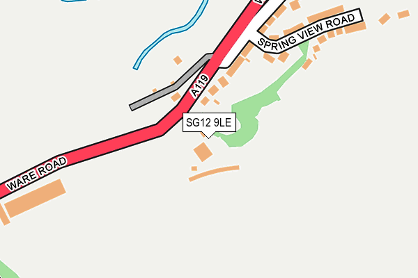
SG12 9LE is located in the Ware Priory electoral ward, within the local authority district of East Hertfordshire and the English Parliamentary constituency of Hertford and Stortford. The Sub Integrated Care Board (ICB) Location is NHS Hertfordshire and West Essex ICB - 06K and the police force is Hertfordshire. This postcode has been in use since January 1980.


GetTheData
Source: OS OpenMap – Local (Ordnance Survey)
Source: OS VectorMap District (Ordnance Survey)
Licence: Open Government Licence (requires attribution)
| Easting | 535118 |
| Northing | 213577 |
| Latitude | 51.804521 |
| Longitude | -0.041668 |
GetTheData
Source: Open Postcode Geo
Licence: Open Government Licence
| Country | England |
| Postcode District | SG12 |
| ➜ SG12 open data dashboard ➜ See where SG12 is on a map | |
GetTheData
Source: Land Registry Price Paid Data
Licence: Open Government Licence
Elevation or altitude of SG12 9LE as distance above sea level:
| Metres | Feet | |
|---|---|---|
| Elevation | 50m | 164ft |
Elevation is measured from the approximate centre of the postcode, to the nearest point on an OS contour line from OS Terrain 50, which has contour spacing of ten vertical metres.
➜ How high above sea level am I? Find the elevation of your current position using your device's GPS.
GetTheData
Source: Open Postcode Elevation
Licence: Open Government Licence
| Ward | Ware Priory |
| Constituency | Hertford And Stortford |
GetTheData
Source: ONS Postcode Database
Licence: Open Government Licence
| June 2022 | Other theft | On or near Links Avenue | 433m |
| May 2022 | Criminal damage and arson | On or near Chadwell Rise | 388m |
| May 2022 | Criminal damage and arson | On or near Links Avenue | 433m |
| ➜ Get more crime data in our Crime section | |||
GetTheData
Source: data.police.uk
Licence: Open Government Licence
| Springs (Ware Road) | Chadwell | 102m |
| Springs (Ware Road) | Chadwell | 187m |
| Viaduct (Ware Road) | Chadwell | 365m |
| Pumping Station (Hertford Road) | Chadwell | 387m |
| Pumping Station (Hertford Road) | Chadwell | 425m |
| Ware Station | 1km |
| Hertford East Station | 2.2km |
| St Margarets (Herts) Station | 3.5km |
GetTheData
Source: NaPTAN
Licence: Open Government Licence
GetTheData
Source: ONS Postcode Database
Licence: Open Government Licence


➜ Get more ratings from the Food Standards Agency
GetTheData
Source: Food Standards Agency
Licence: FSA terms & conditions
| Last Collection | |||
|---|---|---|---|
| Location | Mon-Fri | Sat | Distance |
| Myddleton Road | 17:15 | 12:00 | 650m |
| Warner Road | 17:15 | 12:00 | 661m |
| Pinehurst | 17:15 | 12:00 | 697m |
GetTheData
Source: Dracos
Licence: Creative Commons Attribution-ShareAlike
| Facility | Distance |
|---|---|
| Chadwell Springs Golf Club Hertford Road, Ware Golf | 36m |
| Sacred Heart Catholic Primary School Broadmeads, Ware Grass Pitches | 702m |
| Presdales School Hoe Lane, Ware Swimming Pool, Grass Pitches, Sports Hall, Outdoor Tennis Courts | 767m |
GetTheData
Source: Active Places
Licence: Open Government Licence
| School | Phase of Education | Distance |
|---|---|---|
| Sacred Heart Catholic Primary School Broadmeads, Ware, SG12 9HY | Primary | 702m |
| Hertford Regional College Scotts Road, Ware, SG12 9JF | 16 plus | 709m |
| Pinewood School Hoe Lane, Ware, SG12 9PB | Not applicable | 724m |
GetTheData
Source: Edubase
Licence: Open Government Licence
The below table lists the International Territorial Level (ITL) codes (formerly Nomenclature of Territorial Units for Statistics (NUTS) codes) and Local Administrative Units (LAU) codes for SG12 9LE:
| ITL 1 Code | Name |
|---|---|
| TLH | East |
| ITL 2 Code | Name |
| TLH2 | Bedfordshire and Hertfordshire |
| ITL 3 Code | Name |
| TLH23 | Hertfordshire CC |
| LAU 1 Code | Name |
| E07000242 | East Hertfordshire |
GetTheData
Source: ONS Postcode Directory
Licence: Open Government Licence
The below table lists the Census Output Area (OA), Lower Layer Super Output Area (LSOA), and Middle Layer Super Output Area (MSOA) for SG12 9LE:
| Code | Name | |
|---|---|---|
| OA | E00119413 | |
| LSOA | E01023510 | East Hertfordshire 013A |
| MSOA | E02004890 | East Hertfordshire 013 |
GetTheData
Source: ONS Postcode Directory
Licence: Open Government Licence
| SG12 9LD | Chadwell | 160m |
| SG12 9LB | Spring View Road | 250m |
| SG12 9JY | Chadwell | 303m |
| SG13 7EW | Ware Road | 333m |
| SG12 9LA | Chadwell Rise | 398m |
| SG12 9JP | Fairway | 401m |
| SG12 9JX | Chadwell | 441m |
| SG13 7FJ | Nags Head Close | 447m |
| SG12 9NQ | Beech Close | 447m |
| SG13 7SR | Links Avenue | 455m |
GetTheData
Source: Open Postcode Geo; Land Registry Price Paid Data
Licence: Open Government Licence