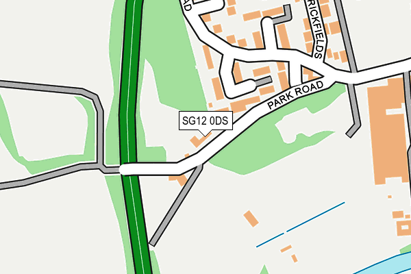
SG12 0DS is located in the Ware St Mary's electoral ward, within the local authority district of East Hertfordshire and the English Parliamentary constituency of Hertford and Stortford. The Sub Integrated Care Board (ICB) Location is NHS Hertfordshire and West Essex ICB - 06K and the police force is Hertfordshire. This postcode has been in use since January 1980.


GetTheData
Source: OS OpenMap – Local (Ordnance Survey)
Source: OS VectorMap District (Ordnance Survey)
Licence: Open Government Licence (requires attribution)
| Easting | 534482 |
| Northing | 214427 |
| Latitude | 51.812306 |
| Longitude | -0.050585 |
GetTheData
Source: Open Postcode Geo
Licence: Open Government Licence
| Country | England |
| Postcode District | SG12 |
| ➜ SG12 open data dashboard ➜ See where SG12 is on a map ➜ Where is Ware? | |
GetTheData
Source: Land Registry Price Paid Data
Licence: Open Government Licence
Elevation or altitude of SG12 0DS as distance above sea level:
| Metres | Feet | |
|---|---|---|
| Elevation | 40m | 131ft |
Elevation is measured from the approximate centre of the postcode, to the nearest point on an OS contour line from OS Terrain 50, which has contour spacing of ten vertical metres.
➜ How high above sea level am I? Find the elevation of your current position using your device's GPS.
GetTheData
Source: Open Postcode Elevation
Licence: Open Government Licence
| Ward | Ware St Mary's |
| Constituency | Hertford And Stortford |
GetTheData
Source: ONS Postcode Database
Licence: Open Government Licence
| June 2022 | Anti-social behaviour | On or near Trapstyle Road | 179m |
| June 2022 | Anti-social behaviour | On or near The Brickfields | 232m |
| June 2022 | Anti-social behaviour | On or near The Brickfields | 232m |
| ➜ Get more crime data in our Crime section | |||
GetTheData
Source: data.police.uk
Licence: Open Government Licence
| The Chauncy School (Park Road) | Ware | 435m |
| Richmond Close (Westmill Road) | Ware | 757m |
| Wengeo Lane (Watton Road) | Ware | 759m |
| Richmond Close (Westmill Road) | Ware | 760m |
| Wengeo Lane (Watton Road) | Ware | 772m |
| Ware Station | 1.6km |
| Hertford East Station | 2.1km |
| Hertford North Station | 3.2km |
GetTheData
Source: NaPTAN
Licence: Open Government Licence
| Percentage of properties with Next Generation Access | 100.0% |
| Percentage of properties with Superfast Broadband | 100.0% |
| Percentage of properties with Ultrafast Broadband | 0.0% |
| Percentage of properties with Full Fibre Broadband | 0.0% |
Superfast Broadband is between 30Mbps and 300Mbps
Ultrafast Broadband is > 300Mbps
| Percentage of properties unable to receive 2Mbps | 0.0% |
| Percentage of properties unable to receive 5Mbps | 0.0% |
| Percentage of properties unable to receive 10Mbps | 0.0% |
| Percentage of properties unable to receive 30Mbps | 0.0% |
GetTheData
Source: Ofcom
Licence: Ofcom Terms of Use (requires attribution)
GetTheData
Source: ONS Postcode Database
Licence: Open Government Licence


➜ Get more ratings from the Food Standards Agency
GetTheData
Source: Food Standards Agency
Licence: FSA terms & conditions
| Last Collection | |||
|---|---|---|---|
| Location | Mon-Fri | Sat | Distance |
| Watton Road | 16:50 | 11:45 | 749m |
| Gentlemens Field | 16:45 | 09:00 | 983m |
| Quincy Road | 16:40 | 11:45 | 1,151m |
GetTheData
Source: Dracos
Licence: Creative Commons Attribution-ShareAlike
| Facility | Distance |
|---|---|
| Allenburys Sports And Social Club Wengeo Lane, Ware Sports Hall, Health and Fitness Gym, Grass Pitches, Studio, Squash Courts, Outdoor Tennis Courts, Artificial Grass Pitch | 136m |
| Fanshawe Pool & Gym Park Road, Ware Swimming Pool, Health and Fitness Gym | 358m |
| The Chauncy School Park Road, Ware Grass Pitches, Sports Hall, Studio | 460m |
GetTheData
Source: Active Places
Licence: Open Government Licence
| School | Phase of Education | Distance |
|---|---|---|
| The Chauncy School Park Road, Ware, SG12 0DP | Secondary | 460m |
| St Catherine's Church of England Primary School Park Road, Ware, SG12 0AW | Primary | 587m |
| Sacred Heart Catholic Primary School Broadmeads, Ware, SG12 9HY | Primary | 1.1km |
GetTheData
Source: Edubase
Licence: Open Government Licence
The below table lists the International Territorial Level (ITL) codes (formerly Nomenclature of Territorial Units for Statistics (NUTS) codes) and Local Administrative Units (LAU) codes for SG12 0DS:
| ITL 1 Code | Name |
|---|---|
| TLH | East |
| ITL 2 Code | Name |
| TLH2 | Bedfordshire and Hertfordshire |
| ITL 3 Code | Name |
| TLH23 | Hertfordshire CC |
| LAU 1 Code | Name |
| E07000242 | East Hertfordshire |
GetTheData
Source: ONS Postcode Directory
Licence: Open Government Licence
The below table lists the Census Output Area (OA), Lower Layer Super Output Area (LSOA), and Middle Layer Super Output Area (MSOA) for SG12 0DS:
| Code | Name | |
|---|---|---|
| OA | E00119450 | |
| LSOA | E01023515 | East Hertfordshire 013C |
| MSOA | E02004890 | East Hertfordshire 013 |
GetTheData
Source: ONS Postcode Directory
Licence: Open Government Licence
| SG12 0BA | Trapstyle Road | 95m |
| SG12 0BB | Trapstyle Road | 183m |
| SG12 0BX | Trapstyle Road | 236m |
| SG12 0AZ | The Brickfields | 252m |
| SG12 0DB | Strawberry Fields | 284m |
| SG12 0FQ | Trapstyle Road | 319m |
| SG12 0ED | Valley Close | 338m |
| SG12 0DR | Rendelsham Close | 342m |
| SG12 0ER | The Hyde | 413m |
| SG12 0AW | Park Road | 581m |
GetTheData
Source: Open Postcode Geo; Land Registry Price Paid Data
Licence: Open Government Licence