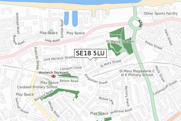
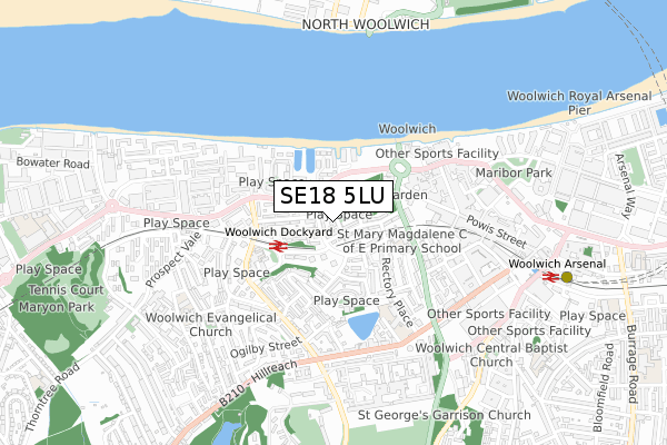
SE18 5LU lies on Sunbury Street in London. SE18 5LU is located in the Woolwich Dockyard electoral ward, within the London borough of Greenwich and the English Parliamentary constituency of Greenwich and Woolwich. The Sub Integrated Care Board (ICB) Location is NHS South East London ICB - 72Q and the police force is Metropolitan Police. This postcode has been in use since March 2018.


GetTheData
Source: OS Open Zoomstack (Ordnance Survey)
Licence: Open Government Licence (requires attribution)
Attribution: Contains OS data © Crown copyright and database right 2024
Source: Open Postcode Geo
Licence: Open Government Licence (requires attribution)
Attribution: Contains OS data © Crown copyright and database right 2024; Contains Royal Mail data © Royal Mail copyright and database right 2024; Source: Office for National Statistics licensed under the Open Government Licence v.3.0
| Easting | 542937 |
| Northing | 179004 |
| Latitude | 51.491921 |
| Longitude | 0.057542 |
GetTheData
Source: Open Postcode Geo
Licence: Open Government Licence
| Street | Sunbury Street |
| Town/City | London |
| Country | England |
| Postcode District | SE18 |
| ➜ SE18 open data dashboard ➜ See where SE18 is on a map ➜ Where is Woolwich? | |
GetTheData
Source: Land Registry Price Paid Data
Licence: Open Government Licence
Elevation or altitude of SE18 5LU as distance above sea level:
| Metres | Feet | |
|---|---|---|
| Elevation | 20m | 66ft |
Elevation is measured from the approximate centre of the postcode, to the nearest point on an OS contour line from OS Terrain 50, which has contour spacing of ten vertical metres.
➜ How high above sea level am I? Find the elevation of your current position using your device's GPS.
GetTheData
Source: Open Postcode Elevation
Licence: Open Government Licence
| Ward | Woolwich Dockyard |
| Constituency | Greenwich And Woolwich |
GetTheData
Source: ONS Postcode Database
Licence: Open Government Licence
| January 2024 | Drugs | On or near Parking Area | 362m |
| January 2024 | Drugs | On or near Parking Area | 362m |
| January 2024 | Vehicle crime | On or near Parking Area | 362m |
| ➜ Sunbury Street crime map and outcomes | |||
GetTheData
Source: data.police.uk
Licence: Open Government Licence
| Kingsman Street (Woolwich Church Street) | Woolwich | 145m |
| Kingsman Street (Woolwich Church Street) | Woolwich | 188m |
| Woolwich Ferry | Woolwich | 221m |
| Frances Street (Woolwich Church Street) | Woolwich | 272m |
| John Wilson Street Powis St (John Wilson Street) | Woolwich | 272m |
| Woolwich Arsenal Dlr Station (Woolwich New Road) | Woolwich | 834m |
| King George V Dlr Station (Rymill Street) | Silvertown | 1,176m |
| London City Airport Dlr Station (Hartmann Road) | Silvertown | 1,416m |
| Woolwich Dockyard Station | 0.2km |
| Woolwich Arsenal Station | 0.8km |
| Plumstead Station | 1.9km |
GetTheData
Source: NaPTAN
Licence: Open Government Licence
| Percentage of properties with Next Generation Access | 100.0% |
| Percentage of properties with Superfast Broadband | 100.0% |
| Percentage of properties with Ultrafast Broadband | 0.0% |
| Percentage of properties with Full Fibre Broadband | 0.0% |
Superfast Broadband is between 30Mbps and 300Mbps
Ultrafast Broadband is > 300Mbps
| Percentage of properties unable to receive 2Mbps | 0.0% |
| Percentage of properties unable to receive 5Mbps | 0.0% |
| Percentage of properties unable to receive 10Mbps | 0.0% |
| Percentage of properties unable to receive 30Mbps | 0.0% |
GetTheData
Source: Ofcom
Licence: Ofcom Terms of Use (requires attribution)
GetTheData
Source: ONS Postcode Database
Licence: Open Government Licence


➜ Get more ratings from the Food Standards Agency
GetTheData
Source: Food Standards Agency
Licence: FSA terms & conditions
| Last Collection | |||
|---|---|---|---|
| Location | Mon-Fri | Sat | Distance |
| Kingsman Street | 17:30 | 12:00 | 214m |
| Woolwich Dockyard | 17:30 | 12:00 | 313m |
| 147 Powis Street | 17:30 | 12:00 | 356m |
GetTheData
Source: Dracos
Licence: Creative Commons Attribution-ShareAlike
| Facility | Distance |
|---|---|
| Clockhouse Community Centre Association (Greenwich) Defiance Walk, London Sports Hall | 374m |
| Energie Fitness (Woolwich) (Closed) Hare Street, Hare Street, London Health and Fitness Gym | 424m |
| Mulgrave Primary School Rectory Place, Rectory Place, London Artificial Grass Pitch | 437m |
GetTheData
Source: Active Places
Licence: Open Government Licence
| School | Phase of Education | Distance |
|---|---|---|
| Saint Mary Magdalene Church of England All Through School Kingsman Street, London, SE18 5PW | All-through | 266m |
| Cardwell Primary School 118 Frances Street, Woolwich, London, SE18 5LP | Primary | 358m |
| Mulgrave Primary School Rectory Place, Woolwich, London, SE18 5DL | Primary | 436m |
GetTheData
Source: Edubase
Licence: Open Government Licence
The below table lists the International Territorial Level (ITL) codes (formerly Nomenclature of Territorial Units for Statistics (NUTS) codes) and Local Administrative Units (LAU) codes for SE18 5LU:
| ITL 1 Code | Name |
|---|---|
| TLI | London |
| ITL 2 Code | Name |
| TLI5 | Outer London - East and North East |
| ITL 3 Code | Name |
| TLI51 | Bexley and Greenwich |
| LAU 1 Code | Name |
| E09000011 | Greenwich |
GetTheData
Source: ONS Postcode Directory
Licence: Open Government Licence
The below table lists the Census Output Area (OA), Lower Layer Super Output Area (LSOA), and Middle Layer Super Output Area (MSOA) for SE18 5LU:
| Code | Name | |
|---|---|---|
| OA | E00008508 | |
| LSOA | E01001712 | Greenwich 004D |
| MSOA | E02000316 | Greenwich 004 |
GetTheData
Source: ONS Postcode Directory
Licence: Open Government Licence
| SE18 5LX | Sunbury Street | 17m |
| SE18 5AN | St Mary Street | 68m |
| SE18 5QF | Kingsman Street | 70m |
| SE18 5AL | St Mary Street | 89m |
| SE18 5LZ | Sunbury Street | 92m |
| SE18 5ND | Woolwich Church Street | 114m |
| SE18 5PY | Lamport Close | 127m |
| SE18 5NB | Church Hill | 137m |
| SE18 5QE | Kingsman Parade | 147m |
| SE18 5PR | Kingsman Street | 149m |
GetTheData
Source: Open Postcode Geo; Land Registry Price Paid Data
Licence: Open Government Licence