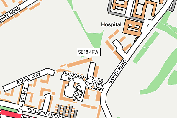
SE18 4PW lies on Farndale Court in London. SE18 4PW is located in the Charlton Hornfair electoral ward, within the London borough of Greenwich and the English Parliamentary constituency of Eltham. The Sub Integrated Care Board (ICB) Location is NHS South East London ICB - 72Q and the police force is Metropolitan Police. This postcode has been in use since May 2002.


GetTheData
Source: OS OpenMap – Local (Ordnance Survey)
Source: OS VectorMap District (Ordnance Survey)
Licence: Open Government Licence (requires attribution)
| Easting | 542238 |
| Northing | 177113 |
| Latitude | 51.475104 |
| Longitude | 0.046693 |
GetTheData
Source: Open Postcode Geo
Licence: Open Government Licence
| Street | Farndale Court |
| Town/City | London |
| Country | England |
| Postcode District | SE18 |
| ➜ SE18 open data dashboard ➜ See where SE18 is on a map ➜ Where is London? | |
GetTheData
Source: Land Registry Price Paid Data
Licence: Open Government Licence
Elevation or altitude of SE18 4PW as distance above sea level:
| Metres | Feet | |
|---|---|---|
| Elevation | 60m | 197ft |
Elevation is measured from the approximate centre of the postcode, to the nearest point on an OS contour line from OS Terrain 50, which has contour spacing of ten vertical metres.
➜ How high above sea level am I? Find the elevation of your current position using your device's GPS.
GetTheData
Source: Open Postcode Elevation
Licence: Open Government Licence
| Ward | Charlton Hornfair |
| Constituency | Eltham |
GetTheData
Source: ONS Postcode Database
Licence: Open Government Licence
| January 2024 | Violence and sexual offences | On or near Melthorpe Gardens | 334m |
| December 2023 | Violence and sexual offences | On or near Melthorpe Gardens | 334m |
| October 2023 | Criminal damage and arson | On or near Melthorpe Gardens | 334m |
| ➜ Get more crime data in our Crime section | |||
GetTheData
Source: data.police.uk
Licence: Open Government Licence
| Greenwich Heights | Charlton | 103m |
| Greenwich Heights (Baker Road) | Charlton | 150m |
| Queen Elizabeth Hospital West Entrance | Charlton | 270m |
| Pallet Way (Shooters Hill Road) | Charlton | 281m |
| Shooters Hill Road Baker Road (Shooters Hill Road) | Shooters Hill | 282m |
| Charlton Station | 1.7km |
| Woolwich Dockyard Station | 1.9km |
| Kidbrooke Station | 2km |
GetTheData
Source: NaPTAN
Licence: Open Government Licence
GetTheData
Source: ONS Postcode Database
Licence: Open Government Licence


➜ Get more ratings from the Food Standards Agency
GetTheData
Source: Food Standards Agency
Licence: FSA terms & conditions
| Last Collection | |||
|---|---|---|---|
| Location | Mon-Fri | Sat | Distance |
| Baker Road | 17:30 | 12:00 | 126m |
| Shooters Hill Road | 17:30 | 12:00 | 309m |
| Charlton Park Lane | 17:30 | 12:00 | 447m |
GetTheData
Source: Dracos
Licence: Creative Commons Attribution-ShareAlike
| Facility | Distance |
|---|---|
| Hornfair Park Shooters Hill Road, London Grass Pitches, Cycling | 211m |
| Meridian Sports And Social Club Ltd Charlton Park Lane, London Artificial Grass Pitch, Grass Pitches | 435m |
| London Marathon Playing Field Greenwich Shooters Hill Road, London Grass Pitches | 492m |
GetTheData
Source: Active Places
Licence: Open Government Licence
| School | Phase of Education | Distance |
|---|---|---|
| Ark Greenwich Free School 403 Shooters Hill Road, London, SE18 4LH | Secondary | 548m |
| Charlton Manor Primary School Indus Road, Charlton, London, SE7 7EF | Primary | 730m |
| Charlton Park Academy Charlton Park Road, Charlton, London, SE7 8HX | Not applicable | 744m |
GetTheData
Source: Edubase
Licence: Open Government Licence
The below table lists the International Territorial Level (ITL) codes (formerly Nomenclature of Territorial Units for Statistics (NUTS) codes) and Local Administrative Units (LAU) codes for SE18 4PW:
| ITL 1 Code | Name |
|---|---|
| TLI | London |
| ITL 2 Code | Name |
| TLI5 | Outer London - East and North East |
| ITL 3 Code | Name |
| TLI51 | Bexley and Greenwich |
| LAU 1 Code | Name |
| E09000011 | Greenwich |
GetTheData
Source: ONS Postcode Directory
Licence: Open Government Licence
The below table lists the Census Output Area (OA), Lower Layer Super Output Area (LSOA), and Middle Layer Super Output Area (MSOA) for SE18 4PW:
| Code | Name | |
|---|---|---|
| OA | E00008215 | |
| LSOA | E01001646 | Greenwich 019A |
| MSOA | E02000331 | Greenwich 019 |
GetTheData
Source: ONS Postcode Directory
Licence: Open Government Licence
| SE18 4PU | Farndale Court | 23m |
| SE18 4NP | Master Gunners Place | 36m |
| SE18 4NW | Master Gunners Place | 36m |
| SE18 4PN | Farndale Court | 46m |
| SE18 4PL | Farndale Court | 67m |
| SE18 4GF | Gunyard Mews | 86m |
| SE18 4GG | Berber Parade | 97m |
| SE18 4GA | Berber Parade | 99m |
| SE18 4GE | Gunyard Mews | 105m |
| SE18 4GH | Berber Parade | 110m |
GetTheData
Source: Open Postcode Geo; Land Registry Price Paid Data
Licence: Open Government Licence