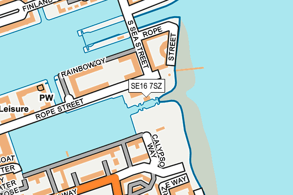
SE16 7SZ is located in the Surrey Docks electoral ward, within the London borough of Southwark and the English Parliamentary constituency of Bermondsey and Old Southwark. The Sub Integrated Care Board (ICB) Location is NHS South East London ICB - 72Q and the police force is Metropolitan Police. This postcode has been in use since December 1999.


GetTheData
Source: OS OpenMap – Local (Ordnance Survey)
Source: OS VectorMap District (Ordnance Survey)
Licence: Open Government Licence (requires attribution)
| Easting | 536606 |
| Northing | 179084 |
| Latitude | 51.494203 |
| Longitude | -0.033588 |
GetTheData
Source: Open Postcode Geo
Licence: Open Government Licence
| Country | England |
| Postcode District | SE16 |
➜ See where SE16 is on a map ➜ Where is London? | |
GetTheData
Source: Land Registry Price Paid Data
Licence: Open Government Licence
Elevation or altitude of SE16 7SZ as distance above sea level:
| Metres | Feet | |
|---|---|---|
| Elevation | 10m | 33ft |
Elevation is measured from the approximate centre of the postcode, to the nearest point on an OS contour line from OS Terrain 50, which has contour spacing of ten vertical metres.
➜ How high above sea level am I? Find the elevation of your current position using your device's GPS.
GetTheData
Source: Open Postcode Elevation
Licence: Open Government Licence
| Ward | Surrey Docks |
| Constituency | Bermondsey And Old Southwark |
GetTheData
Source: ONS Postcode Database
Licence: Open Government Licence
| Grove Street Plough Way (Grove Street) | Deptford | 219m |
| Grove Street Plough Way (Grove Street) | Deptford | 235m |
| Dunnage Crescent (Plough Way) | Surrey Quays | 246m |
| Dunnage Crescent (Plough Way) | Surrey Quays | 279m |
| Windlass Place (Grove Street) | Deptford | 417m |
| Canada Water Underground Station | Canada Water | 1,195m |
| Heron Quays Dlr Station (Heron Quay) | Heron Quays | 1,325m |
| Crossharbour Dlr Station (Limeharbour) | Crossharbour | 1,329m |
| Mudchute Dlr Station (East Ferry Road) | Mudchute | 1,366m |
| South Quay Dlr Station (Marsh Wall) | South Quay | 1,376m |
| Surrey Quays Station | 1km |
| Canada Water Station | 1.2km |
| Rotherhithe Station | 1.5km |
GetTheData
Source: NaPTAN
Licence: Open Government Licence
GetTheData
Source: ONS Postcode Database
Licence: Open Government Licence


➜ Get more ratings from the Food Standards Agency
GetTheData
Source: Food Standards Agency
Licence: FSA terms & conditions
| Last Collection | |||
|---|---|---|---|
| Location | Mon-Fri | Sat | Distance |
| Finland Street | 17:30 | 12:00 | 265m |
| Grove Street | 17:30 | 12:00 | 283m |
| Plough Way | 17:30 | 12:00 | 506m |
GetTheData
Source: Dracos
Licence: Creative Commons Attribution-ShareAlike
| Risk of SE16 7SZ flooding from rivers and sea | Very Low |
| ➜ SE16 7SZ flood map | |
GetTheData
Source: Open Flood Risk by Postcode
Licence: Open Government Licence
The below table lists the International Territorial Level (ITL) codes (formerly Nomenclature of Territorial Units for Statistics (NUTS) codes) and Local Administrative Units (LAU) codes for SE16 7SZ:
| ITL 1 Code | Name |
|---|---|
| TLI | London |
| ITL 2 Code | Name |
| TLI4 | Inner London - East |
| ITL 3 Code | Name |
| TLI44 | Lewisham and Southwark |
| LAU 1 Code | Name |
| E09000028 | Southwark |
GetTheData
Source: ONS Postcode Directory
Licence: Open Government Licence
The below table lists the Census Output Area (OA), Lower Layer Super Output Area (LSOA), and Middle Layer Super Output Area (MSOA) for SE16 7SZ:
| Code | Name | |
|---|---|---|
| OA | E00020427 | |
| LSOA | E01004058 | Southwark 008C |
| MSOA | E02000814 | Southwark 008 |
GetTheData
Source: ONS Postcode Directory
Licence: Open Government Licence
| SE16 7TY | Rope Street | 18m |
| SE16 7US | South Sea Street | 73m |
| SE16 7TQ | Rope Street | 90m |
| SE16 7TD | Princes Court | 97m |
| SE16 7FL | Windsock Close | 99m |
| SE16 7UF | Rainbow Quay | 119m |
| SE16 7UX | Plough Way | 163m |
| SE16 7FJ | Dunnage Crescent | 177m |
| SE8 3RD | Enterprize Way | 193m |
| SE16 7TB | Queen Of Denmark Court | 195m |
GetTheData
Source: Open Postcode Geo; Land Registry Price Paid Data
Licence: Open Government Licence