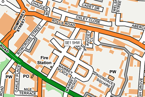
SE1 5HW lies on Fortune Place in London. SE1 5HW is located in the Old Kent Road electoral ward, within the London borough of Southwark and the English Parliamentary constituency of Bermondsey and Old Southwark. The Sub Integrated Care Board (ICB) Location is NHS South East London ICB - 72Q and the police force is Metropolitan Police. This postcode has been in use since January 2008.


GetTheData
Source: OS OpenMap – Local (Ordnance Survey)
Source: OS VectorMap District (Ordnance Survey)
Licence: Open Government Licence (requires attribution)
| Easting | 533939 |
| Northing | 178300 |
| Latitude | 51.487796 |
| Longitude | -0.072254 |
GetTheData
Source: Open Postcode Geo
Licence: Open Government Licence
| Street | Fortune Place |
| Town/City | London |
| Country | England |
| Postcode District | SE1 |
➜ See where SE1 is on a map ➜ Where is London? | |
GetTheData
Source: Land Registry Price Paid Data
Licence: Open Government Licence
Elevation or altitude of SE1 5HW as distance above sea level:
| Metres | Feet | |
|---|---|---|
| Elevation | 10m | 33ft |
Elevation is measured from the approximate centre of the postcode, to the nearest point on an OS contour line from OS Terrain 50, which has contour spacing of ten vertical metres.
➜ How high above sea level am I? Find the elevation of your current position using your device's GPS.
GetTheData
Source: Open Postcode Elevation
Licence: Open Government Licence
| Ward | Old Kent Road |
| Constituency | Bermondsey And Old Southwark |
GetTheData
Source: ONS Postcode Database
Licence: Open Government Licence
| Trafalgar Avenue | Old Kent Road | 148m |
| Trafalgar Avenue (Old Kent Road) | Old Kent Road | 185m |
| Nile Terrace (Trafalgar Avenue) | Old Kent Road | 228m |
| Nile Terrace | Old Kent Road | 232m |
| Humphrey Street | Old Kent Road | 238m |
| Bermondsey Underground Station | Bermondsey | 1,275m |
| South Bermondsey Station | 1.2km |
| Surrey Quays Station | 1.8km |
| Queens Road Peckham Station | 1.9km |
GetTheData
Source: NaPTAN
Licence: Open Government Licence
| Percentage of properties with Next Generation Access | 0.0% |
| Percentage of properties with Superfast Broadband | 0.0% |
| Percentage of properties with Ultrafast Broadband | 0.0% |
| Percentage of properties with Full Fibre Broadband | 0.0% |
Superfast Broadband is between 30Mbps and 300Mbps
Ultrafast Broadband is > 300Mbps
| Percentage of properties unable to receive 2Mbps | 0.0% |
| Percentage of properties unable to receive 5Mbps | 0.0% |
| Percentage of properties unable to receive 10Mbps | 0.0% |
| Percentage of properties unable to receive 30Mbps | 100.0% |
GetTheData
Source: Ofcom
Licence: Ofcom Terms of Use (requires attribution)
GetTheData
Source: ONS Postcode Database
Licence: Open Government Licence


➜ Get more ratings from the Food Standards Agency
GetTheData
Source: Food Standards Agency
Licence: FSA terms & conditions
| Last Collection | |||
|---|---|---|---|
| Location | Mon-Fri | Sat | Distance |
| Rolls Road | 18:30 | 13:00 | 93m |
| 380 Old Kent Road | 18:30 | 13:00 | 159m |
| Old Kent Road | 18:30 | 13:00 | 253m |
GetTheData
Source: Dracos
Licence: Creative Commons Attribution-ShareAlike
| Risk of SE1 5HW flooding from rivers and sea | Very Low |
| ➜ SE1 5HW flood map | |
GetTheData
Source: Open Flood Risk by Postcode
Licence: Open Government Licence
The below table lists the International Territorial Level (ITL) codes (formerly Nomenclature of Territorial Units for Statistics (NUTS) codes) and Local Administrative Units (LAU) codes for SE1 5HW:
| ITL 1 Code | Name |
|---|---|
| TLI | London |
| ITL 2 Code | Name |
| TLI4 | Inner London - East |
| ITL 3 Code | Name |
| TLI44 | Lewisham and Southwark |
| LAU 1 Code | Name |
| E09000028 | Southwark |
GetTheData
Source: ONS Postcode Directory
Licence: Open Government Licence
The below table lists the Census Output Area (OA), Lower Layer Super Output Area (LSOA), and Middle Layer Super Output Area (MSOA) for SE1 5HW:
| Code | Name | |
|---|---|---|
| OA | E00020353 | |
| LSOA | E01004040 | Southwark 013C |
| MSOA | E02000819 | Southwark 013 |
GetTheData
Source: ONS Postcode Directory
Licence: Open Government Licence
| SE1 5JA | Coopers Road | 39m |
| SE1 5YA | Coopers Road | 50m |
| SE1 5HY | Coopers Road | 54m |
| SE1 5JB | Coopers Road | 63m |
| SE1 5HZ | Coopers Road | 63m |
| SE1 5HX | Coopers Road | 77m |
| SE1 5DX | Rolls Road | 100m |
| SE1 5NY | Avondale Square | 125m |
| SE1 5NZ | Avondale Square | 125m |
| SE1 5HS | Rowcross Street | 128m |
GetTheData
Source: Open Postcode Geo; Land Registry Price Paid Data
Licence: Open Government Licence