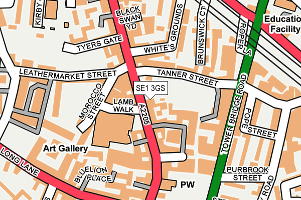
SE1 3GS is located in the London Bridge & West Bermondsey electoral ward, within the London borough of Southwark and the English Parliamentary constituency of Bermondsey and Old Southwark. The Sub Integrated Care Board (ICB) Location is NHS South East London ICB - 72Q and the police force is Metropolitan Police. This postcode has been in use since June 2002.


GetTheData
Source: OS OpenMap – Local (Ordnance Survey)
Source: OS VectorMap District (Ordnance Survey)
Licence: Open Government Licence (requires attribution)
| Easting | 533282 |
| Northing | 179633 |
| Latitude | 51.499929 |
| Longitude | -0.081234 |
GetTheData
Source: Open Postcode Geo
Licence: Open Government Licence
| Country | England |
| Postcode District | SE1 |
➜ See where SE1 is on a map ➜ Where is Bermondsey? | |
GetTheData
Source: Land Registry Price Paid Data
Licence: Open Government Licence
Elevation or altitude of SE1 3GS as distance above sea level:
| Metres | Feet | |
|---|---|---|
| Elevation | 10m | 33ft |
Elevation is measured from the approximate centre of the postcode, to the nearest point on an OS contour line from OS Terrain 50, which has contour spacing of ten vertical metres.
➜ How high above sea level am I? Find the elevation of your current position using your device's GPS.
GetTheData
Source: Open Postcode Elevation
Licence: Open Government Licence
| Ward | London Bridge & West Bermondsey |
| Constituency | Bermondsey And Old Southwark |
GetTheData
Source: ONS Postcode Database
Licence: Open Government Licence
| Abbey Street (Tower Bridge Road) | Bermondsey | 157m |
| Bermondsey Street | The Borough | 223m |
| Bermondsey Street | The Borough | 237m |
| Abbey Street (Tower Bridge Road) | Bermondsey | 240m |
| Druid Street | Bermondsey | 242m |
| London Bridge Underground Station | London Bridge | 834m |
| Borough Underground Station | The Borough | 854m |
| Tower Hill Underground Station | Tower Hill | 1,163m |
| Bermondsey Underground Station | Bermondsey | 1,232m |
| Monument Underground Station | Monument | 1,242m |
| London Bridge Station | 0.7km |
| London Fenchurch Street Station | 1.3km |
| Elephant & Castle Station | 1.4km |
GetTheData
Source: NaPTAN
Licence: Open Government Licence
| Percentage of properties with Next Generation Access | 100.0% |
| Percentage of properties with Superfast Broadband | 100.0% |
| Percentage of properties with Ultrafast Broadband | 0.0% |
| Percentage of properties with Full Fibre Broadband | 0.0% |
Superfast Broadband is between 30Mbps and 300Mbps
Ultrafast Broadband is > 300Mbps
| Median download speed | 39.0Mbps |
| Average download speed | 36.0Mbps |
| Maximum download speed | 50.26Mbps |
| Median upload speed | 10.0Mbps |
| Average upload speed | 11.3Mbps |
| Maximum upload speed | 20.00Mbps |
| Percentage of properties unable to receive 2Mbps | 0.0% |
| Percentage of properties unable to receive 5Mbps | 0.0% |
| Percentage of properties unable to receive 10Mbps | 0.0% |
| Percentage of properties unable to receive 30Mbps | 0.0% |
GetTheData
Source: Ofcom
Licence: Ofcom Terms of Use (requires attribution)
GetTheData
Source: ONS Postcode Database
Licence: Open Government Licence


➜ Get more ratings from the Food Standards Agency
GetTheData
Source: Food Standards Agency
Licence: FSA terms & conditions
| Last Collection | |||
|---|---|---|---|
| Location | Mon-Fri | Sat | Distance |
| Post Office | 18:45 | 13:00 | 87m |
| Long Lane | 18:30 | 13:00 | 233m |
| Weston Street | 18:30 | 13:00 | 268m |
GetTheData
Source: Dracos
Licence: Creative Commons Attribution-ShareAlike
| Risk of SE1 3GS flooding from rivers and sea | Very Low |
| ➜ SE1 3GS flood map | |
GetTheData
Source: Open Flood Risk by Postcode
Licence: Open Government Licence
The below table lists the International Territorial Level (ITL) codes (formerly Nomenclature of Territorial Units for Statistics (NUTS) codes) and Local Administrative Units (LAU) codes for SE1 3GS:
| ITL 1 Code | Name |
|---|---|
| TLI | London |
| ITL 2 Code | Name |
| TLI4 | Inner London - East |
| ITL 3 Code | Name |
| TLI44 | Lewisham and Southwark |
| LAU 1 Code | Name |
| E09000028 | Southwark |
GetTheData
Source: ONS Postcode Directory
Licence: Open Government Licence
The below table lists the Census Output Area (OA), Lower Layer Super Output Area (LSOA), and Middle Layer Super Output Area (MSOA) for SE1 3GS:
| Code | Name | |
|---|---|---|
| OA | E00167982 | |
| LSOA | E01032646 | Southwark 003I |
| MSOA | E02000809 | Southwark 003 |
GetTheData
Source: ONS Postcode Directory
Licence: Open Government Licence
| SE1 3HA | Bermondsey Street | 49m |
| SE1 3TX | Bermondsey Street | 54m |
| SE1 3UX | Bell Yard Mews | 61m |
| SE1 3UF | Bermondsey Street | 65m |
| SE1 3GL | Lamb Walk | 66m |
| SE1 3HB | Morocco Street | 77m |
| SE1 3UA | Bell Yard Mews | 77m |
| SE1 3XB | Bermondsey Street | 82m |
| SE1 3TR | Royal Oak Yard | 83m |
| SE1 3UY | Bell Yard Mews | 86m |
GetTheData
Source: Open Postcode Geo; Land Registry Price Paid Data
Licence: Open Government Licence