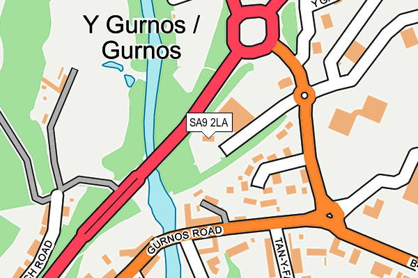
SA9 2LA is located in the Cwm-twrch electoral ward, within the unitary authority of Powys and the Welsh Parliamentary constituency of Brecon and Radnorshire. The Local Health Board is Powys Teaching and the police force is Dyfed-Powys. This postcode has been in use since January 1980.


GetTheData
Source: OS OpenMap – Local (Ordnance Survey)
Source: OS VectorMap District (Ordnance Survey)
Licence: Open Government Licence (requires attribution)
| Easting | 277340 |
| Northing | 209327 |
| Latitude | 51.769146 |
| Longitude | -3.779032 |
GetTheData
Source: Open Postcode Geo
Licence: Open Government Licence
| Country | Wales |
| Postcode District | SA9 |
| ➜ SA9 open data dashboard ➜ See where SA9 is on a map ➜ Where is Gurnos? | |
GetTheData
Source: Land Registry Price Paid Data
Licence: Open Government Licence
Elevation or altitude of SA9 2LA as distance above sea level:
| Metres | Feet | |
|---|---|---|
| Elevation | 70m | 230ft |
Elevation is measured from the approximate centre of the postcode, to the nearest point on an OS contour line from OS Terrain 50, which has contour spacing of ten vertical metres.
➜ How high above sea level am I? Find the elevation of your current position using your device's GPS.
GetTheData
Source: Open Postcode Elevation
Licence: Open Government Licence
| Ward | Cwm-twrch |
| Constituency | Brecon And Radnorshire |
GetTheData
Source: ONS Postcode Database
Licence: Open Government Licence
| June 2022 | Violence and sexual offences | On or near Supermarket | 124m |
| June 2022 | Violence and sexual offences | On or near Supermarket | 124m |
| June 2022 | Other theft | On or near Gurnos Road | 137m |
| ➜ Get more crime data in our Crime section | |||
GetTheData
Source: data.police.uk
Licence: Open Government Licence
| Co-op Store (Grounds) | Glanrhyd | 77m |
| Capital Shops (Gurnos Road) | Glanrhyd | 135m |
| Capital Buildings (Gurnos Road) | Glanrhyd | 148m |
| New Swan Inn (Gurnos Road) | Ystalyfera | 243m |
| New Swan Inn (Gurnos Road) | Ystalyfera | 253m |
GetTheData
Source: NaPTAN
Licence: Open Government Licence
GetTheData
Source: ONS Postcode Database
Licence: Open Government Licence


➜ Get more ratings from the Food Standards Agency
GetTheData
Source: Food Standards Agency
Licence: FSA terms & conditions
| Last Collection | |||
|---|---|---|---|
| Location | Mon-Fri | Sat | Distance |
| Gurnos P O | 17:30 | 12:00 | 263m |
| Ystalyfera P O | 17:30 | 12:00 | 882m |
| Ynysydarren P O | 17:30 | 12:00 | 974m |
GetTheData
Source: Dracos
Licence: Creative Commons Attribution-ShareAlike
| School | Phase of Education | Distance |
|---|---|---|
| Ysgol Maes-Y-Dderwen Tudor Street, Ystradgynlais, Swansea, SA9 1AP | Not applicable | 711m |
| Godre'rgraig Primary School Graig Road, Godre'rgraig, Swansea, SA9 2NY | Not applicable | 3.2km |
| YGGD Cwmllynfell Pen-Y-Bryn, Cwmllynfell, Swansea, SA9 2FL | Not applicable | 4.4km |
GetTheData
Source: Edubase
Licence: Open Government Licence
The below table lists the International Territorial Level (ITL) codes (formerly Nomenclature of Territorial Units for Statistics (NUTS) codes) and Local Administrative Units (LAU) codes for SA9 2LA:
| ITL 1 Code | Name |
|---|---|
| TLL | Wales |
| ITL 2 Code | Name |
| TLL2 | East Wales |
| ITL 3 Code | Name |
| TLL24 | Powys |
| LAU 1 Code | Name |
| W06000023 | Powys |
GetTheData
Source: ONS Postcode Directory
Licence: Open Government Licence
The below table lists the Census Output Area (OA), Lower Layer Super Output Area (LSOA), and Middle Layer Super Output Area (MSOA) for SA9 2LA:
| Code | Name | |
|---|---|---|
| OA | W00002329 | |
| LSOA | W01001899 | Powys 021F |
| MSOA | W02000416 | Powys 021 |
GetTheData
Source: ONS Postcode Directory
Licence: Open Government Licence
| SA9 2JT | Gurnos Road | 89m |
| SA9 2JY | Gurnos Road | 106m |
| SA9 2JZ | Maes Y Coed | 107m |
| SA9 2JS | Gurnos Road | 119m |
| SA9 2JP | Gurnos Road | 124m |
| SA9 2JR | Glantwrch Houses | 165m |
| SA9 1BX | 236m | |
| SA9 2JA | Gurnos Road | 239m |
| SA9 1BY | Wharf Cottages | 244m |
| SA9 2JU | Tan Y Farteg | 263m |
GetTheData
Source: Open Postcode Geo; Land Registry Price Paid Data
Licence: Open Government Licence