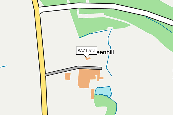
SA71 5TJ is located in the Hundleton electoral ward, within the unitary authority of Pembrokeshire and the Welsh Parliamentary constituency of Carmarthen West and South Pembrokeshire. The Local Health Board is Hywel Dda University and the police force is Dyfed-Powys. This postcode has been in use since January 1980.


GetTheData
Source: OS OpenMap – Local (Ordnance Survey)
Source: OS VectorMap District (Ordnance Survey)
Licence: Open Government Licence (requires attribution)
| Easting | 192530 |
| Northing | 202151 |
| Latitude | 51.679701 |
| Longitude | -5.002376 |
GetTheData
Source: Open Postcode Geo
Licence: Open Government Licence
| Country | Wales |
| Postcode District | SA71 |
| ➜ SA71 open data dashboard ➜ See where SA71 is on a map | |
GetTheData
Source: Land Registry Price Paid Data
Licence: Open Government Licence
Elevation or altitude of SA71 5TJ as distance above sea level:
| Metres | Feet | |
|---|---|---|
| Elevation | 30m | 98ft |
Elevation is measured from the approximate centre of the postcode, to the nearest point on an OS contour line from OS Terrain 50, which has contour spacing of ten vertical metres.
➜ How high above sea level am I? Find the elevation of your current position using your device's GPS.
GetTheData
Source: Open Postcode Elevation
Licence: Open Government Licence
| Ward | Hundleton |
| Constituency | Carmarthen West And South Pembrokeshire |
GetTheData
Source: ONS Postcode Database
Licence: Open Government Licence
| Pembroke Dock Station | 4.7km |
| Milford Haven Station | 4.7km |
GetTheData
Source: NaPTAN
Licence: Open Government Licence
GetTheData
Source: ONS Postcode Database
Licence: Open Government Licence

➜ Get more ratings from the Food Standards Agency
GetTheData
Source: Food Standards Agency
Licence: FSA terms & conditions
| Last Collection | |||
|---|---|---|---|
| Location | Mon-Fri | Sat | Distance |
| Riverside Av | 16:15 | 12:00 | 4,519m |
| Mastlebridge | 12:00 | 12:00 | 4,574m |
| High St | 16:15 | 12:00 | 4,960m |
GetTheData
Source: Dracos
Licence: Creative Commons Attribution-ShareAlike
| School | Phase of Education | Distance |
|---|---|---|
| Pennar Community School Owen Street, Pennar, Pembroke Dock, Pembrokeshire, SA72 6SL | Not applicable | 3.5km |
| Milford Haven Community Primary School Prioryville, Milford Haven, SA73 2LQ | Not applicable | 4.5km |
| St Francis V.R.C. School Priory Road, Milford Haven, Pembrokeshire, SA73 2EE | Not applicable | 4.7km |
GetTheData
Source: Edubase
Licence: Open Government Licence
The below table lists the International Territorial Level (ITL) codes (formerly Nomenclature of Territorial Units for Statistics (NUTS) codes) and Local Administrative Units (LAU) codes for SA71 5TJ:
| ITL 1 Code | Name |
|---|---|
| TLL | Wales |
| ITL 2 Code | Name |
| TLL1 | West Wales and The Valleys |
| ITL 3 Code | Name |
| TLL14 | South West Wales |
| LAU 1 Code | Name |
| W06000009 | Pembrokeshire |
GetTheData
Source: ONS Postcode Directory
Licence: Open Government Licence
The below table lists the Census Output Area (OA), Lower Layer Super Output Area (LSOA), and Middle Layer Super Output Area (MSOA) for SA71 5TJ:
| Code | Name | |
|---|---|---|
| OA | W00003068 | |
| LSOA | W01000574 | Pembrokeshire 015A |
| MSOA | W02000140 | Pembrokeshire 015 |
GetTheData
Source: ONS Postcode Directory
Licence: Open Government Licence
| SA71 5TP | 1374m | |
| SA71 5SH | 1508m | |
| SA72 6RA | Ocean Way | 2211m |
| SA72 6RF | Haven Drive | 2277m |
| SA72 6GL | The Crescent | 2336m |
| SA71 5TG | 2437m | |
| SA71 5RX | 2458m | |
| SA71 5AG | 2605m | |
| SA72 6TP | Beach Road | 3040m |
| SA72 6SE | Military Road | 3048m |
GetTheData
Source: Open Postcode Geo; Land Registry Price Paid Data
Licence: Open Government Licence