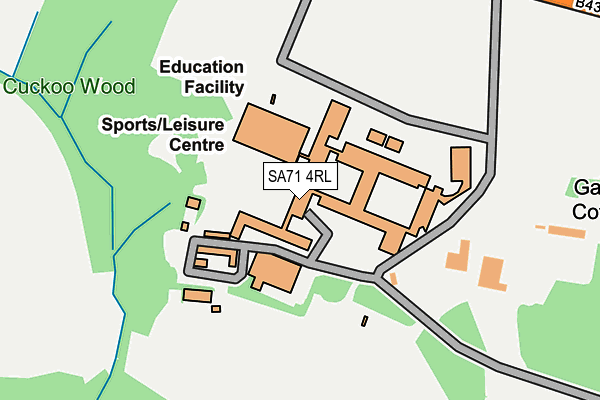
SA71 4RL is located in the Pembroke: St Mary North electoral ward, within the unitary authority of Pembrokeshire and the Welsh Parliamentary constituency of Carmarthen West and South Pembrokeshire. The Local Health Board is Hywel Dda University and the police force is Dyfed-Powys. This postcode has been in use since January 1980.


GetTheData
Source: OS OpenMap – Local (Ordnance Survey)
Source: OS VectorMap District (Ordnance Survey)
Licence: Open Government Licence (requires attribution)
| Easting | 198030 |
| Northing | 202558 |
| Latitude | 51.685372 |
| Longitude | -4.923203 |
GetTheData
Source: Open Postcode Geo
Licence: Open Government Licence
| Country | Wales |
| Postcode District | SA71 |
| ➜ SA71 open data dashboard ➜ See where SA71 is on a map | |
GetTheData
Source: Land Registry Price Paid Data
Licence: Open Government Licence
Elevation or altitude of SA71 4RL as distance above sea level:
| Metres | Feet | |
|---|---|---|
| Elevation | 40m | 131ft |
Elevation is measured from the approximate centre of the postcode, to the nearest point on an OS contour line from OS Terrain 50, which has contour spacing of ten vertical metres.
➜ How high above sea level am I? Find the elevation of your current position using your device's GPS.
GetTheData
Source: Open Postcode Elevation
Licence: Open Government Licence
| Ward | Pembroke: St Mary North |
| Constituency | Carmarthen West And South Pembrokeshire |
GetTheData
Source: ONS Postcode Database
Licence: Open Government Licence
| June 2022 | Violence and sexual offences | On or near Sports/Recreation Area | 330m |
| June 2022 | Other crime | On or near Sports/Recreation Area | 330m |
| June 2022 | Other theft | On or near Sports/Recreation Area | 330m |
| ➜ Get more crime data in our Crime section | |||
GetTheData
Source: data.police.uk
Licence: Open Government Licence
| Pembroke School (Pembroke Road) | Pembroke Dock | 123m |
| Pembroke School (Pembroke Road) | Pembroke Dock | 168m |
| Pembroke School Grounds (Grounds) | Pembroke Dock | 218m |
| Devon Drive | Green | 611m |
| Bush Camp (Bush Street) | Waterloo | 652m |
| Pembroke Dock Station | 1.4km |
| Pembroke Station | 1.8km |
| Lamphey Station | 4km |
GetTheData
Source: NaPTAN
Licence: Open Government Licence
GetTheData
Source: ONS Postcode Database
Licence: Open Government Licence


➜ Get more ratings from the Food Standards Agency
GetTheData
Source: Food Standards Agency
Licence: FSA terms & conditions
| Last Collection | |||
|---|---|---|---|
| Location | Mon-Fri | Sat | Distance |
| The Green | 16:15 | 11:30 | 901m |
| Castle Ter | 17:15 | 12:00 | 1,038m |
| Pembroke Post Office | 17:30 | 12:30 | 1,202m |
GetTheData
Source: Dracos
Licence: Creative Commons Attribution-ShareAlike
| School | Phase of Education | Distance |
|---|---|---|
| Ysgol Harri Tudur/Henry Tudor School Bush, Pembroke, Pembrokeshire, SA71 4RL | Not applicable | 302m |
| Pembroke Dock CP School Bush Street, Pembroke Dock, Pembrokeshire, SA72 6LQ | Not applicable | 1km |
| Monkton Priory CP School St Martin's Road, Monkton, Pembroke, Pembrokeshire, SA71 4NG | Not applicable | 1.2km |
GetTheData
Source: Edubase
Licence: Open Government Licence
The below table lists the International Territorial Level (ITL) codes (formerly Nomenclature of Territorial Units for Statistics (NUTS) codes) and Local Administrative Units (LAU) codes for SA71 4RL:
| ITL 1 Code | Name |
|---|---|
| TLL | Wales |
| ITL 2 Code | Name |
| TLL1 | West Wales and The Valleys |
| ITL 3 Code | Name |
| TLL14 | South West Wales |
| LAU 1 Code | Name |
| W06000009 | Pembrokeshire |
GetTheData
Source: ONS Postcode Directory
Licence: Open Government Licence
The below table lists the Census Output Area (OA), Lower Layer Super Output Area (LSOA), and Middle Layer Super Output Area (MSOA) for SA71 4RL:
| Code | Name | |
|---|---|---|
| OA | W00003255 | |
| LSOA | W01000607 | Pembrokeshire 015C |
| MSOA | W02000140 | Pembrokeshire 015 |
GetTheData
Source: ONS Postcode Directory
Licence: Open Government Licence
| SA71 4TQ | Gatehouse View | 274m |
| SA71 4TP | Gatehouse View | 325m |
| SA71 4TR | Rose Close | 342m |
| SA71 4TN | Buttermilk Close | 451m |
| SA71 4QS | Whitehall Drive | 514m |
| SA71 5TX | Strongbow Walk | 526m |
| SA72 6ND | Munro Court | 528m |
| SA72 6NE | Wesley Court | 557m |
| SA71 4QR | Whitehall Avenue | 577m |
| SA72 6NG | Bush Street | 623m |
GetTheData
Source: Open Postcode Geo; Land Registry Price Paid Data
Licence: Open Government Licence