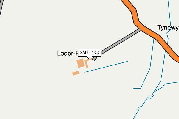
SA66 7RD is in Morvil, Clynderwen. SA66 7RD is located in the Bro Gwaun electoral ward, within the unitary authority of Pembrokeshire and the Welsh Parliamentary constituency of Preseli Pembrokeshire. The Local Health Board is Hywel Dda University and the police force is Dyfed-Powys. This postcode has been in use since January 1980.


GetTheData
Source: OS OpenMap – Local (Ordnance Survey)
Source: OS VectorMap District (Ordnance Survey)
Licence: Open Government Licence (requires attribution)
| Easting | 204852 |
| Northing | 230798 |
| Latitude | 51.941369 |
| Longitude | -4.840524 |
GetTheData
Source: Open Postcode Geo
Licence: Open Government Licence
| Locality | Morvil |
| Town/City | Clynderwen |
| Country | Wales |
| Postcode District | SA66 |
| ➜ SA66 open data dashboard ➜ See where SA66 is on a map | |
GetTheData
Source: Land Registry Price Paid Data
Licence: Open Government Licence
Elevation or altitude of SA66 7RD as distance above sea level:
| Metres | Feet | |
|---|---|---|
| Elevation | 250m | 820ft |
Elevation is measured from the approximate centre of the postcode, to the nearest point on an OS contour line from OS Terrain 50, which has contour spacing of ten vertical metres.
➜ How high above sea level am I? Find the elevation of your current position using your device's GPS.
GetTheData
Source: Open Postcode Elevation
Licence: Open Government Licence
| Ward | Bro Gwaun |
| Constituency | Preseli Pembrokeshire |
GetTheData
Source: ONS Postcode Database
Licence: Open Government Licence
| Old New Inn (B4329) | Greenway | 1,440m |
| Old New Inn (B4329) | Greenway | 1,449m |
GetTheData
Source: NaPTAN
Licence: Open Government Licence
➜ Broadband speed and availability dashboard for SA66 7RD
| Percentage of properties with Next Generation Access | 100.0% |
| Percentage of properties with Superfast Broadband | 0.0% |
| Percentage of properties with Ultrafast Broadband | 0.0% |
| Percentage of properties with Full Fibre Broadband | 0.0% |
Superfast Broadband is between 30Mbps and 300Mbps
Ultrafast Broadband is > 300Mbps
| Median download speed | 2.4Mbps |
| Average download speed | 2.5Mbps |
| Maximum download speed | 3.78Mbps |
| Median upload speed | 0.5Mbps |
| Average upload speed | 0.6Mbps |
| Maximum upload speed | 0.76Mbps |
| Percentage of properties unable to receive 2Mbps | 0.0% |
| Percentage of properties unable to receive 5Mbps | 85.7% |
| Percentage of properties unable to receive 10Mbps | 100.0% |
| Percentage of properties unable to receive 30Mbps | 100.0% |
➜ Broadband speed and availability dashboard for SA66 7RD
GetTheData
Source: Ofcom
Licence: Ofcom Terms of Use (requires attribution)
GetTheData
Source: ONS Postcode Database
Licence: Open Government Licence


➜ Get more ratings from the Food Standards Agency
GetTheData
Source: Food Standards Agency
Licence: FSA terms & conditions
| Last Collection | |||
|---|---|---|---|
| Location | Mon-Fri | Sat | Distance |
| Tufton P O | 12:30 | 12:00 | 2,856m |
| Cilrhedyn Bridge | 11:30 | 11:30 | 5,957m |
GetTheData
Source: Dracos
Licence: Creative Commons Attribution-ShareAlike
| School | Phase of Education | Distance |
|---|---|---|
| Ysgol Llanychllwydog Pontfaen, Fishguard, Pembrokeshire, SA65 9SE | Not applicable | 3.7km |
| Puncheston CP Puncheston, Haverfordwest, Pembrokeshire, SA62 5RL | Not applicable | 4.3km |
| Y.G. Maenclochog Maenclochog, Clunderwen, Sir Benfro, SA66 7LB | Not applicable | 4.6km |
GetTheData
Source: Edubase
Licence: Open Government Licence
The below table lists the International Territorial Level (ITL) codes (formerly Nomenclature of Territorial Units for Statistics (NUTS) codes) and Local Administrative Units (LAU) codes for SA66 7RD:
| ITL 1 Code | Name |
|---|---|
| TLL | Wales |
| ITL 2 Code | Name |
| TLL1 | West Wales and The Valleys |
| ITL 3 Code | Name |
| TLL14 | South West Wales |
| LAU 1 Code | Name |
| W06000009 | Pembrokeshire |
GetTheData
Source: ONS Postcode Directory
Licence: Open Government Licence
The below table lists the Census Output Area (OA), Lower Layer Super Output Area (LSOA), and Middle Layer Super Output Area (MSOA) for SA66 7RD:
| Code | Name | |
|---|---|---|
| OA | W00003001 | |
| LSOA | W01000562 | Pembrokeshire 002A |
| MSOA | W02000127 | Pembrokeshire 002 |
GetTheData
Source: ONS Postcode Directory
Licence: Open Government Licence
| SA66 7RA | 1476m | |
| SA63 4UB | 1986m | |
| SA66 7QY | 2340m | |
| SA63 4TU | 2780m | |
| SA63 4UA | 2804m | |
| SA66 7QT | 2925m | |
| SA66 7QS | 2935m | |
| SA66 7QX | The Terrace | 2995m |
| SA66 7QU | 3017m | |
| SA65 9TU | 3140m |
GetTheData
Source: Open Postcode Geo; Land Registry Price Paid Data
Licence: Open Government Licence