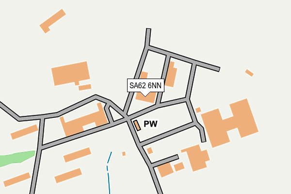
SA62 6NN is located in the Solva electoral ward, within the unitary authority of Pembrokeshire and the Welsh Parliamentary constituency of Preseli Pembrokeshire. The Local Health Board is Hywel Dda University and the police force is Dyfed-Powys. This postcode has been in use since January 1980.


GetTheData
Source: OS OpenMap – Local (Ordnance Survey)
Source: OS VectorMap District (Ordnance Survey)
Licence: Open Government Licence (requires attribution)
| Easting | 184721 |
| Northing | 224645 |
| Latitude | 51.878705 |
| Longitude | -5.129105 |
GetTheData
Source: Open Postcode Geo
Licence: Open Government Licence
| Country | Wales |
| Postcode District | SA62 |
| ➜ SA62 open data dashboard ➜ See where SA62 is on a map ➜ Where is Brawdy? | |
GetTheData
Source: Land Registry Price Paid Data
Licence: Open Government Licence
Elevation or altitude of SA62 6NN as distance above sea level:
| Metres | Feet | |
|---|---|---|
| Elevation | 100m | 328ft |
Elevation is measured from the approximate centre of the postcode, to the nearest point on an OS contour line from OS Terrain 50, which has contour spacing of ten vertical metres.
➜ How high above sea level am I? Find the elevation of your current position using your device's GPS.
GetTheData
Source: Open Postcode Elevation
Licence: Open Government Licence
| Ward | Solva |
| Constituency | Preseli Pembrokeshire |
GetTheData
Source: ONS Postcode Database
Licence: Open Government Licence
| June 2022 | Other crime | On or near Airport/Airfield | 416m |
| April 2022 | Public order | On or near Airport/Airfield | 416m |
| March 2022 | Violence and sexual offences | On or near Airport/Airfield | 416m |
| ➜ Get more crime data in our Crime section | |||
GetTheData
Source: data.police.uk
Licence: Open Government Licence
| Brawdy Camp (Brawdy Lane) | Penycwm | 672m |
| Post Office (A487) | Penycwm | 1,242m |
| Post Office (A487) | Penycwm | 1,289m |
| Brawdy Turn (A487) | Penycwm | 1,476m |
| Brawdy Turn (A487) | Penycwm | 1,508m |
GetTheData
Source: NaPTAN
Licence: Open Government Licence
GetTheData
Source: ONS Postcode Database
Licence: Open Government Licence


➜ Get more ratings from the Food Standards Agency
GetTheData
Source: Food Standards Agency
Licence: FSA terms & conditions
| Last Collection | |||
|---|---|---|---|
| Location | Mon-Fri | Sat | Distance |
| Whitchurch | 12:00 | 12:00 | 4,848m |
GetTheData
Source: Dracos
Licence: Creative Commons Attribution-ShareAlike
| School | Phase of Education | Distance |
|---|---|---|
| Marlowe St David's Education Unit Pembroke House, Brawdy Business Park, Haverfordwest, Pembrokeshire, SA62 6NP | Not applicable | 1km |
| Roch C.P. School Roch, Haverfordwest, Pembrokeshire, SA62 6JU | Not applicable | 3.8km |
GetTheData
Source: Edubase
Licence: Open Government Licence
The below table lists the International Territorial Level (ITL) codes (formerly Nomenclature of Territorial Units for Statistics (NUTS) codes) and Local Administrative Units (LAU) codes for SA62 6NN:
| ITL 1 Code | Name |
|---|---|
| TLL | Wales |
| ITL 2 Code | Name |
| TLL1 | West Wales and The Valleys |
| ITL 3 Code | Name |
| TLL14 | South West Wales |
| LAU 1 Code | Name |
| W06000009 | Pembrokeshire |
GetTheData
Source: ONS Postcode Directory
Licence: Open Government Licence
The below table lists the Census Output Area (OA), Lower Layer Super Output Area (LSOA), and Middle Layer Super Output Area (MSOA) for SA62 6NN:
| Code | Name | |
|---|---|---|
| OA | W00003319 | |
| LSOA | W01000618 | Pembrokeshire 003D |
| MSOA | W02000128 | Pembrokeshire 003 |
GetTheData
Source: ONS Postcode Directory
Licence: Open Government Licence
| SA62 6NP | Brawdy Business Park | 1053m |
| SA62 6AY | 1231m | |
| SA62 6LA | 1276m | |
| SA62 6AU | Erw Lon | 1313m |
| SA62 6AX | 1365m | |
| SA62 6AT | 1379m | |
| SA62 6LP | 1935m | |
| SA62 6AS | 2183m | |
| SA62 6NE | 2299m | |
| SA62 6NG | Bryngolau | 2333m |
GetTheData
Source: Open Postcode Geo; Land Registry Price Paid Data
Licence: Open Government Licence