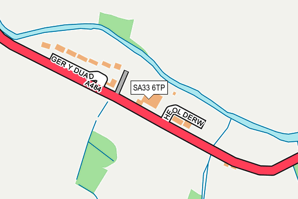
SA33 6TP is located in the Cynwyl Elfed electoral ward, within the unitary authority of Carmarthenshire and the Welsh Parliamentary constituency of Carmarthen West and South Pembrokeshire. The Local Health Board is Hywel Dda University and the police force is Dyfed-Powys. This postcode has been in use since January 1980.


GetTheData
Source: OS OpenMap – Local (Ordnance Survey)
Source: OS VectorMap District (Ordnance Survey)
Licence: Open Government Licence (requires attribution)
| Easting | 237691 |
| Northing | 226921 |
| Latitude | 51.917096 |
| Longitude | -4.361419 |
GetTheData
Source: Open Postcode Geo
Licence: Open Government Licence
| Country | Wales |
| Postcode District | SA33 |
| ➜ SA33 open data dashboard ➜ See where SA33 is on a map ➜ Where is Cynwyl Elfed? | |
GetTheData
Source: Land Registry Price Paid Data
Licence: Open Government Licence
Elevation or altitude of SA33 6TP as distance above sea level:
| Metres | Feet | |
|---|---|---|
| Elevation | 70m | 230ft |
Elevation is measured from the approximate centre of the postcode, to the nearest point on an OS contour line from OS Terrain 50, which has contour spacing of ten vertical metres.
➜ How high above sea level am I? Find the elevation of your current position using your device's GPS.
GetTheData
Source: Open Postcode Elevation
Licence: Open Government Licence
| Ward | Cynwyl Elfed |
| Constituency | Carmarthen West And South Pembrokeshire |
GetTheData
Source: ONS Postcode Database
Licence: Open Government Licence
| June 2022 | Violence and sexual offences | On or near Heol Derw | 76m |
| June 2022 | Violence and sexual offences | On or near Heol Derw | 76m |
| June 2022 | Public order | On or near Ger Y Duad | 154m |
| ➜ Get more crime data in our Crime section | |||
GetTheData
Source: data.police.uk
Licence: Open Government Licence
| Bro Elfed (A484) | Cynwyl Elfed | 519m |
| Bro Elfed (A484) | Cynwyl Elfed | 552m |
| Post Office (A484) | Cynwyl Elfed | 740m |
| Post Office (A484) | Cynwyl Elfed | 741m |
GetTheData
Source: NaPTAN
Licence: Open Government Licence
| Percentage of properties with Next Generation Access | 100.0% |
| Percentage of properties with Superfast Broadband | 100.0% |
| Percentage of properties with Ultrafast Broadband | 0.0% |
| Percentage of properties with Full Fibre Broadband | 0.0% |
Superfast Broadband is between 30Mbps and 300Mbps
Ultrafast Broadband is > 300Mbps
| Percentage of properties unable to receive 2Mbps | 0.0% |
| Percentage of properties unable to receive 5Mbps | 0.0% |
| Percentage of properties unable to receive 10Mbps | 0.0% |
| Percentage of properties unable to receive 30Mbps | 0.0% |
GetTheData
Source: Ofcom
Licence: Ofcom Terms of Use (requires attribution)
GetTheData
Source: ONS Postcode Database
Licence: Open Government Licence


➜ Get more ratings from the Food Standards Agency
GetTheData
Source: Food Standards Agency
Licence: FSA terms & conditions
| Last Collection | |||
|---|---|---|---|
| Location | Mon-Fri | Sat | Distance |
| Penmaes | 10:15 | 10:15 | 2,924m |
| Cilwen Road | 16:00 | 11:00 | 3,520m |
| Talog Post Office | 16:00 | 10:30 | 4,855m |
GetTheData
Source: Dracos
Licence: Creative Commons Attribution-ShareAlike
| School | Phase of Education | Distance |
|---|---|---|
| Y.G. Cynwyl Elfed Stryd Y Meddyg, Cynwyl Elfed, Caerfyrddin, Sir Gaerfyrddin, SA33 6TR | Not applicable | 905m |
| Ysgol G. Llanpumsaint Llanpumsaint, Carmarthen, Carmarthenshire, SA33 6BY | Not applicable | 4.9km |
| Abernant C.P. School Abernant, Carmarthen, Carmarthenshire, SA33 5RR | Not applicable | 5.2km |
GetTheData
Source: Edubase
Licence: Open Government Licence
The below table lists the International Territorial Level (ITL) codes (formerly Nomenclature of Territorial Units for Statistics (NUTS) codes) and Local Administrative Units (LAU) codes for SA33 6TP:
| ITL 1 Code | Name |
|---|---|
| TLL | Wales |
| ITL 2 Code | Name |
| TLL1 | West Wales and The Valleys |
| ITL 3 Code | Name |
| TLL14 | South West Wales |
| LAU 1 Code | Name |
| W06000010 | Carmarthenshire |
GetTheData
Source: ONS Postcode Directory
Licence: Open Government Licence
The below table lists the Census Output Area (OA), Lower Layer Super Output Area (LSOA), and Middle Layer Super Output Area (MSOA) for SA33 6TP:
| Code | Name | |
|---|---|---|
| OA | W00003487 | |
| LSOA | W01000649 | Carmarthenshire 006E |
| MSOA | W02000147 | Carmarthenshire 006 |
GetTheData
Source: ONS Postcode Directory
Licence: Open Government Licence
| SA33 6TN | Bro Elfed | 534m |
| SA33 6TL | 698m | |
| SA33 6TT | 706m | |
| SA33 6TS | 810m | |
| SA33 6TR | Surgeon Street | 831m |
| SA33 6UJ | 1218m | |
| SA33 6TY | 1476m | |
| SA33 6AR | Cynwyl Road | 1659m |
| SA33 6UL | 1857m | |
| SA33 6SP | 1983m |
GetTheData
Source: Open Postcode Geo; Land Registry Price Paid Data
Licence: Open Government Licence