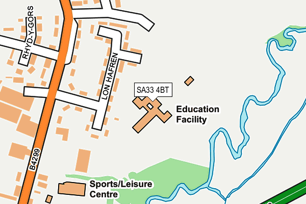
SA33 4BT is located in the St Clears and Llansteffan electoral ward, within the unitary authority of Carmarthenshire and the Welsh Parliamentary constituency of Carmarthen West and South Pembrokeshire. The Local Health Board is Hywel Dda University and the police force is Dyfed-Powys. This postcode has been in use since November 2004.


GetTheData
Source: OS OpenMap – Local (Ordnance Survey)
Source: OS VectorMap District (Ordnance Survey)
Licence: Open Government Licence (requires attribution)
| Easting | 228528 |
| Northing | 216822 |
| Latitude | 51.823646 |
| Longitude | -4.489526 |
GetTheData
Source: Open Postcode Geo
Licence: Open Government Licence
| Country | Wales |
| Postcode District | SA33 |
| ➜ SA33 open data dashboard ➜ See where SA33 is on a map ➜ Where is St Clears? | |
GetTheData
Source: Land Registry Price Paid Data
Licence: Open Government Licence
Elevation or altitude of SA33 4BT as distance above sea level:
| Metres | Feet | |
|---|---|---|
| Elevation | 10m | 33ft |
Elevation is measured from the approximate centre of the postcode, to the nearest point on an OS contour line from OS Terrain 50, which has contour spacing of ten vertical metres.
➜ How high above sea level am I? Find the elevation of your current position using your device's GPS.
GetTheData
Source: Open Postcode Elevation
Licence: Open Government Licence
| Ward | St Clears And Llansteffan |
| Constituency | Carmarthen West And South Pembrokeshire |
GetTheData
Source: ONS Postcode Database
Licence: Open Government Licence
| January 2024 | Violence and sexual offences | On or near Police Station | 422m |
| November 2023 | Violence and sexual offences | On or near Police Station | 422m |
| November 2023 | Public order | On or near Police Station | 422m |
| ➜ Get more crime data in our Crime section | |||
GetTheData
Source: data.police.uk
Licence: Open Government Licence
| Lon Hafren (Station Road) | St Clears | 193m |
| Lon Hafren (Station Road) | St Clears | 203m |
| Wembley Garage (B4299) | St Clears | 414m |
| By-pass (A40) | St Clears | 438m |
| Black Lion (Pentre Road) | St Clears | 552m |
GetTheData
Source: NaPTAN
Licence: Open Government Licence
GetTheData
Source: ONS Postcode Database
Licence: Open Government Licence


➜ Get more ratings from the Food Standards Agency
GetTheData
Source: Food Standards Agency
Licence: FSA terms & conditions
| Last Collection | |||
|---|---|---|---|
| Location | Mon-Fri | Sat | Distance |
| Llysonnen Cottages | 17:00 | 11:30 | 5,412m |
GetTheData
Source: Dracos
Licence: Creative Commons Attribution-ShareAlike
| School | Phase of Education | Distance |
|---|---|---|
| Ysgol Griffith Jones Heol Yr Osaf, San Cler, Sir Gaerfyrddin, SA33 4BT | Not applicable | 1m |
| Westward House School Pentre Road, St Clears, Carmarthen, SA33 4AA | Not applicable | 699m |
| Meidrim C.P. School Meidrim, Carmarthenshire, SA33 5QN | Not applicable | 4.1km |
GetTheData
Source: Edubase
Licence: Open Government Licence
The below table lists the International Territorial Level (ITL) codes (formerly Nomenclature of Territorial Units for Statistics (NUTS) codes) and Local Administrative Units (LAU) codes for SA33 4BT:
| ITL 1 Code | Name |
|---|---|
| TLL | Wales |
| ITL 2 Code | Name |
| TLL1 | West Wales and The Valleys |
| ITL 3 Code | Name |
| TLL14 | South West Wales |
| LAU 1 Code | Name |
| W06000010 | Carmarthenshire |
GetTheData
Source: ONS Postcode Directory
Licence: Open Government Licence
The below table lists the Census Output Area (OA), Lower Layer Super Output Area (LSOA), and Middle Layer Super Output Area (MSOA) for SA33 4BT:
| Code | Name | |
|---|---|---|
| OA | W00003869 | |
| LSOA | W01000721 | Carmarthenshire 027C |
| MSOA | W02000418 | Carmarthenshire 027 |
GetTheData
Source: ONS Postcode Directory
Licence: Open Government Licence
| SA33 4BS | Lon Hafren | 87m |
| SA33 4BU | Lon Hafren | 129m |
| SA33 4BX | Station Road | 224m |
| SA33 4BW | Clos Griffith Jones | 240m |
| SA33 4BP | Station Road | 272m |
| SA33 4DB | Rhyd Y Gors | 288m |
| SA33 4BY | Station Road | 312m |
| SA33 4BQ | Station Road | 348m |
| SA33 4LX | 381m | |
| SA33 4DE | Lewis Terrace | 396m |
GetTheData
Source: Open Postcode Geo; Land Registry Price Paid Data
Licence: Open Government Licence