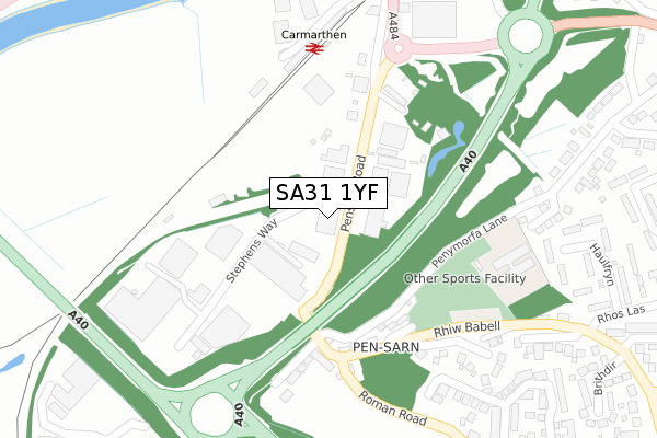
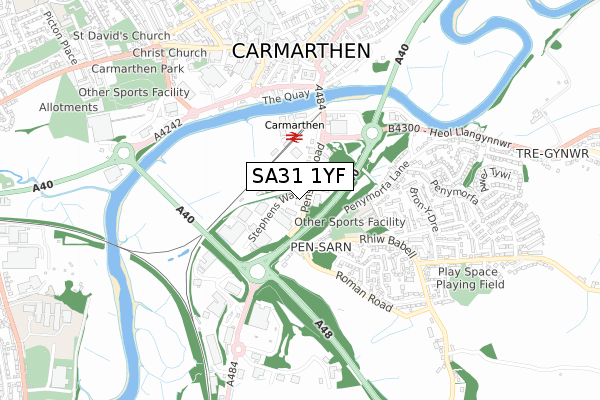
SA31 1YF is located in the Llangunnor electoral ward, within the unitary authority of Carmarthenshire and the Welsh Parliamentary constituency of Carmarthen East and Dinefwr. The Local Health Board is Hywel Dda University and the police force is Dyfed-Powys. This postcode has been in use since May 2019.


GetTheData
Source: OS Open Zoomstack (Ordnance Survey)
Licence: Open Government Licence (requires attribution)
Attribution: Contains OS data © Crown copyright and database right 2024
Source: Open Postcode Geo
Licence: Open Government Licence (requires attribution)
Attribution: Contains OS data © Crown copyright and database right 2024; Contains Royal Mail data © Royal Mail copyright and database right 2024; Source: Office for National Statistics licensed under the Open Government Licence v.3.0
| Easting | 241300 |
| Northing | 219431 |
| Latitude | 51.850859 |
| Longitude | -4.305565 |
GetTheData
Source: Open Postcode Geo
Licence: Open Government Licence
| Country | Wales |
| Postcode District | SA31 |
| ➜ SA31 open data dashboard ➜ See where SA31 is on a map ➜ Where is Carmarthen? | |
GetTheData
Source: Land Registry Price Paid Data
Licence: Open Government Licence
Elevation or altitude of SA31 1YF as distance above sea level:
| Metres | Feet | |
|---|---|---|
| Elevation | 10m | 33ft |
Elevation is measured from the approximate centre of the postcode, to the nearest point on an OS contour line from OS Terrain 50, which has contour spacing of ten vertical metres.
➜ How high above sea level am I? Find the elevation of your current position using your device's GPS.
GetTheData
Source: Open Postcode Elevation
Licence: Open Government Licence
| Ward | Llangunnor |
| Constituency | Carmarthen East And Dinefwr |
GetTheData
Source: ONS Postcode Database
Licence: Open Government Licence
| September 2023 | Other crime | On or near Hen Heol Llangynnwr | 421m |
| February 2023 | Vehicle crime | On or near Hen Heol Llangynnwr | 421m |
| January 2023 | Shoplifting | On or near Hen Heol Llangynnwr | 421m |
| ➜ Get more crime data in our Crime section | |||
GetTheData
Source: data.police.uk
Licence: Open Government Licence
| Pensarn Road (A484) | Pensarn | 24m |
| Tiles R Us (A484) | Pensarn | 98m |
| Pen-sarn Kwik Save (Stephens Way) | Pensarn | 193m |
| Southern Terrace (A484) | Pensarn | 219m |
| Railway Station (Station Approach) | Carmarthen | 292m |
| Carmarthen Station | 0.3km |
GetTheData
Source: NaPTAN
Licence: Open Government Licence
GetTheData
Source: ONS Postcode Database
Licence: Open Government Licence


➜ Get more ratings from the Food Standards Agency
GetTheData
Source: Food Standards Agency
Licence: FSA terms & conditions
| Last Collection | |||
|---|---|---|---|
| Location | Mon-Fri | Sat | Distance |
| Carmarthen Do | 18:30 | 12:15 | 29m |
| Carmarthen Delivery Office | 18:30 | 12:15 | 30m |
| Railway Station | 18:00 | 12:00 | 267m |
GetTheData
Source: Dracos
Licence: Creative Commons Attribution-ShareAlike
| School | Phase of Education | Distance |
|---|---|---|
| Llangunnor CP Penymorfa Lane, Pensarn, Llangunnor, Carmarthenshire, SA31 2NN | Not applicable | 295m |
| St Mary's R.C. Primary School Union Street, Carmarthen, Carmarthenshire, SA31 3DE | Not applicable | 1.1km |
| Richmond Park Primary School Priory Street, Carmarthen, Carmarthenshire, SA31 1HF | Not applicable | 1.2km |
GetTheData
Source: Edubase
Licence: Open Government Licence
The below table lists the International Territorial Level (ITL) codes (formerly Nomenclature of Territorial Units for Statistics (NUTS) codes) and Local Administrative Units (LAU) codes for SA31 1YF:
| ITL 1 Code | Name |
|---|---|
| TLL | Wales |
| ITL 2 Code | Name |
| TLL1 | West Wales and The Valleys |
| ITL 3 Code | Name |
| TLL14 | South West Wales |
| LAU 1 Code | Name |
| W06000010 | Carmarthenshire |
GetTheData
Source: ONS Postcode Directory
Licence: Open Government Licence
The below table lists the Census Output Area (OA), Lower Layer Super Output Area (LSOA), and Middle Layer Super Output Area (MSOA) for SA31 1YF:
| Code | Name | |
|---|---|---|
| OA | W00003726 | |
| LSOA | W01000694 | Carmarthenshire 008D |
| MSOA | W02000149 | Carmarthenshire 008 |
GetTheData
Source: ONS Postcode Directory
Licence: Open Government Licence
| SA31 9ZZ | Clos Ffynnon | 2m |
| SA31 2BG | Stephens Way | 179m |
| SA31 2DD | Pensarn Road | 183m |
| SA31 2BP | Southern Terrace | 215m |
| SA31 2DJ | Babell Hill | 220m |
| SA31 2DL | Emlyn Terrace | 242m |
| SA31 2JY | Babell Road | 270m |
| SA31 2NN | Penymorfa Lane | 322m |
| SA31 2DS | Haulfryn | 368m |
| SA31 2LA | Mounthill Rise | 387m |
GetTheData
Source: Open Postcode Geo; Land Registry Price Paid Data
Licence: Open Government Licence