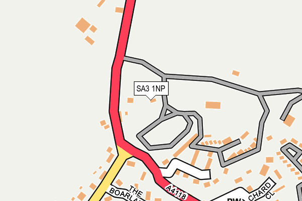
SA3 1NP is located in the Gower electoral ward, within the unitary authority of Swansea and the Welsh Parliamentary constituency of Gower. The Local Health Board is Swansea Bay University and the police force is South Wales. This postcode has been in use since January 1980.


GetTheData
Source: OS OpenMap – Local (Ordnance Survey)
Source: OS VectorMap District (Ordnance Survey)
Licence: Open Government Licence (requires attribution)
| Easting | 246521 |
| Northing | 185606 |
| Latitude | 51.548419 |
| Longitude | -4.214930 |
GetTheData
Source: Open Postcode Geo
Licence: Open Government Licence
| Country | Wales |
| Postcode District | SA3 |
| ➜ SA3 open data dashboard ➜ See where SA3 is on a map ➜ Where is Port-Eynon? | |
GetTheData
Source: Land Registry Price Paid Data
Licence: Open Government Licence
Elevation or altitude of SA3 1NP as distance above sea level:
| Metres | Feet | |
|---|---|---|
| Elevation | 60m | 197ft |
Elevation is measured from the approximate centre of the postcode, to the nearest point on an OS contour line from OS Terrain 50, which has contour spacing of ten vertical metres.
➜ How high above sea level am I? Find the elevation of your current position using your device's GPS.
GetTheData
Source: Open Postcode Elevation
Licence: Open Government Licence
| Ward | Gower |
| Constituency | Gower |
GetTheData
Source: ONS Postcode Database
Licence: Open Government Licence
| June 2022 | Other theft | On or near Parking Area | 463m |
| June 2022 | Criminal damage and arson | On or near Parking Area | 463m |
| April 2022 | Criminal damage and arson | On or near The Boarlands | 197m |
| ➜ Get more crime data in our Crime section | |||
GetTheData
Source: data.police.uk
Licence: Open Government Licence
| Overton Turn (A4118) | Port Eynon | 108m |
| Terminus (A4118) | Port Eynon | 447m |
| Car Park | Horton | 824m |
| Moor Corner Farm (A4118) | Port Eynon | 844m |
| Moor Corner Farm (A4118) | Port Eynon | 856m |
GetTheData
Source: NaPTAN
Licence: Open Government Licence
GetTheData
Source: ONS Postcode Database
Licence: Open Government Licence


➜ Get more ratings from the Food Standards Agency
GetTheData
Source: Food Standards Agency
Licence: FSA terms & conditions
| Last Collection | |||
|---|---|---|---|
| Location | Mon-Fri | Sat | Distance |
| Reynoldston P O | 17:15 | 11:15 | 4,872m |
| Rhossili P O | 16:45 | 10:45 | 5,072m |
GetTheData
Source: Dracos
Licence: Creative Commons Attribution-ShareAlike
| School | Phase of Education | Distance |
|---|---|---|
| Knelston Primary School Reynoldston, Gower, Swansea, SA3 1AR | Not applicable | 3.4km |
GetTheData
Source: Edubase
Licence: Open Government Licence
The below table lists the International Territorial Level (ITL) codes (formerly Nomenclature of Territorial Units for Statistics (NUTS) codes) and Local Administrative Units (LAU) codes for SA3 1NP:
| ITL 1 Code | Name |
|---|---|
| TLL | Wales |
| ITL 2 Code | Name |
| TLL1 | West Wales and The Valleys |
| ITL 3 Code | Name |
| TLL18 | Swansea |
| LAU 1 Code | Name |
| W06000011 | Swansea |
GetTheData
Source: ONS Postcode Directory
Licence: Open Government Licence
The below table lists the Census Output Area (OA), Lower Layer Super Output Area (LSOA), and Middle Layer Super Output Area (MSOA) for SA3 1NP:
| Code | Name | |
|---|---|---|
| OA | W00004167 | |
| LSOA | W01000775 | Swansea 030A |
| MSOA | W02000197 | Swansea 030 |
GetTheData
Source: ONS Postcode Directory
Licence: Open Government Licence
| SA3 1NX | The Boarlands | 186m |
| SA3 1NL | 240m | |
| SA3 1NZ | Orchard Close | 281m |
| SA3 1NR | Overton Lane | 495m |
| SA3 1NN | 515m | |
| SA3 1LQ | 841m | |
| SA3 1LW | Great House Court | 895m |
| SA3 1LE | Castle Hill | 913m |
| SA3 1LB | 999m | |
| SA3 1AX | Milestone Court | 1927m |
GetTheData
Source: Open Postcode Geo; Land Registry Price Paid Data
Licence: Open Government Licence