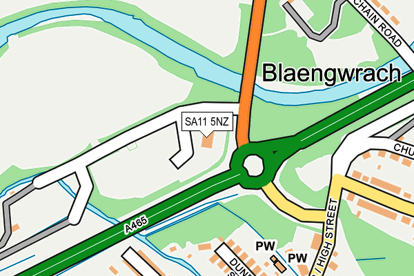
SA11 5NZ is located in the Blaengwrach and Glynneath West electoral ward, within the unitary authority of Neath Port Talbot and the Welsh Parliamentary constituency of Neath. The Local Health Board is Swansea Bay University and the police force is South Wales. This postcode has been in use since June 2001.


GetTheData
Source: OS OpenMap – Local (Ordnance Survey)
Source: OS VectorMap District (Ordnance Survey)
Licence: Open Government Licence (requires attribution)
| Easting | 286710 |
| Northing | 205571 |
| Latitude | 51.737360 |
| Longitude | -3.642062 |
GetTheData
Source: Open Postcode Geo
Licence: Open Government Licence
| Country | Wales |
| Postcode District | SA11 |
| ➜ SA11 open data dashboard ➜ See where SA11 is on a map | |
GetTheData
Source: Land Registry Price Paid Data
Licence: Open Government Licence
Elevation or altitude of SA11 5NZ as distance above sea level:
| Metres | Feet | |
|---|---|---|
| Elevation | 50m | 164ft |
Elevation is measured from the approximate centre of the postcode, to the nearest point on an OS contour line from OS Terrain 50, which has contour spacing of ten vertical metres.
➜ How high above sea level am I? Find the elevation of your current position using your device's GPS.
GetTheData
Source: Open Postcode Elevation
Licence: Open Government Licence
| Ward | Blaengwrach And Glynneath West |
| Constituency | Neath |
GetTheData
Source: ONS Postcode Database
Licence: Open Government Licence
| June 2022 | Violence and sexual offences | On or near Dunraven Street | 209m |
| June 2022 | Violence and sexual offences | On or near Dunraven Street | 209m |
| June 2022 | Violence and sexual offences | On or near Dunraven Street | 209m |
| ➜ Get more crime data in our Crime section | |||
GetTheData
Source: data.police.uk
Licence: Open Government Licence
| Cwmgwrach Roundabout (Chain Road) | Blaengwrach | 193m |
| Cwmgwrach High Street (High Street) | Blaengwrach | 227m |
| Chain Road (B4242) | Aberpergwm | 233m |
| Dunraven Road (High Street) | Cwmgwrach | 271m |
| Dunraven Arms (High Street) | Cwmgwrach | 290m |
GetTheData
Source: NaPTAN
Licence: Open Government Licence
GetTheData
Source: ONS Postcode Database
Licence: Open Government Licence


➜ Get more ratings from the Food Standards Agency
GetTheData
Source: Food Standards Agency
Licence: FSA terms & conditions
| Last Collection | |||
|---|---|---|---|
| Location | Mon-Fri | Sat | Distance |
| Pencomen | 16:30 | 11:00 | 4,178m |
GetTheData
Source: Dracos
Licence: Creative Commons Attribution-ShareAlike
| School | Phase of Education | Distance |
|---|---|---|
| Blaengwrach Primary School Heol Wenallt, Cwmgwrach, Neath, SA11 5PS | Not applicable | 400m |
| Cwmnedd Primary School New Street, Glynneath, Neath, SA11 5AA | Not applicable | 1.7km |
| YGG Cwm Nedd New Street, Glynneath, Neath, SA11 5AG | Not applicable | 1.8km |
GetTheData
Source: Edubase
Licence: Open Government Licence
The below table lists the International Territorial Level (ITL) codes (formerly Nomenclature of Territorial Units for Statistics (NUTS) codes) and Local Administrative Units (LAU) codes for SA11 5NZ:
| ITL 1 Code | Name |
|---|---|
| TLL | Wales |
| ITL 2 Code | Name |
| TLL1 | West Wales and The Valleys |
| ITL 3 Code | Name |
| TLL17 | Bridgend and Neath Port Talbot |
| LAU 1 Code | Name |
| W06000012 | Neath Port Talbot |
GetTheData
Source: ONS Postcode Directory
Licence: Open Government Licence
The below table lists the Census Output Area (OA), Lower Layer Super Output Area (LSOA), and Middle Layer Super Output Area (MSOA) for SA11 5NZ:
| Code | Name | |
|---|---|---|
| OA | W00004761 | |
| LSOA | W01000893 | Neath Port Talbot 003A |
| MSOA | W02000201 | Neath Port Talbot 003 |
GetTheData
Source: ONS Postcode Directory
Licence: Open Government Licence
| SA11 5PB | Dunraven Street | 201m |
| SA11 5PE | Cefn Gelli | 231m |
| SA11 5SY | High Street | 251m |
| SA11 5TA | High Street | 270m |
| SA11 5PG | Heol Pantglas | 292m |
| SA11 5PD | Cefn Gelli | 304m |
| SA11 5SL | Church Crescent | 308m |
| SA11 5PF | Cedar Street | 312m |
| SA11 5HW | Chain Road | 317m |
| SA11 5HP | Chain Road | 328m |
GetTheData
Source: Open Postcode Geo; Land Registry Price Paid Data
Licence: Open Government Licence