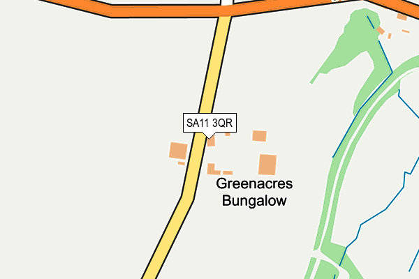
SA11 3QR is located in the Cimla and Pelenna electoral ward, within the unitary authority of Neath Port Talbot and the Welsh Parliamentary constituency of Neath. The Local Health Board is Swansea Bay University and the police force is South Wales. This postcode has been in use since January 1980.


GetTheData
Source: OS OpenMap – Local (Ordnance Survey)
Source: OS VectorMap District (Ordnance Survey)
Licence: Open Government Licence (requires attribution)
| Easting | 277705 |
| Northing | 195623 |
| Latitude | 51.646069 |
| Longitude | -3.768933 |
GetTheData
Source: Open Postcode Geo
Licence: Open Government Licence
| Country | Wales |
| Postcode District | SA11 |
| ➜ SA11 open data dashboard ➜ See where SA11 is on a map | |
GetTheData
Source: Land Registry Price Paid Data
Licence: Open Government Licence
Elevation or altitude of SA11 3QR as distance above sea level:
| Metres | Feet | |
|---|---|---|
| Elevation | 160m | 525ft |
Elevation is measured from the approximate centre of the postcode, to the nearest point on an OS contour line from OS Terrain 50, which has contour spacing of ten vertical metres.
➜ How high above sea level am I? Find the elevation of your current position using your device's GPS.
GetTheData
Source: Open Postcode Elevation
Licence: Open Government Licence
| Ward | Cimla And Pelenna |
| Constituency | Neath |
GetTheData
Source: ONS Postcode Database
Licence: Open Government Licence
| Cefn Saeson Playing Fields (B4287) | Efail-fach | 219m |
| Playing Fields (B4287) | Efail-fach | 241m |
| Tyn-y-waun (B4287) | Efail-fach | 348m |
| Tyn-y-waun (B4287) | Efail-fach | 405m |
| The Farmers (B4287) | Efail-fach | 502m |
| Neath Station | 3.2km |
| Briton Ferry Station | 3.6km |
| Baglan Station | 4.5km |
GetTheData
Source: NaPTAN
Licence: Open Government Licence
| Percentage of properties with Next Generation Access | 100.0% |
| Percentage of properties with Superfast Broadband | 100.0% |
| Percentage of properties with Ultrafast Broadband | 0.0% |
| Percentage of properties with Full Fibre Broadband | 0.0% |
Superfast Broadband is between 30Mbps and 300Mbps
Ultrafast Broadband is > 300Mbps
| Percentage of properties unable to receive 2Mbps | 0.0% |
| Percentage of properties unable to receive 5Mbps | 0.0% |
| Percentage of properties unable to receive 10Mbps | 0.0% |
| Percentage of properties unable to receive 30Mbps | 0.0% |
GetTheData
Source: Ofcom
Licence: Ofcom Terms of Use (requires attribution)
GetTheData
Source: ONS Postcode Database
Licence: Open Government Licence


➜ Get more ratings from the Food Standards Agency
GetTheData
Source: Food Standards Agency
Licence: FSA terms & conditions
| Last Collection | |||
|---|---|---|---|
| Location | Mon-Fri | Sat | Distance |
| Cimla Cres | 17:00 | 11:45 | 1,971m |
| Neath Delivery Office | 18:30 | 13:00 | 3,158m |
| New Street | 18:00 | 12:30 | 3,180m |
GetTheData
Source: Dracos
Licence: Creative Commons Attribution-ShareAlike
| School | Phase of Education | Distance |
|---|---|---|
| Cefn Saeson Comprehensive School Afan Valley Road, Cimla, Neath, SA11 3TA | Not applicable | 678m |
| St Joseph's Catholic Primary School (Neath) Cook Rees Avenue, Neath, SA11 1UR | Not applicable | 2.3km |
| Gnoll Primary School Wellfield Avenue, Neath, SA11 1AQ | Not applicable | 2.6km |
GetTheData
Source: Edubase
Licence: Open Government Licence
The below table lists the International Territorial Level (ITL) codes (formerly Nomenclature of Territorial Units for Statistics (NUTS) codes) and Local Administrative Units (LAU) codes for SA11 3QR:
| ITL 1 Code | Name |
|---|---|
| TLL | Wales |
| ITL 2 Code | Name |
| TLL1 | West Wales and The Valleys |
| ITL 3 Code | Name |
| TLL17 | Bridgend and Neath Port Talbot |
| LAU 1 Code | Name |
| W06000012 | Neath Port Talbot |
GetTheData
Source: ONS Postcode Directory
Licence: Open Government Licence
The below table lists the Census Output Area (OA), Lower Layer Super Output Area (LSOA), and Middle Layer Super Output Area (MSOA) for SA11 3QR:
| Code | Name | |
|---|---|---|
| OA | W00004852 | |
| LSOA | W01000911 | Neath Port Talbot 009C |
| MSOA | W02000207 | Neath Port Talbot 009 |
GetTheData
Source: ONS Postcode Directory
Licence: Open Government Licence
| SA11 3QP | Tynywaun Cottages | 340m |
| SA11 3QQ | Ridgewood Gardens | 622m |
| SA11 3QW | 623m | |
| SA12 9SN | 682m | |
| SA11 2DY | Brynsiriol | 754m |
| SA11 3QX | Ridgewood Gardens | 760m |
| SA11 3QF | Ridgewood Gardens | 791m |
| SA11 2BP | Cobham Drive | 816m |
| SA11 3SW | Heol Uchaf | 826m |
| SA11 3QG | Ridgewood Gardens | 836m |
GetTheData
Source: Open Postcode Geo; Land Registry Price Paid Data
Licence: Open Government Licence