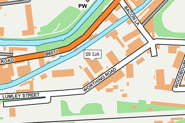
S9 3JA is located in the Darnall electoral ward, within the metropolitan district of Sheffield and the English Parliamentary constituency of Sheffield South East. The Sub Integrated Care Board (ICB) Location is NHS South Yorkshire ICB - 03N and the police force is South Yorkshire. This postcode has been in use since January 1980.


GetTheData
Source: OS OpenMap – Local (Ordnance Survey)
Source: OS VectorMap District (Ordnance Survey)
Licence: Open Government Licence (requires attribution)
| Easting | 437308 |
| Northing | 388039 |
| Latitude | 53.387899 |
| Longitude | -1.440518 |
GetTheData
Source: Open Postcode Geo
Licence: Open Government Licence
| Country | England |
| Postcode District | S9 |
| ➜ S9 open data dashboard ➜ See where S9 is on a map ➜ Where is Sheffield? | |
GetTheData
Source: Land Registry Price Paid Data
Licence: Open Government Licence
Elevation or altitude of S9 3JA as distance above sea level:
| Metres | Feet | |
|---|---|---|
| Elevation | 50m | 164ft |
Elevation is measured from the approximate centre of the postcode, to the nearest point on an OS contour line from OS Terrain 50, which has contour spacing of ten vertical metres.
➜ How high above sea level am I? Find the elevation of your current position using your device's GPS.
GetTheData
Source: Open Postcode Elevation
Licence: Open Government Licence
| Ward | Darnall |
| Constituency | Sheffield South East |
GetTheData
Source: ONS Postcode Database
Licence: Open Government Licence
| June 2022 | Anti-social behaviour | On or near Lumley Street | 158m |
| June 2022 | Criminal damage and arson | On or near Stoke Street | 294m |
| June 2022 | Anti-social behaviour | On or near Shopping Area | 437m |
| ➜ Get more crime data in our Crime section | |||
GetTheData
Source: data.police.uk
Licence: Open Government Licence
| Washford Road (Attercliffe Road) | Attercliffe | 336m |
| Parkway Avenue (Woodbourn Road) | Wybourn | 340m |
| Parkway Avenue (Woodbourn Road) | Wybourn | 351m |
| Windsor Street (Attercliffe Road) | Attercliffe | 351m |
| Woodbourn Road (Parkway Avenue) | Parkway Industrial Estate | 360m |
| Nunnery Square (Sheffield Supertram) (Nunnery Square) | Attercliffe | 277m |
| Woodbourn Road (Sheffield Supertram) (Woodbourn Road) | Attercliffe | 411m |
| Cricket Inn Road (Sheffield Supertram) (Cricket Inn Road) | Park Hill | 592m |
| Attercliffe (Sheffield Supertram) (Shortridge Street) | Attercliffe | 856m |
| Hyde Park (Sheffield Supertram) (Cricket Inn Road) | Hyde Park | 870m |
| Sheffield Station | 1.8km |
| Darnall Station | 1.9km |
| Meadowhall Station | 3.8km |
GetTheData
Source: NaPTAN
Licence: Open Government Licence
GetTheData
Source: ONS Postcode Database
Licence: Open Government Licence


➜ Get more ratings from the Food Standards Agency
GetTheData
Source: Food Standards Agency
Licence: FSA terms & conditions
| Last Collection | |||
|---|---|---|---|
| Location | Mon-Fri | Sat | Distance |
| Parkway Avenue | 18:30 | 341m | |
| Washford Road | 17:30 | 10:30 | 353m |
| Cricket Inn Road | 17:45 | 09:30 | 604m |
GetTheData
Source: Dracos
Licence: Creative Commons Attribution-ShareAlike
| Facility | Distance |
|---|---|
| Muscle Madness & Bodybuilding Gym Effingham Road, Sheffield Health and Fitness Gym | 502m |
| Sheffield Hallam University City Athletics Stadium Woodbourn Road, Sheffield Athletics, Grass Pitches | 615m |
| Leisure United Darnall Stadium Way, Sheffield Artificial Grass Pitch | 619m |
GetTheData
Source: Active Places
Licence: Open Government Licence
| School | Phase of Education | Distance |
|---|---|---|
| Wybourn Community Primary & Nursery School Manor Oaks Road, Sheffield, S2 5ED | Primary | 1km |
| Oasis Academy Don Valley Leeds Road, Sheffield, S9 3TY | All-through | 1.2km |
| Emmaus Catholic and CofE Primary School Southend Road, Sheffield, S2 5FT | Primary | 1.2km |
GetTheData
Source: Edubase
Licence: Open Government Licence
The below table lists the International Territorial Level (ITL) codes (formerly Nomenclature of Territorial Units for Statistics (NUTS) codes) and Local Administrative Units (LAU) codes for S9 3JA:
| ITL 1 Code | Name |
|---|---|
| TLE | Yorkshire and The Humber |
| ITL 2 Code | Name |
| TLE3 | South Yorkshire |
| ITL 3 Code | Name |
| TLE32 | Sheffield |
| LAU 1 Code | Name |
| E08000019 | Sheffield |
GetTheData
Source: ONS Postcode Directory
Licence: Open Government Licence
The below table lists the Census Output Area (OA), Lower Layer Super Output Area (LSOA), and Middle Layer Super Output Area (MSOA) for S9 3JA:
| Code | Name | |
|---|---|---|
| OA | E00039942 | |
| LSOA | E01007883 | Sheffield 027A |
| MSOA | E02001637 | Sheffield 027 |
GetTheData
Source: ONS Postcode Directory
Licence: Open Government Licence
| S4 7YT | Effingham Road | 237m |
| S9 3QH | Stoke Street | 293m |
| S9 3LQ | Woodbourn Road | 345m |
| S9 3QU | Attercliffe Road | 357m |
| S4 7WZ | Attercliffe Road | 389m |
| S4 7WB | Windsor Street | 427m |
| S2 5AU | Cricket Inn Road | 466m |
| S9 3XU | Trent Street | 474m |
| S9 3XL | Birch Road | 479m |
| S9 3XW | Washford Road | 484m |
GetTheData
Source: Open Postcode Geo; Land Registry Price Paid Data
Licence: Open Government Licence