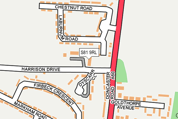
S81 9RL is located in the Langold electoral ward, within the local authority district of Bassetlaw and the English Parliamentary constituency of Bassetlaw. The Sub Integrated Care Board (ICB) Location is NHS Nottingham and Nottinghamshire ICB - 02Q and the police force is Nottinghamshire. This postcode has been in use since December 1994.


GetTheData
Source: OS OpenMap – Local (Ordnance Survey)
Source: OS VectorMap District (Ordnance Survey)
Licence: Open Government Licence (requires attribution)
| Easting | 458626 |
| Northing | 387545 |
| Latitude | 53.381529 |
| Longitude | -1.120116 |
GetTheData
Source: Open Postcode Geo
Licence: Open Government Licence
| Country | England |
| Postcode District | S81 |
| ➜ S81 open data dashboard ➜ See where S81 is on a map ➜ Where is Langold? | |
GetTheData
Source: Land Registry Price Paid Data
Licence: Open Government Licence
Elevation or altitude of S81 9RL as distance above sea level:
| Metres | Feet | |
|---|---|---|
| Elevation | 40m | 131ft |
Elevation is measured from the approximate centre of the postcode, to the nearest point on an OS contour line from OS Terrain 50, which has contour spacing of ten vertical metres.
➜ How high above sea level am I? Find the elevation of your current position using your device's GPS.
GetTheData
Source: Open Postcode Elevation
Licence: Open Government Licence
| Ward | Langold |
| Constituency | Bassetlaw |
GetTheData
Source: ONS Postcode Database
Licence: Open Government Licence
| June 2022 | Burglary | On or near Laburnum Road | 49m |
| June 2022 | Burglary | On or near Laburnum Road | 49m |
| June 2022 | Burglary | On or near Dyscarr Close | 99m |
| ➜ Get more crime data in our Crime section | |||
GetTheData
Source: data.police.uk
Licence: Open Government Licence
| Harrison Drive (Doncaster Road) | Langold | 125m |
| Harrison Drive (Doncaster Road) | Langold | 168m |
| Laburnum Road (Doncaster Road) | Langold | 187m |
| Laburnum Road (Doncaster Road) | Langold | 252m |
| Markham Road | Langold | 256m |
GetTheData
Source: NaPTAN
Licence: Open Government Licence
| Percentage of properties with Next Generation Access | 100.0% |
| Percentage of properties with Superfast Broadband | 100.0% |
| Percentage of properties with Ultrafast Broadband | 0.0% |
| Percentage of properties with Full Fibre Broadband | 0.0% |
Superfast Broadband is between 30Mbps and 300Mbps
Ultrafast Broadband is > 300Mbps
| Percentage of properties unable to receive 2Mbps | 0.0% |
| Percentage of properties unable to receive 5Mbps | 0.0% |
| Percentage of properties unable to receive 10Mbps | 0.0% |
| Percentage of properties unable to receive 30Mbps | 0.0% |
GetTheData
Source: Ofcom
Licence: Ofcom Terms of Use (requires attribution)
GetTheData
Source: ONS Postcode Database
Licence: Open Government Licence


➜ Get more ratings from the Food Standards Agency
GetTheData
Source: Food Standards Agency
Licence: FSA terms & conditions
| Last Collection | |||
|---|---|---|---|
| Location | Mon-Fri | Sat | Distance |
| Chestnut Road | 16:00 | 10:30 | 156m |
| Markham Road | 16:00 | 10:30 | 267m |
| Langold Post Office | 16:00 | 10:30 | 421m |
GetTheData
Source: Dracos
Licence: Creative Commons Attribution-ShareAlike
| Facility | Distance |
|---|---|
| Harrison Drive Recreation Ground Laburnum Road, Langold, Worksop Grass Pitches | 119m |
| Langold Dyscarr Community School School Road, Langold, Worksop Artificial Grass Pitch, Grass Pitches | 642m |
| Langold Country Park Doncaster Road, Costhorpe, Worksop Grass Pitches | 876m |
GetTheData
Source: Active Places
Licence: Open Government Licence
| School | Phase of Education | Distance |
|---|---|---|
| Langold Dyscarr Community School School Road, Langold, Worksop, S81 9PX | Primary | 637m |
| Kingston Park Academy Long Lane, Carlton-in-Lindrick, Worksop, S81 9AW | Primary | 2.8km |
| Ramsden Primary School High Road, Carlton-in-Lindrick, Worksop, S81 9DY | Primary | 3.2km |
GetTheData
Source: Edubase
Licence: Open Government Licence
The below table lists the International Territorial Level (ITL) codes (formerly Nomenclature of Territorial Units for Statistics (NUTS) codes) and Local Administrative Units (LAU) codes for S81 9RL:
| ITL 1 Code | Name |
|---|---|
| TLF | East Midlands (England) |
| ITL 2 Code | Name |
| TLF1 | Derbyshire and Nottinghamshire |
| ITL 3 Code | Name |
| TLF15 | North Nottinghamshire |
| LAU 1 Code | Name |
| E07000171 | Bassetlaw |
GetTheData
Source: ONS Postcode Directory
Licence: Open Government Licence
The below table lists the Census Output Area (OA), Lower Layer Super Output Area (LSOA), and Middle Layer Super Output Area (MSOA) for S81 9RL:
| Code | Name | |
|---|---|---|
| OA | E00142817 | |
| LSOA | E01028029 | Bassetlaw 004E |
| MSOA | E02005838 | Bassetlaw 004 |
GetTheData
Source: ONS Postcode Directory
Licence: Open Government Licence
| S81 9RR | Laburnum Road | 59m |
| S81 9SA | Firbeck Crescent | 136m |
| S81 9SB | Firbeck Crescent | 161m |
| S81 9RS | Chestnut Road | 174m |
| S81 9RP | Doncaster Road | 187m |
| S81 9RY | Doncaster Road | 221m |
| S81 9RT | Doncaster Road | 223m |
| S81 9SD | Markham Road | 230m |
| S81 9SW | Markham Road | 262m |
| S81 9SH | Markham Road | 287m |
GetTheData
Source: Open Postcode Geo; Land Registry Price Paid Data
Licence: Open Government Licence