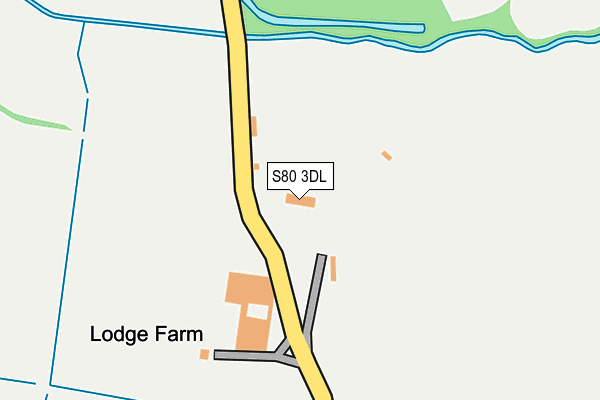
S80 3DL lies on Mansfield Road in Worksop. S80 3DL is located in the Worksop South electoral ward, within the local authority district of Bassetlaw and the English Parliamentary constituency of Bassetlaw. The Sub Integrated Care Board (ICB) Location is NHS Nottingham and Nottinghamshire ICB - 02Q and the police force is Nottinghamshire. This postcode has been in use since January 1980.


GetTheData
Source: OS OpenMap – Local (Ordnance Survey)
Source: OS VectorMap District (Ordnance Survey)
Licence: Open Government Licence (requires attribution)
| Easting | 456492 |
| Northing | 379197 |
| Latitude | 53.306713 |
| Longitude | -1.153680 |
GetTheData
Source: Open Postcode Geo
Licence: Open Government Licence
| Street | Mansfield Road |
| Town/City | Worksop |
| Country | England |
| Postcode District | S80 |
| ➜ S80 open data dashboard ➜ See where S80 is on a map | |
GetTheData
Source: Land Registry Price Paid Data
Licence: Open Government Licence
Elevation or altitude of S80 3DL as distance above sea level:
| Metres | Feet | |
|---|---|---|
| Elevation | 40m | 131ft |
Elevation is measured from the approximate centre of the postcode, to the nearest point on an OS contour line from OS Terrain 50, which has contour spacing of ten vertical metres.
➜ How high above sea level am I? Find the elevation of your current position using your device's GPS.
GetTheData
Source: Open Postcode Elevation
Licence: Open Government Licence
| Ward | Worksop South |
| Constituency | Bassetlaw |
GetTheData
Source: ONS Postcode Database
Licence: Open Government Licence
| October 2023 | Burglary | On or near Wallingbrook Rise | 478m |
| March 2023 | Other theft | On or near Wallingbrook Rise | 478m |
| January 2023 | Burglary | On or near Wallingbrook Rise | 478m |
| ➜ Get more crime data in our Crime section | |||
GetTheData
Source: data.police.uk
Licence: Open Government Licence
| Westwood Drive (St Annes Drive) | St Anne's Drive | 566m |
| Westwood Drive (St Annes Drive) | St Anne's Drive | 575m |
| Birchfield Drive (St Annes Drive) | St Anne's Drive | 637m |
| Mable Street | Rhodesia | 675m |
| Birchfield Drive (St Annes Drive) | St Anne's Drive | 675m |
| Worksop Station | 2.1km |
| Shireoaks Station | 2.2km |
| Whitwell (Derbys) Station | 4.3km |
GetTheData
Source: NaPTAN
Licence: Open Government Licence
| Percentage of properties with Next Generation Access | 100.0% |
| Percentage of properties with Superfast Broadband | 0.0% |
| Percentage of properties with Ultrafast Broadband | 0.0% |
| Percentage of properties with Full Fibre Broadband | 0.0% |
Superfast Broadband is between 30Mbps and 300Mbps
Ultrafast Broadband is > 300Mbps
| Percentage of properties unable to receive 2Mbps | 0.0% |
| Percentage of properties unable to receive 5Mbps | 0.0% |
| Percentage of properties unable to receive 10Mbps | 0.0% |
| Percentage of properties unable to receive 30Mbps | 100.0% |
GetTheData
Source: Ofcom
Licence: Ofcom Terms of Use (requires attribution)
GetTheData
Source: ONS Postcode Database
Licence: Open Government Licence


➜ Get more ratings from the Food Standards Agency
GetTheData
Source: Food Standards Agency
Licence: FSA terms & conditions
| Last Collection | |||
|---|---|---|---|
| Location | Mon-Fri | Sat | Distance |
| Rhodesia Post Office | 16:00 | 10:30 | 881m |
| St Annes Drive | 16:00 | 10:30 | 930m |
| Shireoaks Road | 16:00 | 10:30 | 1,097m |
GetTheData
Source: Dracos
Licence: Creative Commons Attribution-ShareAlike
| Facility | Distance |
|---|---|
| Haggonfields Primary And Nursery School Marjorie Street, Rhodesia, Worksop Grass Pitches | 762m |
| Worksop Rugby Union Football Club Stubbing Lane, Worksop Grass Pitches | 1.2km |
| Rockware Glass Sports And Social Club Sandy Lane, Worksop Grass Pitches | 1.3km |
GetTheData
Source: Active Places
Licence: Open Government Licence
| School | Phase of Education | Distance |
|---|---|---|
| Haggonfields Primary and Nursery School Marjorie Street, Rhodesia, Worksop, S80 3HP | Primary | 768m |
| St Anne's CofE (Aided) Primary School Harrington Street, Worksop, S80 1NQ | Primary | 1.5km |
| Redlands Primary and Nursery School Crown Street, Worksop, S80 1TH | Primary | 1.6km |
GetTheData
Source: Edubase
Licence: Open Government Licence
The below table lists the International Territorial Level (ITL) codes (formerly Nomenclature of Territorial Units for Statistics (NUTS) codes) and Local Administrative Units (LAU) codes for S80 3DL:
| ITL 1 Code | Name |
|---|---|
| TLF | East Midlands (England) |
| ITL 2 Code | Name |
| TLF1 | Derbyshire and Nottinghamshire |
| ITL 3 Code | Name |
| TLF15 | North Nottinghamshire |
| LAU 1 Code | Name |
| E07000171 | Bassetlaw |
GetTheData
Source: ONS Postcode Directory
Licence: Open Government Licence
The below table lists the Census Output Area (OA), Lower Layer Super Output Area (LSOA), and Middle Layer Super Output Area (MSOA) for S80 3DL:
| Code | Name | |
|---|---|---|
| OA | E00142986 | |
| LSOA | E01028063 | Bassetlaw 014D |
| MSOA | E02005848 | Bassetlaw 014 |
GetTheData
Source: ONS Postcode Directory
Licence: Open Government Licence
| S80 3PG | Wallingbrook Rise | 486m |
| S80 3PH | Hillwood Close | 528m |
| S80 3PJ | Ashwood Road | 544m |
| S80 3HS | Queen Elizabeth Crescent | 551m |
| S80 3JF | Mary Street | 580m |
| S80 3PF | Oakwood Mews | 580m |
| S80 3PL | Ladylea Close | 604m |
| S80 3HY | Winifred Street | 619m |
| S80 3JE | Mary Street | 631m |
| S80 3QU | Manor Grove | 652m |
GetTheData
Source: Open Postcode Geo; Land Registry Price Paid Data
Licence: Open Government Licence