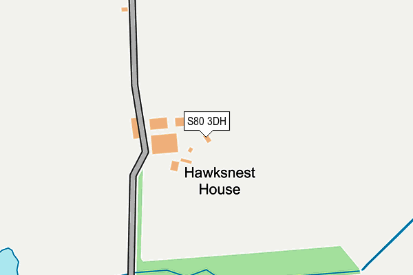
S80 3DH is located in the Worksop South electoral ward, within the local authority district of Bassetlaw and the English Parliamentary constituency of Bassetlaw. The Sub Integrated Care Board (ICB) Location is NHS Nottingham and Nottinghamshire ICB - 02Q and the police force is Nottinghamshire. This postcode has been in use since January 1980.


GetTheData
Source: OS OpenMap – Local (Ordnance Survey)
Source: OS VectorMap District (Ordnance Survey)
Licence: Open Government Licence (requires attribution)
| Easting | 456337 |
| Northing | 377519 |
| Latitude | 53.291648 |
| Longitude | -1.156303 |
GetTheData
Source: Open Postcode Geo
Licence: Open Government Licence
| Country | England |
| Postcode District | S80 |
| ➜ S80 open data dashboard ➜ See where S80 is on a map | |
GetTheData
Source: Land Registry Price Paid Data
Licence: Open Government Licence
Elevation or altitude of S80 3DH as distance above sea level:
| Metres | Feet | |
|---|---|---|
| Elevation | 50m | 164ft |
Elevation is measured from the approximate centre of the postcode, to the nearest point on an OS contour line from OS Terrain 50, which has contour spacing of ten vertical metres.
➜ How high above sea level am I? Find the elevation of your current position using your device's GPS.
GetTheData
Source: Open Postcode Elevation
Licence: Open Government Licence
| Ward | Worksop South |
| Constituency | Bassetlaw |
GetTheData
Source: ONS Postcode Database
Licence: Open Government Licence
| Chesterfield Road (Mansfield Road) | Worksop | 540m |
| Chesterfield Road (Mansfield Road) | Worksop | 562m |
| Ratcliffe Grange Farm (Mansfield Road) | Worksop | 619m |
| Ratcliffe Grange Farm (Mansfield Road) | Worksop | 626m |
| Manor Lodge Lane (Mansfield Road) | Worksop | 847m |
| Worksop Station | 3.1km |
| Whitwell (Derbys) Station | 3.2km |
| Shireoaks Station | 3.8km |
GetTheData
Source: NaPTAN
Licence: Open Government Licence
GetTheData
Source: ONS Postcode Database
Licence: Open Government Licence


➜ Get more ratings from the Food Standards Agency
GetTheData
Source: Food Standards Agency
Licence: FSA terms & conditions
| Last Collection | |||
|---|---|---|---|
| Location | Mon-Fri | Sat | Distance |
| Steetley Corner | 16:00 | 08:15 | 935m |
| St Annes Drive | 16:00 | 10:30 | 1,692m |
| 172 Newcastle Avenue | 17:00 | 11:00 | 1,919m |
GetTheData
Source: Dracos
Licence: Creative Commons Attribution-ShareAlike
| Facility | Distance |
|---|---|
| St Annes C E Primary School Harrington Street, Worksop Grass Pitches | 2km |
| Farr Park Devonshire Street, Worksop Grass Pitches | 2.1km |
| Hartland School (Closed) Sparken Hill, Worksop Sports Hall, Grass Pitches | 2.3km |
GetTheData
Source: Active Places
Licence: Open Government Licence
| School | Phase of Education | Distance |
|---|---|---|
| St Anne's CofE (Aided) Primary School Harrington Street, Worksop, S80 1NQ | Primary | 2km |
| Whitegates College Dukeries Centre, Park Street, Worksop, S80 1HH | Not applicable | 2.4km |
| Haggonfields Primary and Nursery School Marjorie Street, Rhodesia, Worksop, S80 3HP | Primary | 2.4km |
GetTheData
Source: Edubase
Licence: Open Government Licence
The below table lists the International Territorial Level (ITL) codes (formerly Nomenclature of Territorial Units for Statistics (NUTS) codes) and Local Administrative Units (LAU) codes for S80 3DH:
| ITL 1 Code | Name |
|---|---|
| TLF | East Midlands (England) |
| ITL 2 Code | Name |
| TLF1 | Derbyshire and Nottinghamshire |
| ITL 3 Code | Name |
| TLF15 | North Nottinghamshire |
| LAU 1 Code | Name |
| E07000171 | Bassetlaw |
GetTheData
Source: ONS Postcode Directory
Licence: Open Government Licence
The below table lists the Census Output Area (OA), Lower Layer Super Output Area (LSOA), and Middle Layer Super Output Area (MSOA) for S80 3DH:
| Code | Name | |
|---|---|---|
| OA | E00142986 | |
| LSOA | E01028063 | Bassetlaw 014D |
| MSOA | E02005848 | Bassetlaw 014 |
GetTheData
Source: ONS Postcode Directory
Licence: Open Government Licence
| S80 3DP | Mansfield Road | 871m |
| S80 3DU | High Park | 907m |
| S80 3DS | 1043m | |
| S80 3DW | Mansfield Road | 1063m |
| S80 3AB | Mansfield Road | 1115m |
| S80 3EW | Hazelwood Grove | 1166m |
| S80 3EP | Spruce Court | 1190m |
| S80 3DY | Alpine Court | 1255m |
| S80 3EL | Nursery Gardens | 1293m |
| S80 3DX | Birchfield Drive | 1299m |
GetTheData
Source: Open Postcode Geo; Land Registry Price Paid Data
Licence: Open Government Licence