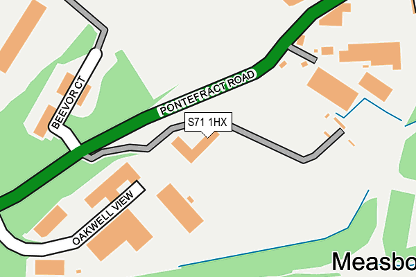
S71 1HX is located in the Central electoral ward, within the metropolitan district of Barnsley and the English Parliamentary constituency of Barnsley Central. The Sub Integrated Care Board (ICB) Location is NHS South Yorkshire ICB - 02P and the police force is South Yorkshire. This postcode has been in use since June 1998.


GetTheData
Source: OS OpenMap – Local (Ordnance Survey)
Source: OS VectorMap District (Ordnance Survey)
Licence: Open Government Licence (requires attribution)
| Easting | 435685 |
| Northing | 406136 |
| Latitude | 53.550668 |
| Longitude | -1.462872 |
GetTheData
Source: Open Postcode Geo
Licence: Open Government Licence
| Country | England |
| Postcode District | S71 |
| ➜ S71 open data dashboard ➜ See where S71 is on a map ➜ Where is Barnsley? | |
GetTheData
Source: Land Registry Price Paid Data
Licence: Open Government Licence
Elevation or altitude of S71 1HX as distance above sea level:
| Metres | Feet | |
|---|---|---|
| Elevation | 70m | 230ft |
Elevation is measured from the approximate centre of the postcode, to the nearest point on an OS contour line from OS Terrain 50, which has contour spacing of ten vertical metres.
➜ How high above sea level am I? Find the elevation of your current position using your device's GPS.
GetTheData
Source: Open Postcode Elevation
Licence: Open Government Licence
| Ward | Central |
| Constituency | Barnsley Central |
GetTheData
Source: ONS Postcode Database
Licence: Open Government Licence
| December 2023 | Vehicle crime | On or near Elm Row | 376m |
| December 2023 | Vehicle crime | On or near Elm Row | 376m |
| November 2023 | Other theft | On or near Elm Row | 376m |
| ➜ Get more crime data in our Crime section | |||
GetTheData
Source: data.police.uk
Licence: Open Government Licence
| Beevor Hall (Pontefract Road) | Hoyle Mill | 108m |
| Beevor Hall (Pontefract Road) | Hoyle Mill | 219m |
| Elm Row (Pontefract Road) | Hoyle Mill | 405m |
| Portland Street (Doncaster Road) | Kendray | 411m |
| Beevor Street (Pontefract Road) | Hoyle Mill | 418m |
| Barnsley Station | 1km |
| Dodworth Station | 4.6km |
| Wombwell Station | 4.8km |
GetTheData
Source: NaPTAN
Licence: Open Government Licence
| Median download speed | 50.6Mbps |
| Average download speed | 39.0Mbps |
| Maximum download speed | 62.82Mbps |
| Median upload speed | 12.7Mbps |
| Average upload speed | 10.1Mbps |
| Maximum upload speed | 19.30Mbps |
GetTheData
Source: Ofcom
Licence: Ofcom Terms of Use (requires attribution)
GetTheData
Source: ONS Postcode Database
Licence: Open Government Licence

➜ Get more ratings from the Food Standards Agency
GetTheData
Source: Food Standards Agency
Licence: FSA terms & conditions
| Last Collection | |||
|---|---|---|---|
| Location | Mon-Fri | Sat | Distance |
| Post Office | 18:30 | 11:00 | 418m |
| Oakwell Ins Services | 16:00 | 11:00 | 493m |
| Hoyle Mill | 16:00 | 11:00 | 530m |
GetTheData
Source: Dracos
Licence: Creative Commons Attribution-ShareAlike
| Facility | Distance |
|---|---|
| Barnsley Fc (Oakwell Stadium) Grove Street, Barnsley Grass Pitches | 364m |
| Barnsley Fc Training Ground Grove Street, Barnsley Artificial Grass Pitch, Grass Pitches | 425m |
| Barnsley Metrodome Leisure Complex Queens Road, Barnsley Sports Hall, Indoor Bowls, Swimming Pool, Health and Fitness Gym, Studio, Squash Courts | 722m |
GetTheData
Source: Active Places
Licence: Open Government Licence
| School | Phase of Education | Distance |
|---|---|---|
| Oakwell Rise Primary Academy Doncaster Road, Barnsley, S70 1TS | Primary | 569m |
| Queens Road Academy Queens Road, Barnsley, S71 1AR | Primary | 774m |
| The Forest Academy Thornton Road, Kendray, Barnsley, S70 3NG | Primary | 1.1km |
GetTheData
Source: Edubase
Licence: Open Government Licence
The below table lists the International Territorial Level (ITL) codes (formerly Nomenclature of Territorial Units for Statistics (NUTS) codes) and Local Administrative Units (LAU) codes for S71 1HX:
| ITL 1 Code | Name |
|---|---|
| TLE | Yorkshire and The Humber |
| ITL 2 Code | Name |
| TLE3 | South Yorkshire |
| ITL 3 Code | Name |
| TLE31 | Barnsley, Doncaster and Rotherham |
| LAU 1 Code | Name |
| E08000016 | Barnsley |
GetTheData
Source: ONS Postcode Directory
Licence: Open Government Licence
The below table lists the Census Output Area (OA), Lower Layer Super Output Area (LSOA), and Middle Layer Super Output Area (MSOA) for S71 1HX:
| Code | Name | |
|---|---|---|
| OA | E00168691 | |
| LSOA | E01007337 | Barnsley 015D |
| MSOA | E02001523 | Barnsley 015 |
GetTheData
Source: ONS Postcode Directory
Licence: Open Government Licence
| S71 1HH | Mount Osborne Industrial Park | 165m |
| S70 3RW | Barnsbridge Grove | 272m |
| S70 3QT | Portland Street | 317m |
| S70 1UY | Jubilee Terrace | 323m |
| S70 1UZ | Burton Terrace | 328m |
| S70 3QU | Boundary Street | 330m |
| S70 1UX | Evelyn Terrace | 343m |
| S70 1XD | King George Terrace | 343m |
| S70 1UP | Sunderland Terrace | 346m |
| S70 3RU | Honeymere Court | 361m |
GetTheData
Source: Open Postcode Geo; Land Registry Price Paid Data
Licence: Open Government Licence