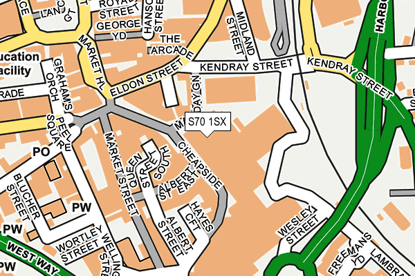
S70 1SX is located in the Central electoral ward, within the metropolitan district of Barnsley and the English Parliamentary constituency of Barnsley Central. The Sub Integrated Care Board (ICB) Location is NHS South Yorkshire ICB - 02P and the police force is South Yorkshire. This postcode has been in use since January 1980.


GetTheData
Source: OS OpenMap – Local (Ordnance Survey)
Source: OS VectorMap District (Ordnance Survey)
Licence: Open Government Licence (requires attribution)
| Easting | 434720 |
| Northing | 406340 |
| Latitude | 53.552566 |
| Longitude | -1.477414 |
GetTheData
Source: Open Postcode Geo
Licence: Open Government Licence
| Country | England |
| Postcode District | S70 |
| ➜ S70 open data dashboard ➜ See where S70 is on a map ➜ Where is Barnsley? | |
GetTheData
Source: Land Registry Price Paid Data
Licence: Open Government Licence
Elevation or altitude of S70 1SX as distance above sea level:
| Metres | Feet | |
|---|---|---|
| Elevation | 100m | 328ft |
Elevation is measured from the approximate centre of the postcode, to the nearest point on an OS contour line from OS Terrain 50, which has contour spacing of ten vertical metres.
➜ How high above sea level am I? Find the elevation of your current position using your device's GPS.
GetTheData
Source: Open Postcode Elevation
Licence: Open Government Licence
| Ward | Central |
| Constituency | Barnsley Central |
GetTheData
Source: ONS Postcode Database
Licence: Open Government Licence
| January 2024 | Anti-social behaviour | On or near Shopping Area | 195m |
| January 2024 | Burglary | On or near Shopping Area | 195m |
| January 2024 | Drugs | On or near Shopping Area | 195m |
| ➜ Get more crime data in our Crime section | |||
GetTheData
Source: data.police.uk
Licence: Open Government Licence
| Schwabisch Gmund Way (Schwabish Gmund Way) | Barnsley Town Centre | 159m |
| Barnsley Interchange (Eldon Street) | Barnsley Town Centre | 179m |
| Market Hill (Eldon Street) | Barnsley Town Centre | 238m |
| New Street (West Way) | Barnsley Town Centre | 252m |
| County Way (Regent Street) | Barnsley Town Centre | 283m |
| Barnsley Station | 0.2km |
| Dodworth Station | 3.7km |
| Darton Station | 5.4km |
GetTheData
Source: NaPTAN
Licence: Open Government Licence
GetTheData
Source: ONS Postcode Database
Licence: Open Government Licence


➜ Get more ratings from the Food Standards Agency
GetTheData
Source: Food Standards Agency
Licence: FSA terms & conditions
| Last Collection | |||
|---|---|---|---|
| Location | Mon-Fri | Sat | Distance |
| New Street | 19:00 | 11:00 | 217m |
| Church Street | 18:45 | 11:00 | 331m |
| Barnsley Delivery Office | 19:30 | 12:45 | 332m |
GetTheData
Source: Dracos
Licence: Creative Commons Attribution-ShareAlike
| Facility | Distance |
|---|---|
| Womens Workout World (Barnsley) (Closed) Eldon Arcade, Barnsley Health and Fitness Gym | 144m |
| Queens Road Academy Queens Road, Barnsley Grass Pitches | 336m |
| Hope House School (Closed) Blucher Street, Barnsley Sports Hall | 367m |
GetTheData
Source: Active Places
Licence: Open Government Licence
| School | Phase of Education | Distance |
|---|---|---|
| Queens Road Academy Queens Road, Barnsley, S71 1AR | Primary | 280m |
| Barnsley College PO Box 266, Church Street, Barnsley, S70 2YW | 16 plus | 346m |
| Trinity Academy St. Edwards 9 Eastgate, Barnsley, S70 2EX | Secondary | 384m |
GetTheData
Source: Edubase
Licence: Open Government Licence
The below table lists the International Territorial Level (ITL) codes (formerly Nomenclature of Territorial Units for Statistics (NUTS) codes) and Local Administrative Units (LAU) codes for S70 1SX:
| ITL 1 Code | Name |
|---|---|
| TLE | Yorkshire and The Humber |
| ITL 2 Code | Name |
| TLE3 | South Yorkshire |
| ITL 3 Code | Name |
| TLE31 | Barnsley, Doncaster and Rotherham |
| LAU 1 Code | Name |
| E08000016 | Barnsley |
GetTheData
Source: ONS Postcode Directory
Licence: Open Government Licence
The below table lists the Census Output Area (OA), Lower Layer Super Output Area (LSOA), and Middle Layer Super Output Area (MSOA) for S70 1SX:
| Code | Name | |
|---|---|---|
| OA | E00037176 | |
| LSOA | E01007336 | Barnsley 013A |
| MSOA | E02001521 | Barnsley 013 |
GetTheData
Source: ONS Postcode Directory
Licence: Open Government Licence
| S70 1SH | May Day Green | 153m |
| S70 2JJ | Eldon Street | 154m |
| S71 1AY | Pontefract Road | 170m |
| S70 2JR | Eldon Street | 188m |
| S70 1RX | New Street | 188m |
| S70 1SJ | Queen Street | 198m |
| S70 2QP | The Arcade | 215m |
| S70 1RJ | Queen Street | 218m |
| S71 1AJ | Pontefract Road | 224m |
| S70 1RS | Albert Street East | 225m |
GetTheData
Source: Open Postcode Geo; Land Registry Price Paid Data
Licence: Open Government Licence