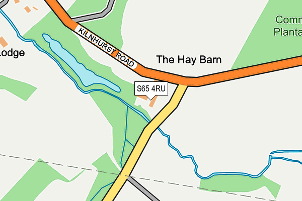
S65 4RU is located in the Bramley & Ravenfield electoral ward, within the metropolitan district of Rotherham and the English Parliamentary constituency of Wentworth and Dearne. The Sub Integrated Care Board (ICB) Location is NHS South Yorkshire ICB - 03L and the police force is South Yorkshire. This postcode has been in use since September 2009.


GetTheData
Source: OS OpenMap – Local (Ordnance Survey)
Source: OS VectorMap District (Ordnance Survey)
Licence: Open Government Licence (requires attribution)
| Easting | 447340 |
| Northing | 396987 |
| Latitude | 53.467502 |
| Longitude | -1.288351 |
GetTheData
Source: Open Postcode Geo
Licence: Open Government Licence
| Country | England |
| Postcode District | S65 |
| ➜ S65 open data dashboard ➜ See where S65 is on a map | |
GetTheData
Source: Land Registry Price Paid Data
Licence: Open Government Licence
Elevation or altitude of S65 4RU as distance above sea level:
| Metres | Feet | |
|---|---|---|
| Elevation | 20m | 66ft |
Elevation is measured from the approximate centre of the postcode, to the nearest point on an OS contour line from OS Terrain 50, which has contour spacing of ten vertical metres.
➜ How high above sea level am I? Find the elevation of your current position using your device's GPS.
GetTheData
Source: Open Postcode Elevation
Licence: Open Government Licence
| Ward | Bramley & Ravenfield |
| Constituency | Wentworth And Dearne |
GetTheData
Source: ONS Postcode Database
Licence: Open Government Licence
| December 2021 | Violence and sexual offences | On or near Carr Lane | 41m |
| November 2021 | Violence and sexual offences | On or near Carr Lane | 41m |
| October 2021 | Burglary | On or near Carr Lane | 41m |
| ➜ Get more crime data in our Crime section | |||
GetTheData
Source: data.police.uk
Licence: Open Government Licence
| Carr Lane (Doncaster Road) | Thrybergh | 735m |
| O/S Thrybergh Country Pk (Doncaster Road) | Thrybergh | 746m |
| Ravenfield Lane (Doncaster Road) | Hooton Roberts | 780m |
| Doncaster Road (Kilnhurst Road) | Hooton Roberts | 790m |
| Doncaster Road (Kilnhurst Road) | Hooton Roberts | 793m |
| Swinton (South Yorks) Station | 2.4km |
| Mexborough Station | 2.6km |
| Conisbrough Station | 4.3km |
GetTheData
Source: NaPTAN
Licence: Open Government Licence
GetTheData
Source: ONS Postcode Database
Licence: Open Government Licence


➜ Get more ratings from the Food Standards Agency
GetTheData
Source: Food Standards Agency
Licence: FSA terms & conditions
| Last Collection | |||
|---|---|---|---|
| Location | Mon-Fri | Sat | Distance |
| Doncaster Road | 16:15 | 11:00 | 999m |
| Wharf Road | 17:00 | 12:00 | 1,070m |
| Thrybergh Post Office | 16:15 | 12:00 | 1,631m |
GetTheData
Source: Dracos
Licence: Creative Commons Attribution-ShareAlike
| Facility | Distance |
|---|---|
| Rotherham United Fc Training Ground (Closed) Kilnhurst Road, Hooton Roberts, Rotherham Grass Pitches | 773m |
| Kilnhurst Primary School Hooton Road, Kilnhurst, Rotherham Grass Pitches | 842m |
| Rotherham Golf Club Doncaster Road, Thrybergh, Rotherham Golf | 956m |
GetTheData
Source: Active Places
Licence: Open Government Licence
| School | Phase of Education | Distance |
|---|---|---|
| Kilnhurst Primary School Hooton Road, Kilnhurst, Mexborough, S64 5TA | Primary | 848m |
| Kilnhurst St Thomas' CofE Primary Academy Meadow View Road, Kilnhurst, Mexborough, S64 5UA | Primary | 1.7km |
| Thrybergh Fullerton Church of England Primary Academy Church View, Thrybergh, Rotherham, S65 4BL | Primary | 1.8km |
GetTheData
Source: Edubase
Licence: Open Government Licence
The below table lists the International Territorial Level (ITL) codes (formerly Nomenclature of Territorial Units for Statistics (NUTS) codes) and Local Administrative Units (LAU) codes for S65 4RU:
| ITL 1 Code | Name |
|---|---|
| TLE | Yorkshire and The Humber |
| ITL 2 Code | Name |
| TLE3 | South Yorkshire |
| ITL 3 Code | Name |
| TLE31 | Barnsley, Doncaster and Rotherham |
| LAU 1 Code | Name |
| E08000018 | Rotherham |
GetTheData
Source: ONS Postcode Directory
Licence: Open Government Licence
The below table lists the Census Output Area (OA), Lower Layer Super Output Area (LSOA), and Middle Layer Super Output Area (MSOA) for S65 4RU:
| Code | Name | |
|---|---|---|
| OA | E00039130 | |
| LSOA | E01007720 | Rotherham 010B |
| MSOA | E02001587 | Rotherham 010 |
GetTheData
Source: ONS Postcode Directory
Licence: Open Government Licence
| S65 4TE | Elm Tree Farm Court | 590m |
| S65 4PE | Kilnhurst Road | 767m |
| S64 5TA | Hooton Road | 893m |
| S65 4PQ | Ravenfield Lane | 996m |
| S65 4PF | Doncaster Road | 1010m |
| S64 5TQ | Glasshouse Road | 1029m |
| S65 4PJ | Holmes Lane | 1046m |
| S64 5SP | Victoria Street | 1068m |
| S65 4PL | Holly Barn Fold | 1086m |
| S65 4NU | Doncaster Road | 1122m |
GetTheData
Source: Open Postcode Geo; Land Registry Price Paid Data
Licence: Open Government Licence