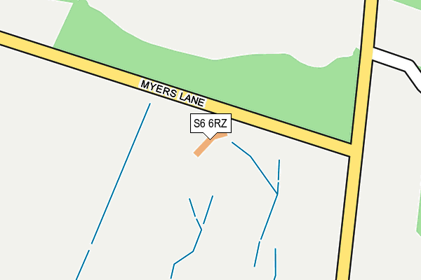
S6 6RZ is located in the Stannington electoral ward, within the metropolitan district of Sheffield and the English Parliamentary constituency of Sheffield, Hallam. The Sub Integrated Care Board (ICB) Location is NHS South Yorkshire ICB - 03N and the police force is South Yorkshire. This postcode has been in use since May 2013.


GetTheData
Source: OS OpenMap – Local (Ordnance Survey)
Source: OS VectorMap District (Ordnance Survey)
Licence: Open Government Licence (requires attribution)
| Easting | 430317 |
| Northing | 390874 |
| Latitude | 53.413809 |
| Longitude | -1.545356 |
GetTheData
Source: Open Postcode Geo
Licence: Open Government Licence
| Country | England |
| Postcode District | S6 |
| ➜ S6 open data dashboard ➜ See where S6 is on a map | |
GetTheData
Source: Land Registry Price Paid Data
Licence: Open Government Licence
Elevation or altitude of S6 6RZ as distance above sea level:
| Metres | Feet | |
|---|---|---|
| Elevation | 230m | 755ft |
Elevation is measured from the approximate centre of the postcode, to the nearest point on an OS contour line from OS Terrain 50, which has contour spacing of ten vertical metres.
➜ How high above sea level am I? Find the elevation of your current position using your device's GPS.
GetTheData
Source: Open Postcode Elevation
Licence: Open Government Licence
| Ward | Stannington |
| Constituency | Sheffield, Hallam |
GetTheData
Source: ONS Postcode Database
Licence: Open Government Licence
| March 2022 | Anti-social behaviour | On or near Parking Area | 396m |
| July 2021 | Other crime | On or near Long Lane | 242m |
| February 2021 | Other theft | On or near Long Lane | 242m |
| ➜ Get more crime data in our Crime section | |||
GetTheData
Source: data.police.uk
Licence: Open Government Licence
| Rowell Lane (Loxley Road) | Loxley | 808m |
| Rowell Lane (Loxley Road) | Loxley | 813m |
| Barnfield House (Loxley Road) | Loxley | 831m |
| Barnfield House (Loxley Road) | Loxley | 850m |
| Long Lane (Loxley Road) | Loxley | 908m |
GetTheData
Source: NaPTAN
Licence: Open Government Licence
GetTheData
Source: ONS Postcode Database
Licence: Open Government Licence


➜ Get more ratings from the Food Standards Agency
GetTheData
Source: Food Standards Agency
Licence: FSA terms & conditions
| Last Collection | |||
|---|---|---|---|
| Location | Mon-Fri | Sat | Distance |
| Loxley Road | 16:15 | 11:45 | 802m |
| 590 Loxley Road | 16:30 | 11:45 | 1,021m |
| Phillips Road | 16:30 | 11:45 | 1,059m |
GetTheData
Source: Dracos
Licence: Creative Commons Attribution-ShareAlike
| Facility | Distance |
|---|---|
| Loxley Driving Range Myers Lane, Loxley, Sheffield Golf | 26m |
| Loxley Primary School Rodney Hill, Loxley, Sheffield Grass Pitches | 1.1km |
| Bradfield School Kirk Edge Road, Worrall, Sheffield Grass Pitches, Sports Hall, Outdoor Tennis Courts, Artificial Grass Pitch | 1.2km |
GetTheData
Source: Active Places
Licence: Open Government Licence
| School | Phase of Education | Distance |
|---|---|---|
| Loxley Primary School Rodney Hill, Loxley, Sheffield, S6 6SG | Primary | 1.1km |
| Bradfield School Kirk Edge Road, Sheffield, S35 0AE | Secondary | 1.2km |
| Wisewood Community Primary School Ben Lane, Wisewood, Sheffield, S6 4SD | Primary | 1.8km |
GetTheData
Source: Edubase
Licence: Open Government Licence
The below table lists the International Territorial Level (ITL) codes (formerly Nomenclature of Territorial Units for Statistics (NUTS) codes) and Local Administrative Units (LAU) codes for S6 6RZ:
| ITL 1 Code | Name |
|---|---|
| TLE | Yorkshire and The Humber |
| ITL 2 Code | Name |
| TLE3 | South Yorkshire |
| ITL 3 Code | Name |
| TLE32 | Sheffield |
| LAU 1 Code | Name |
| E08000019 | Sheffield |
GetTheData
Source: ONS Postcode Directory
Licence: Open Government Licence
The below table lists the Census Output Area (OA), Lower Layer Super Output Area (LSOA), and Middle Layer Super Output Area (MSOA) for S6 6RZ:
| Code | Name | |
|---|---|---|
| OA | E00041175 | |
| LSOA | E01008128 | Sheffield 008C |
| MSOA | E02001618 | Sheffield 008 |
GetTheData
Source: ONS Postcode Directory
Licence: Open Government Licence
| S6 6RW | Loxley Road | 748m |
| S6 6ST | Hunters Gardens | 863m |
| S6 6SP | Alders Green | 871m |
| S6 6RH | Leaton Close | 878m |
| S6 6RL | Long Lane | 892m |
| S6 6RF | Hanson Road | 915m |
| S6 6SR | Archer Gate | 920m |
| S6 6RB | Dunkerley Road | 928m |
| S6 6RD | France Road | 935m |
| S6 6SS | Garland Drive | 946m |
GetTheData
Source: Open Postcode Geo; Land Registry Price Paid Data
Licence: Open Government Licence