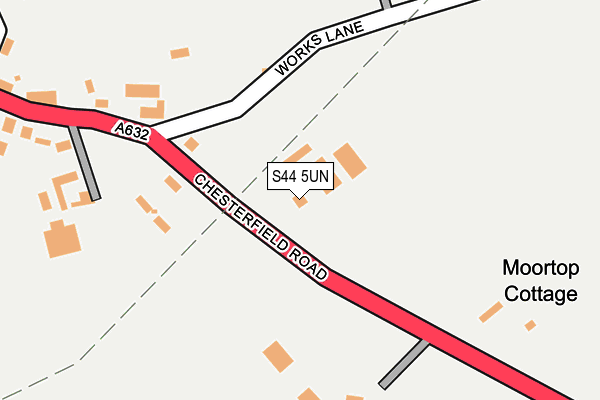
S44 5UN lies on Chesterfield Road in Calow, Chesterfield. S44 5UN is located in the Sutton electoral ward, within the local authority district of North East Derbyshire and the English Parliamentary constituency of Bolsover. The Sub Integrated Care Board (ICB) Location is NHS Derby and Derbyshire ICB - 15M and the police force is Derbyshire. This postcode has been in use since January 1980.


GetTheData
Source: OS OpenMap – Local (Ordnance Survey)
Source: OS VectorMap District (Ordnance Survey)
Licence: Open Government Licence (requires attribution)
| Easting | 441906 |
| Northing | 370868 |
| Latitude | 53.233201 |
| Longitude | -1.373651 |
GetTheData
Source: Open Postcode Geo
Licence: Open Government Licence
| Street | Chesterfield Road |
| Locality | Calow |
| Town/City | Chesterfield |
| Country | England |
| Postcode District | S44 |
| ➜ S44 open data dashboard ➜ See where S44 is on a map | |
GetTheData
Source: Land Registry Price Paid Data
Licence: Open Government Licence
Elevation or altitude of S44 5UN as distance above sea level:
| Metres | Feet | |
|---|---|---|
| Elevation | 130m | 427ft |
Elevation is measured from the approximate centre of the postcode, to the nearest point on an OS contour line from OS Terrain 50, which has contour spacing of ten vertical metres.
➜ How high above sea level am I? Find the elevation of your current position using your device's GPS.
GetTheData
Source: Open Postcode Elevation
Licence: Open Government Licence
| Ward | Sutton |
| Constituency | Bolsover |
GetTheData
Source: ONS Postcode Database
Licence: Open Government Licence
| June 2022 | Anti-social behaviour | On or near Eastwood Drive | 391m |
| May 2022 | Anti-social behaviour | On or near Eastwood Drive | 391m |
| April 2022 | Public order | On or near Eastwood Drive | 391m |
| ➜ Get more crime data in our Crime section | |||
GetTheData
Source: data.police.uk
Licence: Open Government Licence
| White Hart (Top Road) | Calow | 231m |
| White Hart (Top Road) | Calow | 316m |
| Bole Hill (Chesterfield Road) | Arkwright Town | 324m |
| Bole Hill (Chesterfield Road) | Arkwright Town | 365m |
| Eastwood Park (Top Road) | Calow | 464m |
| Chesterfield Station | 3.2km |
GetTheData
Source: NaPTAN
Licence: Open Government Licence
| Percentage of properties with Next Generation Access | 100.0% |
| Percentage of properties with Superfast Broadband | 100.0% |
| Percentage of properties with Ultrafast Broadband | 0.0% |
| Percentage of properties with Full Fibre Broadband | 0.0% |
Superfast Broadband is between 30Mbps and 300Mbps
Ultrafast Broadband is > 300Mbps
| Percentage of properties unable to receive 2Mbps | 0.0% |
| Percentage of properties unable to receive 5Mbps | 0.0% |
| Percentage of properties unable to receive 10Mbps | 0.0% |
| Percentage of properties unable to receive 30Mbps | 0.0% |
GetTheData
Source: Ofcom
Licence: Ofcom Terms of Use (requires attribution)
GetTheData
Source: ONS Postcode Database
Licence: Open Government Licence


➜ Get more ratings from the Food Standards Agency
GetTheData
Source: Food Standards Agency
Licence: FSA terms & conditions
| Last Collection | |||
|---|---|---|---|
| Location | Mon-Fri | Sat | Distance |
| Calow Post Office | 16:00 | 10:00 | 258m |
| Arkwright Town Post Office | 16:00 | 10:30 | 790m |
| Top Road | 16:00 | 10:00 | 928m |
GetTheData
Source: Dracos
Licence: Creative Commons Attribution-ShareAlike
| Facility | Distance |
|---|---|
| Duckmanton Lodge (Closed) Chesterfield Road, Calow, Chesterfield Grass Pitches | 166m |
| Oaks Farm Lane Recreation Ground Oaks Farm Lane, Calow, Chesterfield Grass Pitches, Outdoor Tennis Courts | 558m |
| Arkwright Football Pitch Hardwick Drive, Arkwright Town Grass Pitches | 683m |
GetTheData
Source: Active Places
Licence: Open Government Licence
| School | Phase of Education | Distance |
|---|---|---|
| Arkwright Primary School School Lane, Arkwright Town, Chesterfield, S44 5BZ | Primary | 779m |
| Calow CofE VC Primary School North Road, Calow, Chesterfield, S44 5BD | Primary | 1.2km |
| Brimington Manor Infant and Nursery School Manor Road, Brimington Common, Chesterfield, S43 1NT | Primary | 1.7km |
GetTheData
Source: Edubase
Licence: Open Government Licence
The below table lists the International Territorial Level (ITL) codes (formerly Nomenclature of Territorial Units for Statistics (NUTS) codes) and Local Administrative Units (LAU) codes for S44 5UN:
| ITL 1 Code | Name |
|---|---|
| TLF | East Midlands (England) |
| ITL 2 Code | Name |
| TLF1 | Derbyshire and Nottinghamshire |
| ITL 3 Code | Name |
| TLF12 | East Derbyshire |
| LAU 1 Code | Name |
| E07000038 | North East Derbyshire |
GetTheData
Source: ONS Postcode Directory
Licence: Open Government Licence
The below table lists the Census Output Area (OA), Lower Layer Super Output Area (LSOA), and Middle Layer Super Output Area (MSOA) for S44 5UN:
| Code | Name | |
|---|---|---|
| OA | E00100317 | |
| LSOA | E01019822 | North East Derbyshire 007C |
| MSOA | E02004111 | North East Derbyshire 007 |
GetTheData
Source: ONS Postcode Directory
Licence: Open Government Licence
| S44 5UL | Old Works Lane | 264m |
| S44 5TE | Top Road | 351m |
| S44 5TF | Eastwood Drive | 399m |
| S44 5XA | Hasland Lane | 453m |
| S44 5UZ | Bole Hill | 616m |
| S44 5TD | Top Road | 622m |
| S44 5TQ | Blacksmith Lane | 626m |
| S44 5DN | Deepsic Lane | 642m |
| S44 5XB | Bole Hill | 667m |
| S44 5TH | Rose Avenue | 669m |
GetTheData
Source: Open Postcode Geo; Land Registry Price Paid Data
Licence: Open Government Licence