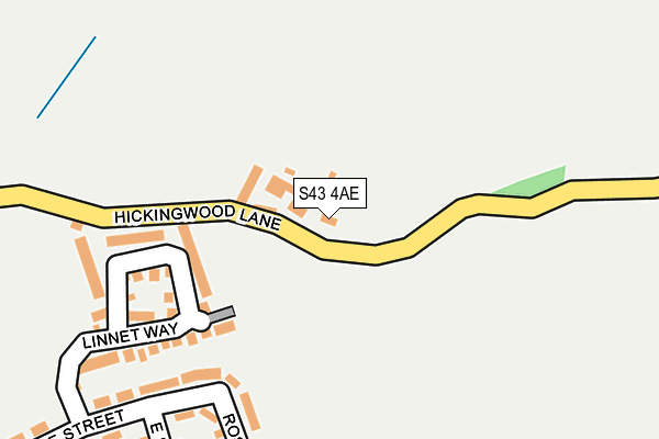
S43 4AE lies on Hickinwood Lane in Clowne, Chesterfield. S43 4AE is located in the Clowne East electoral ward, within the local authority district of Bolsover and the English Parliamentary constituency of Bolsover. The Sub Integrated Care Board (ICB) Location is NHS Derby and Derbyshire ICB - 15M and the police force is Derbyshire. This postcode has been in use since January 1980.


GetTheData
Source: OS OpenMap – Local (Ordnance Survey)
Source: OS VectorMap District (Ordnance Survey)
Licence: Open Government Licence (requires attribution)
| Easting | 450391 |
| Northing | 376297 |
| Latitude | 53.281283 |
| Longitude | -1.245687 |
GetTheData
Source: Open Postcode Geo
Licence: Open Government Licence
| Street | Hickinwood Lane |
| Locality | Clowne |
| Town/City | Chesterfield |
| Country | England |
| Postcode District | S43 |
| ➜ S43 open data dashboard ➜ See where S43 is on a map | |
GetTheData
Source: Land Registry Price Paid Data
Licence: Open Government Licence
Elevation or altitude of S43 4AE as distance above sea level:
| Metres | Feet | |
|---|---|---|
| Elevation | 140m | 459ft |
Elevation is measured from the approximate centre of the postcode, to the nearest point on an OS contour line from OS Terrain 50, which has contour spacing of ten vertical metres.
➜ How high above sea level am I? Find the elevation of your current position using your device's GPS.
GetTheData
Source: Open Postcode Elevation
Licence: Open Government Licence
| Ward | Clowne East |
| Constituency | Bolsover |
GetTheData
Source: ONS Postcode Database
Licence: Open Government Licence
| January 2024 | Criminal damage and arson | On or near Southgate Crescent | 466m |
| June 2022 | Violence and sexual offences | On or near Rose Avenue | 236m |
| June 2022 | Violence and sexual offences | On or near Rose Avenue | 236m |
| ➜ Get more crime data in our Crime section | |||
GetTheData
Source: data.police.uk
Licence: Open Government Licence
| Markland Avenue | Clowne | 398m |
| Clune Street (Wilson Avenue) | Clowne | 448m |
| Duke Street (Creswell Road) | Clowne | 528m |
| Wilson Avenue | Clowne | 532m |
| Duke Street (Creswell Road) | Clowne | 538m |
| Creswell (Derbys) Station | 2.7km |
| Whitwell (Derbys) Station | 3km |
GetTheData
Source: NaPTAN
Licence: Open Government Licence
| Percentage of properties with Next Generation Access | 100.0% |
| Percentage of properties with Superfast Broadband | 100.0% |
| Percentage of properties with Ultrafast Broadband | 0.0% |
| Percentage of properties with Full Fibre Broadband | 0.0% |
Superfast Broadband is between 30Mbps and 300Mbps
Ultrafast Broadband is > 300Mbps
| Percentage of properties unable to receive 2Mbps | 0.0% |
| Percentage of properties unable to receive 5Mbps | 0.0% |
| Percentage of properties unable to receive 10Mbps | 0.0% |
| Percentage of properties unable to receive 30Mbps | 0.0% |
GetTheData
Source: Ofcom
Licence: Ofcom Terms of Use (requires attribution)
GetTheData
Source: ONS Postcode Database
Licence: Open Government Licence


➜ Get more ratings from the Food Standards Agency
GetTheData
Source: Food Standards Agency
Licence: FSA terms & conditions
| Last Collection | |||
|---|---|---|---|
| Location | Mon-Fri | Sat | Distance |
| Ashlea Green | 16:00 | 10:30 | 369m |
| Duke Street | 16:00 | 10:15 | 559m |
| 175 Creswell Road | 16:00 | 10:00 | 659m |
GetTheData
Source: Dracos
Licence: Creative Commons Attribution-ShareAlike
| Facility | Distance |
|---|---|
| Clune Street Recreation Ground Clune Street, Clowne, Chesterfield Grass Pitches | 314m |
| Cawgym (Closed) Mill Street, Clowne, Chesterfield Health and Fitness Gym, Studio | 1.3km |
| Villa Park Recreation Close, Clowne Grass Pitches | 1.4km |
GetTheData
Source: Active Places
Licence: Open Government Licence
| School | Phase of Education | Distance |
|---|---|---|
| Clowne Infant and Nursery School Ringer Lane, Clowne, Chesterfield, S43 4DB | Primary | 1.4km |
| Clowne Junior School King Street, Clowne, Chesterfield, S43 4BS | Primary | 1.4km |
| Heritage High School Boughton Lane, Clowne, Chesterfield, S43 4QG | Secondary | 1.7km |
GetTheData
Source: Edubase
Licence: Open Government Licence
The below table lists the International Territorial Level (ITL) codes (formerly Nomenclature of Territorial Units for Statistics (NUTS) codes) and Local Administrative Units (LAU) codes for S43 4AE:
| ITL 1 Code | Name |
|---|---|
| TLF | East Midlands (England) |
| ITL 2 Code | Name |
| TLF1 | Derbyshire and Nottinghamshire |
| ITL 3 Code | Name |
| TLF12 | East Derbyshire |
| LAU 1 Code | Name |
| E07000033 | Bolsover |
GetTheData
Source: ONS Postcode Directory
Licence: Open Government Licence
The below table lists the Census Output Area (OA), Lower Layer Super Output Area (LSOA), and Middle Layer Super Output Area (MSOA) for S43 4AE:
| Code | Name | |
|---|---|---|
| OA | E00098580 | |
| LSOA | E01019491 | Bolsover 001C |
| MSOA | E02004045 | Bolsover 001 |
GetTheData
Source: ONS Postcode Directory
Licence: Open Government Licence
| S43 4LW | Linnet Way | 187m |
| S43 4NU | Rose Avenue | 229m |
| S43 4NN | Clune Street | 235m |
| S43 4NT | East Street | 279m |
| S43 4NJ | Clune Street | 322m |
| S43 4NW | West Street | 364m |
| S43 4NQ | Jago Avenue | 371m |
| S43 4ND | Jubilee Crescent | 404m |
| S43 4AN | Park View | 427m |
| S43 4NF | Markland Avenue | 427m |
GetTheData
Source: Open Postcode Geo; Land Registry Price Paid Data
Licence: Open Government Licence