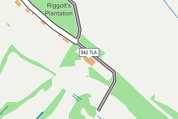
S42 7LA is located in the Brampton & Walton electoral ward, within the local authority district of North East Derbyshire and the English Parliamentary constituency of North East Derbyshire. The Sub Integrated Care Board (ICB) Location is NHS Derby and Derbyshire ICB - 15M and the police force is Derbyshire. This postcode has been in use since January 1980.


GetTheData
Source: OS OpenMap – Local (Ordnance Survey)
Source: OS VectorMap District (Ordnance Survey)
Licence: Open Government Licence (requires attribution)
| Easting | 436936 |
| Northing | 369159 |
| Latitude | 53.218208 |
| Longitude | -1.448302 |
GetTheData
Source: Open Postcode Geo
Licence: Open Government Licence
| Country | England |
| Postcode District | S42 |
| ➜ S42 open data dashboard ➜ See where S42 is on a map ➜ Where is Chesterfield? | |
GetTheData
Source: Land Registry Price Paid Data
Licence: Open Government Licence
Elevation or altitude of S42 7LA as distance above sea level:
| Metres | Feet | |
|---|---|---|
| Elevation | 130m | 427ft |
Elevation is measured from the approximate centre of the postcode, to the nearest point on an OS contour line from OS Terrain 50, which has contour spacing of ten vertical metres.
➜ How high above sea level am I? Find the elevation of your current position using your device's GPS.
GetTheData
Source: Open Postcode Elevation
Licence: Open Government Licence
| Ward | Brampton & Walton |
| Constituency | North East Derbyshire |
GetTheData
Source: ONS Postcode Database
Licence: Open Government Licence
| May 2022 | Other theft | On or near Petrol Station | 312m |
| May 2022 | Other theft | On or near Petrol Station | 312m |
| March 2022 | Shoplifting | On or near Petrol Station | 312m |
| ➜ Get more crime data in our Crime section | |||
GetTheData
Source: data.police.uk
Licence: Open Government Licence
| Blue Stoops (Matlock Road) | Walton | 343m |
| Blue Stoops (Matlock Road) | Walton | 362m |
| Davian Way (Whitecotes Lane) | Walton | 378m |
| Davian Way (Whitecotes Lane) | Walton | 406m |
| Cherry Tree Farm (Matlock Road) | Walton | 636m |
| Chesterfield Station | 2.9km |
GetTheData
Source: NaPTAN
Licence: Open Government Licence
GetTheData
Source: ONS Postcode Database
Licence: Open Government Licence


➜ Get more ratings from the Food Standards Agency
GetTheData
Source: Food Standards Agency
Licence: FSA terms & conditions
| Last Collection | |||
|---|---|---|---|
| Location | Mon-Fri | Sat | Distance |
| Matlock Road | 16:00 | 10:45 | 424m |
| Edwin Avenue | 17:15 | 11:45 | 622m |
| Fairford Close | 17:15 | 11:45 | 694m |
GetTheData
Source: Dracos
Licence: Creative Commons Attribution-ShareAlike
| Facility | Distance |
|---|---|
| Chesterfield Golf Club Matlock Road, Walton Golf | 0m |
| Chesterfield College (Langer Lane) Langer Lane, Birdholme Grass Pitches | 939m |
| Walton Peak Flying High Academy Whitecotes Lane, Chesterfield Grass Pitches | 1km |
GetTheData
Source: Active Places
Licence: Open Government Licence
| School | Phase of Education | Distance |
|---|---|---|
| Walton Peak Flying High Academy Whitecotes Lane, Chesterfield, S40 3HJ | Primary | 1km |
| Spire Nursery and Infant School Derby Road, Chesterfield, S40 2EU | Primary | 1.4km |
| William Rhodes Primary and Nursery School Hunloke Avenue, Boythorpe, Chesterfield, S40 2NR | Primary | 1.4km |
GetTheData
Source: Edubase
Licence: Open Government Licence
The below table lists the International Territorial Level (ITL) codes (formerly Nomenclature of Territorial Units for Statistics (NUTS) codes) and Local Administrative Units (LAU) codes for S42 7LA:
| ITL 1 Code | Name |
|---|---|
| TLF | East Midlands (England) |
| ITL 2 Code | Name |
| TLF1 | Derbyshire and Nottinghamshire |
| ITL 3 Code | Name |
| TLF12 | East Derbyshire |
| LAU 1 Code | Name |
| E07000038 | North East Derbyshire |
GetTheData
Source: ONS Postcode Directory
Licence: Open Government Licence
The below table lists the Census Output Area (OA), Lower Layer Super Output Area (LSOA), and Middle Layer Super Output Area (MSOA) for S42 7LA:
| Code | Name | |
|---|---|---|
| OA | E00100049 | |
| LSOA | E01019772 | North East Derbyshire 008B |
| MSOA | E02004112 | North East Derbyshire 008 |
GetTheData
Source: ONS Postcode Directory
Licence: Open Government Licence
| S42 7LB | Riggotts Lane | 202m |
| S40 3JQ | Matlock Road | 363m |
| S40 3HR | Whitecotes Lane | 371m |
| S40 3EU | Gilbert Avenue | 459m |
| S40 3ET | Lancelot Close | 481m |
| S40 3BT | Walton Road | 503m |
| S40 3BS | Walton Road | 504m |
| S40 3JF | Davian Way | 515m |
| S40 3HT | Ling Road | 547m |
| S40 3JH | Richmond Close | 553m |
GetTheData
Source: Open Postcode Geo; Land Registry Price Paid Data
Licence: Open Government Licence