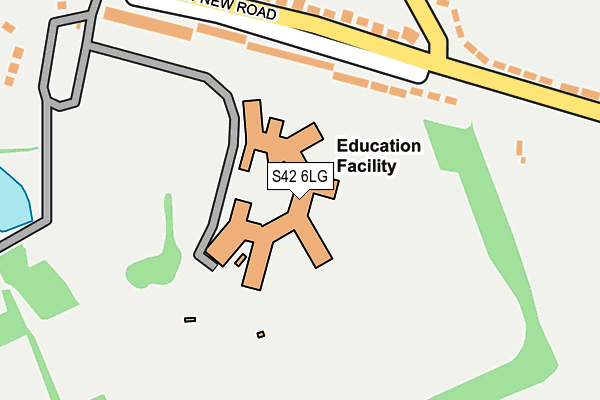
S42 6LG is located in the Tupton electoral ward, within the local authority district of North East Derbyshire and the English Parliamentary constituency of North East Derbyshire. The Sub Integrated Care Board (ICB) Location is NHS Derby and Derbyshire ICB - 15M and the police force is Derbyshire. This postcode has been in use since January 1980.


GetTheData
Source: OS OpenMap – Local (Ordnance Survey)
Source: OS VectorMap District (Ordnance Survey)
Licence: Open Government Licence (requires attribution)
| Easting | 439565 |
| Northing | 365144 |
| Latitude | 53.181931 |
| Longitude | -1.409428 |
GetTheData
Source: Open Postcode Geo
Licence: Open Government Licence
| Country | England |
| Postcode District | S42 |
| ➜ S42 open data dashboard ➜ See where S42 is on a map ➜ Where is Old Tupton? | |
GetTheData
Source: Land Registry Price Paid Data
Licence: Open Government Licence
Elevation or altitude of S42 6LG as distance above sea level:
| Metres | Feet | |
|---|---|---|
| Elevation | 120m | 394ft |
Elevation is measured from the approximate centre of the postcode, to the nearest point on an OS contour line from OS Terrain 50, which has contour spacing of ten vertical metres.
➜ How high above sea level am I? Find the elevation of your current position using your device's GPS.
GetTheData
Source: Open Postcode Elevation
Licence: Open Government Licence
| Ward | Tupton |
| Constituency | North East Derbyshire |
GetTheData
Source: ONS Postcode Database
Licence: Open Government Licence
| June 2022 | Violence and sexual offences | On or near Station New Road | 155m |
| June 2022 | Anti-social behaviour | On or near Wingfield Road | 470m |
| June 2022 | Violence and sexual offences | On or near Brassington Lane | 480m |
| ➜ Get more crime data in our Crime section | |||
GetTheData
Source: data.police.uk
Licence: Open Government Licence
| Station New Road | Tupton | 169m |
| Station New Road | Tupton | 176m |
| Wingfield Road (Station New Road) | Tupton | 235m |
| Wingfield Road (Station New Road) | Tupton | 240m |
| Ford Street (Redfern Street) | Tupton | 260m |
GetTheData
Source: NaPTAN
Licence: Open Government Licence
GetTheData
Source: ONS Postcode Database
Licence: Open Government Licence


➜ Get more ratings from the Food Standards Agency
GetTheData
Source: Food Standards Agency
Licence: FSA terms & conditions
| Last Collection | |||
|---|---|---|---|
| Location | Mon-Fri | Sat | Distance |
| 56 Wingfield Road | 16:00 | 10:30 | 417m |
| Station Road | 16:00 | 09:30 | 529m |
| Royal Oak | 16:00 | 10:15 | 665m |
GetTheData
Source: Dracos
Licence: Creative Commons Attribution-ShareAlike
| Facility | Distance |
|---|---|
| Tupton Hall School Old Tupton, Chesterfield Sports Hall, Athletics, Health and Fitness Gym, Artificial Grass Pitch, Grass Pitches, Studio, Outdoor Tennis Courts | 0m |
| Clay Cross Works Cricket Club (Closed) Clay Cross, Chesterfield Grass Pitches | 828m |
| Tupton Primary School Queen Victoria Road, New Tupton, Chesterfield Grass Pitches | 832m |
GetTheData
Source: Active Places
Licence: Open Government Licence
| School | Phase of Education | Distance |
|---|---|---|
| Tupton Hall School Station New Road, Old Tupton, Chesterfield, S42 6LG | Secondary | 0m |
| Tupton Primary and Nursery Academy Queen Victoria Road, New Tupton, Chesterfield, S42 6DY | Primary | 971m |
| North Wingfield Primary and Nursery Academy 80 Chesterfield Road, North Wingfield, S42 5LE | Primary | 1.5km |
GetTheData
Source: Edubase
Licence: Open Government Licence
The below table lists the International Territorial Level (ITL) codes (formerly Nomenclature of Territorial Units for Statistics (NUTS) codes) and Local Administrative Units (LAU) codes for S42 6LG:
| ITL 1 Code | Name |
|---|---|
| TLF | East Midlands (England) |
| ITL 2 Code | Name |
| TLF1 | Derbyshire and Nottinghamshire |
| ITL 3 Code | Name |
| TLF12 | East Derbyshire |
| LAU 1 Code | Name |
| E07000038 | North East Derbyshire |
GetTheData
Source: ONS Postcode Directory
Licence: Open Government Licence
The below table lists the Census Output Area (OA), Lower Layer Super Output Area (LSOA), and Middle Layer Super Output Area (MSOA) for S42 6LG:
| Code | Name | |
|---|---|---|
| OA | E00100328 | |
| LSOA | E01019825 | North East Derbyshire 011F |
| MSOA | E02004115 | North East Derbyshire 011 |
GetTheData
Source: ONS Postcode Directory
Licence: Open Government Licence
| S42 6DD | Station New Road | 147m |
| S42 6DE | Station New Road | 207m |
| S42 6XY | Wingfield Road | 229m |
| S42 6YQ | Redfern Street | 266m |
| S42 6YH | Redfern Street | 301m |
| S42 6DB | Station New Road | 303m |
| S42 6ER | Park Road | 376m |
| S42 6DG | Station New Road | 381m |
| S42 6DF | Station New Road | 387m |
| S42 6YN | Ford Street | 434m |
GetTheData
Source: Open Postcode Geo; Land Registry Price Paid Data
Licence: Open Government Licence