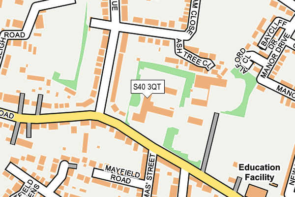
S40 3QT is located in the Brampton West & Loundsley Green electoral ward, within the local authority district of Chesterfield and the English Parliamentary constituency of Chesterfield. The Sub Integrated Care Board (ICB) Location is NHS Derby and Derbyshire ICB - 15M and the police force is Derbyshire. This postcode has been in use since January 1993.


GetTheData
Source: OS OpenMap – Local (Ordnance Survey)
Source: OS VectorMap District (Ordnance Survey)
Licence: Open Government Licence (requires attribution)
| Easting | 436232 |
| Northing | 371102 |
| Latitude | 53.235721 |
| Longitude | -1.458624 |
GetTheData
Source: Open Postcode Geo
Licence: Open Government Licence
| Country | England |
| Postcode District | S40 |
| ➜ S40 open data dashboard ➜ See where S40 is on a map ➜ Where is Chesterfield? | |
GetTheData
Source: Land Registry Price Paid Data
Licence: Open Government Licence
Elevation or altitude of S40 3QT as distance above sea level:
| Metres | Feet | |
|---|---|---|
| Elevation | 110m | 361ft |
Elevation is measured from the approximate centre of the postcode, to the nearest point on an OS contour line from OS Terrain 50, which has contour spacing of ten vertical metres.
➜ How high above sea level am I? Find the elevation of your current position using your device's GPS.
GetTheData
Source: Open Postcode Elevation
Licence: Open Government Licence
| Ward | Brampton West & Loundsley Green |
| Constituency | Chesterfield |
GetTheData
Source: ONS Postcode Database
Licence: Open Government Licence
| January 2024 | Vehicle crime | On or near Netherleigh Road | 257m |
| January 2024 | Vehicle crime | On or near Netherleigh Road | 257m |
| March 2023 | Violence and sexual offences | On or near Alford Close | 231m |
| ➜ Get more crime data in our Crime section | |||
GetTheData
Source: data.police.uk
Licence: Open Government Licence
| Ashgate Avenue (Old Road) | Brampton | 75m |
| St Thomas Street (Old Road) | Brampton | 124m |
| Ashgate Avenue (Old Road) | Brampton | 187m |
| Old Hall Junior School (Old Road) | Brampton | 235m |
| Old Hall Junior School (Old Road) | Brampton | 302m |
| Chesterfield Station | 2.6km |
GetTheData
Source: NaPTAN
Licence: Open Government Licence
GetTheData
Source: ONS Postcode Database
Licence: Open Government Licence


➜ Get more ratings from the Food Standards Agency
GetTheData
Source: Food Standards Agency
Licence: FSA terms & conditions
| Last Collection | |||
|---|---|---|---|
| Location | Mon-Fri | Sat | Distance |
| St Thomas Street | 17:00 | 11:00 | 127m |
| Churston Road | 18:30 | 11:15 | 440m |
| Ashgate Avenue | 17:00 | 08:30 | 448m |
GetTheData
Source: Dracos
Licence: Creative Commons Attribution-ShareAlike
| Facility | Distance |
|---|---|
| Princes Sports Club @themanor Old Road, Chesterfield Swimming Pool, Health and Fitness Gym, Studio, Squash Courts, Outdoor Tennis Courts | 123m |
| Old Hall Junior School Old Road, Chesterfield Grass Pitches | 291m |
| Wasps Nest Playing Field (Closed) Newlands Avenue, Chesterfield Grass Pitches | 349m |
GetTheData
Source: Active Places
Licence: Open Government Licence
| School | Phase of Education | Distance |
|---|---|---|
| Old Hall Junior School Old Road, Chesterfield, S40 3QR | Primary | 294m |
| Ashgate Croft School Ashgate Road, Chesterfield, S40 4BN | Not applicable | 558m |
| Westfield Infant School Vincent Crescent, Brampton, Chesterfield, S40 3NW | Primary | 561m |
GetTheData
Source: Edubase
Licence: Open Government Licence
The below table lists the International Territorial Level (ITL) codes (formerly Nomenclature of Territorial Units for Statistics (NUTS) codes) and Local Administrative Units (LAU) codes for S40 3QT:
| ITL 1 Code | Name |
|---|---|
| TLF | East Midlands (England) |
| ITL 2 Code | Name |
| TLF1 | Derbyshire and Nottinghamshire |
| ITL 3 Code | Name |
| TLF12 | East Derbyshire |
| LAU 1 Code | Name |
| E07000034 | Chesterfield |
GetTheData
Source: ONS Postcode Directory
Licence: Open Government Licence
The below table lists the Census Output Area (OA), Lower Layer Super Output Area (LSOA), and Middle Layer Super Output Area (MSOA) for S40 3QT:
| Code | Name | |
|---|---|---|
| OA | E00099087 | |
| LSOA | E01019590 | Chesterfield 009D |
| MSOA | E02004063 | Chesterfield 009 |
GetTheData
Source: ONS Postcode Directory
Licence: Open Government Licence
| S40 1RZ | Ash Tree Close | 118m |
| S40 1JB | Ashgate Avenue | 121m |
| S40 3QR | Old Road | 123m |
| S40 3QW | Old Road | 138m |
| S40 1HZ | Manor Road | 155m |
| S40 3QX | Old Road | 159m |
| S40 3QN | Old Road | 163m |
| S40 3AH | St Thomas Street | 186m |
| S40 3AJ | Mayfield Road | 190m |
| S40 3SJ | Greengate Close | 220m |
GetTheData
Source: Open Postcode Geo; Land Registry Price Paid Data
Licence: Open Government Licence