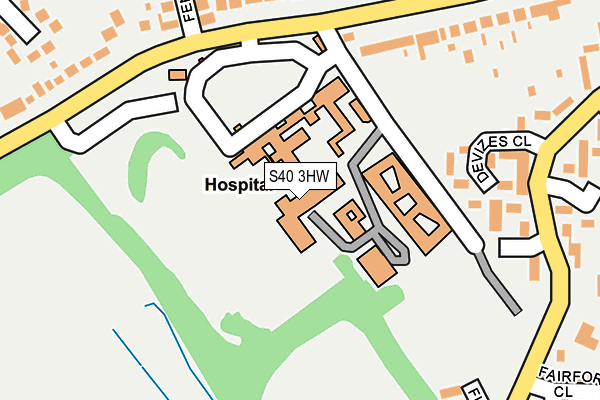
S40 3HW is located in the Walton electoral ward, within the local authority district of Chesterfield and the English Parliamentary constituency of Chesterfield. The Sub Integrated Care Board (ICB) Location is NHS Derby and Derbyshire ICB - 15M and the police force is Derbyshire. This postcode has been in use since January 1980.


GetTheData
Source: OS OpenMap – Local (Ordnance Survey)
Source: OS VectorMap District (Ordnance Survey)
Licence: Open Government Licence (requires attribution)
| Easting | 437362 |
| Northing | 369505 |
| Latitude | 53.221288 |
| Longitude | -1.441882 |
GetTheData
Source: Open Postcode Geo
Licence: Open Government Licence
| Country | England |
| Postcode District | S40 |
| ➜ S40 open data dashboard ➜ See where S40 is on a map ➜ Where is Chesterfield? | |
GetTheData
Source: Land Registry Price Paid Data
Licence: Open Government Licence
Elevation or altitude of S40 3HW as distance above sea level:
| Metres | Feet | |
|---|---|---|
| Elevation | 130m | 427ft |
Elevation is measured from the approximate centre of the postcode, to the nearest point on an OS contour line from OS Terrain 50, which has contour spacing of ten vertical metres.
➜ How high above sea level am I? Find the elevation of your current position using your device's GPS.
GetTheData
Source: Open Postcode Elevation
Licence: Open Government Licence
| Ward | Walton |
| Constituency | Chesterfield |
GetTheData
Source: ONS Postcode Database
Licence: Open Government Licence
| November 2023 | Violence and sexual offences | On or near Harehill Road | 268m |
| November 2023 | Violence and sexual offences | On or near Whitecotes Park | 369m |
| July 2023 | Vehicle crime | On or near Whitecotes Park | 369m |
| ➜ Get more crime data in our Crime section | |||
GetTheData
Source: data.police.uk
Licence: Open Government Licence
| Hospital (Whitecotes Lane) | Walton | 168m |
| Hospital (Whitecotes Lane) | Walton | 184m |
| The Trumpeter (Harehill Road) | Grangewood Farm | 236m |
| The Trumpeter (Harehill Road) | Grangewood Farm | 282m |
| Fairford Close (Harehill Road) | Grangewood Farm | 289m |
| Chesterfield Station | 2.4km |
GetTheData
Source: NaPTAN
Licence: Open Government Licence
GetTheData
Source: ONS Postcode Database
Licence: Open Government Licence


➜ Get more ratings from the Food Standards Agency
GetTheData
Source: Food Standards Agency
Licence: FSA terms & conditions
| Last Collection | |||
|---|---|---|---|
| Location | Mon-Fri | Sat | Distance |
| Fairford Close | 17:15 | 11:45 | 312m |
| Edwin Avenue | 17:15 | 11:45 | 474m |
| Chesterfield Delivery Office | 18:45 | 09:00 | 633m |
GetTheData
Source: Dracos
Licence: Creative Commons Attribution-ShareAlike
| Facility | Distance |
|---|---|
| Walton Peak Flying High Academy Whitecotes Lane, Chesterfield Grass Pitches | 474m |
| Chesterfield Golf Club Matlock Road, Walton Golf | 549m |
| Whitecotes Playing Field Grindlow Avenue, Chesterfield Grass Pitches | 556m |
GetTheData
Source: Active Places
Licence: Open Government Licence
| School | Phase of Education | Distance |
|---|---|---|
| Walton Peak Flying High Academy Whitecotes Lane, Chesterfield, S40 3HJ | Primary | 474m |
| Spire Nursery and Infant School Derby Road, Chesterfield, S40 2EU | Primary | 949m |
| William Rhodes Primary and Nursery School Hunloke Avenue, Boythorpe, Chesterfield, S40 2NR | Primary | 961m |
GetTheData
Source: Edubase
Licence: Open Government Licence
The below table lists the International Territorial Level (ITL) codes (formerly Nomenclature of Territorial Units for Statistics (NUTS) codes) and Local Administrative Units (LAU) codes for S40 3HW:
| ITL 1 Code | Name |
|---|---|
| TLF | East Midlands (England) |
| ITL 2 Code | Name |
| TLF1 | Derbyshire and Nottinghamshire |
| ITL 3 Code | Name |
| TLF12 | East Derbyshire |
| LAU 1 Code | Name |
| E07000034 | Chesterfield |
GetTheData
Source: ONS Postcode Directory
Licence: Open Government Licence
The below table lists the Census Output Area (OA), Lower Layer Super Output Area (LSOA), and Middle Layer Super Output Area (MSOA) for S40 3HW:
| Code | Name | |
|---|---|---|
| OA | E00099073 | |
| LSOA | E01019589 | Chesterfield 011D |
| MSOA | E02004065 | Chesterfield 011 |
GetTheData
Source: ONS Postcode Directory
Licence: Open Government Licence
| S40 3HJ | Whitecotes Lane | 205m |
| S40 2UL | Devizes Close | 209m |
| S40 3RH | Fenland Way | 250m |
| S40 3RP | Holbeach Drive | 287m |
| S40 2NG | Harehill Road | 303m |
| S40 3JH | Richmond Close | 316m |
| S40 3SB | Rother Close | 322m |
| S40 3SD | Whitecotes Close | 322m |
| S40 3HL | Whitecotes Lane | 328m |
| S40 3RN | Delph Bank | 330m |
GetTheData
Source: Open Postcode Geo; Land Registry Price Paid Data
Licence: Open Government Licence