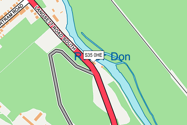
S35 0HE lies on Middlewood Road North in Oughtibridge, Sheffield. S35 0HE is located in the Stannington electoral ward, within the metropolitan district of Sheffield and the English Parliamentary constituency of Sheffield, Hallam. The Sub Integrated Care Board (ICB) Location is NHS South Yorkshire ICB - 03N and the police force is South Yorkshire. This postcode has been in use since June 1997.


GetTheData
Source: OS OpenMap – Local (Ordnance Survey)
Source: OS VectorMap District (Ordnance Survey)
Licence: Open Government Licence (requires attribution)
| Easting | 431463 |
| Northing | 392532 |
| Latitude | 53.428644 |
| Longitude | -1.527951 |
GetTheData
Source: Open Postcode Geo
Licence: Open Government Licence
| Street | Middlewood Road North |
| Locality | Oughtibridge |
| Town/City | Sheffield |
| Country | England |
| Postcode District | S35 |
| ➜ S35 open data dashboard ➜ See where S35 is on a map | |
GetTheData
Source: Land Registry Price Paid Data
Licence: Open Government Licence
Elevation or altitude of S35 0HE as distance above sea level:
| Metres | Feet | |
|---|---|---|
| Elevation | 80m | 262ft |
Elevation is measured from the approximate centre of the postcode, to the nearest point on an OS contour line from OS Terrain 50, which has contour spacing of ten vertical metres.
➜ How high above sea level am I? Find the elevation of your current position using your device's GPS.
GetTheData
Source: Open Postcode Elevation
Licence: Open Government Licence
| Ward | Stannington |
| Constituency | Sheffield, Hallam |
GetTheData
Source: ONS Postcode Database
Licence: Open Government Licence
| June 2022 | Violence and sexual offences | On or near Bertram Road | 306m |
| June 2022 | Public order | On or near Bertram Road | 306m |
| May 2022 | Violence and sexual offences | On or near Bertram Road | 306m |
| ➜ Middlewood Road North crime map and outcomes | |||
GetTheData
Source: data.police.uk
Licence: Open Government Licence
| Bertram Road (Langsett Road South) | Oughtibridge | 316m |
| Birch House Avenue (Langsett Road South) | Oughtibridge | 450m |
| Birch House Avenue (Langsett Road South) | Oughtibridge | 574m |
| Beeley Wood (Middlewood Road North) | Middlewood | 666m |
| Beeley Wood (Middlewood Road North) | Middlewood | 674m |
| Middlewood (Sheffield Supertram) (Middlewood Road) | Middlewood | 1,853m |
| Chapeltown Station | 5.6km |
GetTheData
Source: NaPTAN
Licence: Open Government Licence
| Percentage of properties with Next Generation Access | 100.0% |
| Percentage of properties with Superfast Broadband | 100.0% |
| Percentage of properties with Ultrafast Broadband | 0.0% |
| Percentage of properties with Full Fibre Broadband | 0.0% |
Superfast Broadband is between 30Mbps and 300Mbps
Ultrafast Broadband is > 300Mbps
| Percentage of properties unable to receive 2Mbps | 0.0% |
| Percentage of properties unable to receive 5Mbps | 0.0% |
| Percentage of properties unable to receive 10Mbps | 0.0% |
| Percentage of properties unable to receive 30Mbps | 0.0% |
GetTheData
Source: Ofcom
Licence: Ofcom Terms of Use (requires attribution)
GetTheData
Source: ONS Postcode Database
Licence: Open Government Licence

➜ Get more ratings from the Food Standards Agency
GetTheData
Source: Food Standards Agency
Licence: FSA terms & conditions
| Last Collection | |||
|---|---|---|---|
| Location | Mon-Fri | Sat | Distance |
| 178 Langsett Road South | 18:30 | 12:15 | 436m |
| 360 Middlewood Road North | 18:30 | 12:15 | 803m |
| Worrall Post Office | 17:00 | 12:20 | 836m |
GetTheData
Source: Dracos
Licence: Creative Commons Attribution-ShareAlike
| Facility | Distance |
|---|---|
| Oughtibridge War Memorial Sports Club Waterside Gardens, Oughtibridge, Sheffield Grass Pitches | 877m |
| Oughtibridge Primary School Naylor Road, Oughtibridge, Sheffield Grass Pitches, Sports Hall | 1.1km |
| Forge Lane Sports Ground Forge Lane, Oughtibridge, Sheffield Grass Pitches | 1.3km |
GetTheData
Source: Active Places
Licence: Open Government Licence
| School | Phase of Education | Distance |
|---|---|---|
| Oughtibridge Primary School Naylor Road, Oughtibridge, Sheffield, S35 0HG | Primary | 1km |
| Bradfield School Kirk Edge Road, Sheffield, S35 0AE | Secondary | 1.4km |
| Marlcliffe Community Primary School Marlcliffe Road, Sheffield, S6 4AJ | Primary | 2km |
GetTheData
Source: Edubase
Licence: Open Government Licence
The below table lists the International Territorial Level (ITL) codes (formerly Nomenclature of Territorial Units for Statistics (NUTS) codes) and Local Administrative Units (LAU) codes for S35 0HE:
| ITL 1 Code | Name |
|---|---|
| TLE | Yorkshire and The Humber |
| ITL 2 Code | Name |
| TLE3 | South Yorkshire |
| ITL 3 Code | Name |
| TLE32 | Sheffield |
| LAU 1 Code | Name |
| E08000019 | Sheffield |
GetTheData
Source: ONS Postcode Directory
Licence: Open Government Licence
The below table lists the Census Output Area (OA), Lower Layer Super Output Area (LSOA), and Middle Layer Super Output Area (MSOA) for S35 0HE:
| Code | Name | |
|---|---|---|
| OA | E00041190 | |
| LSOA | E01033280 | Sheffield 008G |
| MSOA | E02001618 | Sheffield 008 |
GetTheData
Source: ONS Postcode Directory
Licence: Open Government Licence
| S35 0AY | Mowson Lane | 283m |
| S35 0FF | Bertram Road | 304m |
| S35 0GU | Hope Road | 380m |
| S35 0HB | Langsett Road South | 390m |
| S35 0FD | Beely Road | 401m |
| S35 0GJ | Greeton Drive | 458m |
| S35 0AD | Mowson Hollow | 463m |
| S35 0FG | Birch Grove | 502m |
| S35 0AW | Oakwood Crescent | 533m |
| S35 0FA | Ashbourne Grove | 578m |
GetTheData
Source: Open Postcode Geo; Land Registry Price Paid Data
Licence: Open Government Licence