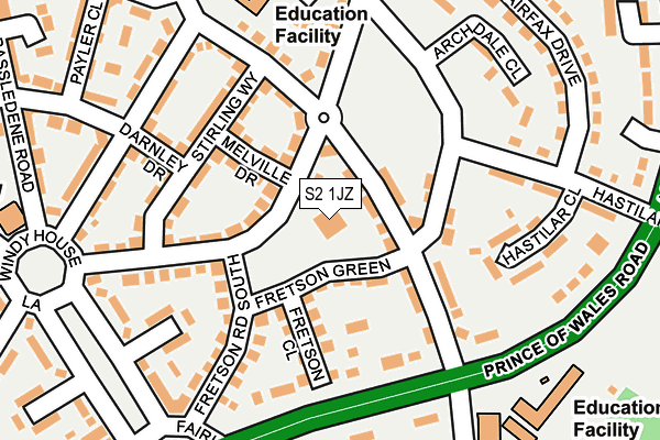
S2 1JZ is located in the Manor Castle electoral ward, within the metropolitan district of Sheffield and the English Parliamentary constituency of Sheffield Central. The Sub Integrated Care Board (ICB) Location is NHS South Yorkshire ICB - 03N and the police force is South Yorkshire. This postcode has been in use since January 1980.


GetTheData
Source: OS OpenMap – Local (Ordnance Survey)
Source: OS VectorMap District (Ordnance Survey)
Licence: Open Government Licence (requires attribution)
| Easting | 438436 |
| Northing | 385616 |
| Latitude | 53.366022 |
| Longitude | -1.423853 |
GetTheData
Source: Open Postcode Geo
Licence: Open Government Licence
| Country | England |
| Postcode District | S2 |
| ➜ S2 open data dashboard ➜ See where S2 is on a map ➜ Where is Sheffield? | |
GetTheData
Source: Land Registry Price Paid Data
Licence: Open Government Licence
Elevation or altitude of S2 1JZ as distance above sea level:
| Metres | Feet | |
|---|---|---|
| Elevation | 170m | 558ft |
Elevation is measured from the approximate centre of the postcode, to the nearest point on an OS contour line from OS Terrain 50, which has contour spacing of ten vertical metres.
➜ How high above sea level am I? Find the elevation of your current position using your device's GPS.
GetTheData
Source: Open Postcode Elevation
Licence: Open Government Licence
| Ward | Manor Castle |
| Constituency | Sheffield Central |
GetTheData
Source: ONS Postcode Database
Licence: Open Government Licence
| January 2024 | Criminal damage and arson | On or near Queen Mary Rise | 392m |
| December 2023 | Anti-social behaviour | On or near Queen Mary Rise | 392m |
| December 2023 | Violence and sexual offences | On or near Queen Mary Rise | 392m |
| ➜ Get more crime data in our Crime section | |||
GetTheData
Source: data.police.uk
Licence: Open Government Licence
| Fretson Road South (Wulfric Road) | Manor | 75m |
| Stirling Way (Wulfric Road) | Manor | 130m |
| Queen Mary Road (Prince Of Wales Road) | Manor | 154m |
| Raynald Road (Queen Mary Road) | Manor | 184m |
| Windy House Lane (Queen Mary Road) | Manor | 196m |
| Manor Top - Elm Tree (Sheffield Supertram) (Off Ridgeway Road) | Manor Top | 772m |
| Spring Lane (Sheffield Supertram) (Park Grange Road) | Fairleigh | 990m |
| Darnall Station | 2.2km |
| Sheffield Station | 2.9km |
| Woodhouse Station | 4.4km |
GetTheData
Source: NaPTAN
Licence: Open Government Licence
GetTheData
Source: ONS Postcode Database
Licence: Open Government Licence


➜ Get more ratings from the Food Standards Agency
GetTheData
Source: Food Standards Agency
Licence: FSA terms & conditions
| Last Collection | |||
|---|---|---|---|
| Location | Mon-Fri | Sat | Distance |
| Fretson Road | 18:00 | 09:00 | 148m |
| Manor Post Office | 15:00 | 12:00 | 316m |
| Ulley Road | 18:15 | 10:00 | 704m |
GetTheData
Source: Dracos
Licence: Creative Commons Attribution-ShareAlike
| Facility | Distance |
|---|---|
| St Theresa's Catholic Primary School Prince Of Wales Road, Sheffield Grass Pitches | 260m |
| Woodthorpe Community Primary School Lewis Road, Sheffield Grass Pitches | 646m |
| The Station Gym Pit Lane, Sheffield Health and Fitness Gym | 654m |
GetTheData
Source: Active Places
Licence: Open Government Licence
| School | Phase of Education | Distance |
|---|---|---|
| Archdale School Archdale Road, Sheffield, S2 1PL | Not applicable | 243m |
| St Theresa's Catholic Primary School Prince of Wales Road, Sheffield, S2 1EY | Primary | 258m |
| Prince Edward Primary School Queen Mary Road, Sheffield, S2 1EE | Primary | 584m |
GetTheData
Source: Edubase
Licence: Open Government Licence
The below table lists the International Territorial Level (ITL) codes (formerly Nomenclature of Territorial Units for Statistics (NUTS) codes) and Local Administrative Units (LAU) codes for S2 1JZ:
| ITL 1 Code | Name |
|---|---|
| TLE | Yorkshire and The Humber |
| ITL 2 Code | Name |
| TLE3 | South Yorkshire |
| ITL 3 Code | Name |
| TLE32 | Sheffield |
| LAU 1 Code | Name |
| E08000019 | Sheffield |
GetTheData
Source: ONS Postcode Directory
Licence: Open Government Licence
The below table lists the Census Output Area (OA), Lower Layer Super Output Area (LSOA), and Middle Layer Super Output Area (MSOA) for S2 1JZ:
| Code | Name | |
|---|---|---|
| OA | E00040626 | |
| LSOA | E01008013 | Sheffield 039C |
| MSOA | E02001649 | Sheffield 039 |
GetTheData
Source: ONS Postcode Directory
Licence: Open Government Licence
| S2 1JJ | Queen Mary Road | 42m |
| S2 1JY | Fretson Green | 56m |
| S2 1DZ | Wulfric Road | 86m |
| S2 1DX | Melville Drive | 94m |
| S2 1JX | Fretson Close | 118m |
| S2 1HX | Queen Mary Road | 130m |
| S2 1EZ | Prince Of Wales Road | 139m |
| S2 1DT | Stirling Way | 147m |
| S2 1GW | Wulfric Road | 157m |
| S2 1JW | Fretson Road South | 162m |
GetTheData
Source: Open Postcode Geo; Land Registry Price Paid Data
Licence: Open Government Licence