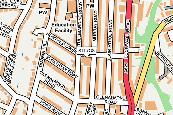
S11 7GS is located in the Ecclesall electoral ward, within the metropolitan district of Sheffield and the English Parliamentary constituency of Sheffield, Hallam. The Sub Integrated Care Board (ICB) Location is NHS South Yorkshire ICB - 03N and the police force is South Yorkshire. This postcode has been in use since January 1980.


GetTheData
Source: OS OpenMap – Local (Ordnance Survey)
Source: OS VectorMap District (Ordnance Survey)
Licence: Open Government Licence (requires attribution)
| Easting | 432686 |
| Northing | 385117 |
| Latitude | 53.361940 |
| Longitude | -1.510310 |
GetTheData
Source: Open Postcode Geo
Licence: Open Government Licence
| Country | England |
| Postcode District | S11 |
| ➜ S11 open data dashboard ➜ See where S11 is on a map ➜ Where is Sheffield? | |
GetTheData
Source: Land Registry Price Paid Data
Licence: Open Government Licence
Elevation or altitude of S11 7GS as distance above sea level:
| Metres | Feet | |
|---|---|---|
| Elevation | 140m | 459ft |
Elevation is measured from the approximate centre of the postcode, to the nearest point on an OS contour line from OS Terrain 50, which has contour spacing of ten vertical metres.
➜ How high above sea level am I? Find the elevation of your current position using your device's GPS.
GetTheData
Source: Open Postcode Elevation
Licence: Open Government Licence
| Ward | Ecclesall |
| Constituency | Sheffield, Hallam |
GetTheData
Source: ONS Postcode Database
Licence: Open Government Licence
| January 2024 | Vehicle crime | On or near Petrol Station | 193m |
| January 2024 | Anti-social behaviour | On or near Petrol Station | 193m |
| December 2023 | Anti-social behaviour | On or near Petrol Station | 193m |
| ➜ Get more crime data in our Crime section | |||
GetTheData
Source: data.police.uk
Licence: Open Government Licence
| Huntingtower Road (Ecclesall Road) | Banner Cross | 132m |
| Huntingtower Road (Ecclesall Road) | Banner Cross | 152m |
| Glenalmond Road (Ecclesall Road) | Banner Cross | 164m |
| Ecclesall Road (Psalter Lane) | Banner Cross | 209m |
| Ecclesall Road (Psalter Lane) | Banner Cross | 215m |
| Sheffield Station | 3.7km |
| Dore & Totley Station | 3.8km |
GetTheData
Source: NaPTAN
Licence: Open Government Licence
GetTheData
Source: ONS Postcode Database
Licence: Open Government Licence


➜ Get more ratings from the Food Standards Agency
GetTheData
Source: Food Standards Agency
Licence: FSA terms & conditions
| Last Collection | |||
|---|---|---|---|
| Location | Mon-Fri | Sat | Distance |
| 81 Glenalmond Road | 17:45 | 09:15 | 166m |
| Banner Cross Post Office | 17:30 | 12:15 | 168m |
| 52 Greystones Road | 17:30 | 09:15 | 236m |
GetTheData
Source: Dracos
Licence: Creative Commons Attribution-ShareAlike
| Facility | Distance |
|---|---|
| Ecclesall Parish Church Halls Ringinglow Road, Sheffield Sports Hall | 530m |
| Ecclesall Lawn Tennis Club Carter Knowle Road, Carter Knowle Road, Sheffield Outdoor Tennis Courts | 669m |
| Hallamshire Tennis & Squash Club Ecclesall Road, Sheffield Health and Fitness Gym, Indoor Tennis Centre, Squash Courts, Studio, Outdoor Tennis Courts | 671m |
GetTheData
Source: Active Places
Licence: Open Government Licence
| School | Phase of Education | Distance |
|---|---|---|
| Greystones Primary School Tullibardine Road, Greystones, Sheffield, S11 7GL | Primary | 181m |
| Ecclesall Primary School High Storrs Road, Ecclesall, Sheffield, S11 7LG | Primary | 703m |
| Hunter's Bar Junior School Sharrow Vale Road, Sheffield, S11 8ZG | Primary | 824m |
GetTheData
Source: Edubase
Licence: Open Government Licence
The below table lists the International Territorial Level (ITL) codes (formerly Nomenclature of Territorial Units for Statistics (NUTS) codes) and Local Administrative Units (LAU) codes for S11 7GS:
| ITL 1 Code | Name |
|---|---|
| TLE | Yorkshire and The Humber |
| ITL 2 Code | Name |
| TLE3 | South Yorkshire |
| ITL 3 Code | Name |
| TLE32 | Sheffield |
| LAU 1 Code | Name |
| E08000019 | Sheffield |
GetTheData
Source: ONS Postcode Directory
Licence: Open Government Licence
The below table lists the Census Output Area (OA), Lower Layer Super Output Area (LSOA), and Middle Layer Super Output Area (MSOA) for S11 7GS:
| Code | Name | |
|---|---|---|
| OA | E00040186 | |
| LSOA | E01007936 | Sheffield 047D |
| MSOA | E02001657 | Sheffield 047 |
GetTheData
Source: ONS Postcode Directory
Licence: Open Government Licence
| S11 7GR | Huntingtower Road | 27m |
| S11 7GN | Tullibardine Road | 75m |
| S11 7GH | Murray Road | 85m |
| S11 7GL | Tullibardine Road | 93m |
| S11 7GD | Blair Athol Road | 93m |
| S11 7GT | Huntingtower Road | 95m |
| S11 7GG | Murray Road | 113m |
| S11 7GU | Strathtay Road | 114m |
| S11 7GF | Murray Road | 128m |
| S11 8TR | Ecclesall Road | 141m |
GetTheData
Source: Open Postcode Geo; Land Registry Price Paid Data
Licence: Open Government Licence