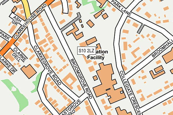
S10 2LZ is located in the Broomhill and Sharrow Vale electoral ward, within the metropolitan district of Sheffield and the English Parliamentary constituency of Sheffield Central. The Sub Integrated Care Board (ICB) Location is NHS South Yorkshire ICB - 03N and the police force is South Yorkshire. This postcode has been in use since January 1980.


GetTheData
Source: OS OpenMap – Local (Ordnance Survey)
Source: OS VectorMap District (Ordnance Survey)
Licence: Open Government Licence (requires attribution)
| Easting | 433807 |
| Northing | 386472 |
| Latitude | 53.374049 |
| Longitude | -1.493322 |
GetTheData
Source: Open Postcode Geo
Licence: Open Government Licence
| Country | England |
| Postcode District | S10 |
| ➜ S10 open data dashboard ➜ See where S10 is on a map ➜ Where is Sheffield? | |
GetTheData
Source: Land Registry Price Paid Data
Licence: Open Government Licence
Elevation or altitude of S10 2LZ as distance above sea level:
| Metres | Feet | |
|---|---|---|
| Elevation | 110m | 361ft |
Elevation is measured from the approximate centre of the postcode, to the nearest point on an OS contour line from OS Terrain 50, which has contour spacing of ten vertical metres.
➜ How high above sea level am I? Find the elevation of your current position using your device's GPS.
GetTheData
Source: Open Postcode Elevation
Licence: Open Government Licence
| Ward | Broomhill And Sharrow Vale |
| Constituency | Sheffield Central |
GetTheData
Source: ONS Postcode Database
Licence: Open Government Licence
| January 2024 | Vehicle crime | On or near Park Crescent | 231m |
| November 2023 | Violence and sexual offences | On or near Clarke Dell | 223m |
| November 2023 | Other theft | On or near Clarke Dell | 223m |
| ➜ Get more crime data in our Crime section | |||
GetTheData
Source: data.police.uk
Licence: Open Government Licence
| Broomgrove Road (Clarkehouse Road) | Broomhill | 183m |
| Clarkehouse Road (Newbould Lane) | Broomhill | 226m |
| Ash Grove (Clarkehouse Road) | Broomhill | 229m |
| Glossop Road (Newbould Lane) | Broomhill | 303m |
| Glossop Road (Clarkehouse Road) | Broomhill | 315m |
| University Of Sheffield (Sheffield Supertram) (Hanover Street) | Western Bank | 964m |
| West Street (Sheffield Supertram) (West Street) | Sheffield Centre | 1,280m |
| Netherthorpe Road (Sheffield Supertram) (Netherthorpe Road) | Netherthorpe | 1,390m |
| City Hall (Sheffield Supertram) (West Street) | Sheffield Centre | 1,610m |
| Sheffield Station | 2.1km |
GetTheData
Source: NaPTAN
Licence: Open Government Licence
GetTheData
Source: ONS Postcode Database
Licence: Open Government Licence


➜ Get more ratings from the Food Standards Agency
GetTheData
Source: Food Standards Agency
Licence: FSA terms & conditions
| Last Collection | |||
|---|---|---|---|
| Location | Mon-Fri | Sat | Distance |
| Clarkehouse Road | 18:30 | 199m | |
| Clarkhouse Road | 17:30 | 10:00 | 199m |
| 23 Collegiate Crescent | 18:00 | 10:00 | 228m |
GetTheData
Source: Dracos
Licence: Creative Commons Attribution-ShareAlike
| Facility | Distance |
|---|---|
| Sheffield Hallam Active (Collegiate Campus) Collegiate Crescent, Sheffield Sports Hall, Health and Fitness Gym, Studio, Squash Courts, Artificial Grass Pitch | 79m |
| King Edwards Swimming Pool Clarkehouse Road, Sheffield Swimming Pool | 253m |
| King Edward Vii School (Upper Site) Glossop Road, Sheffield Sports Hall | 315m |
GetTheData
Source: Active Places
Licence: Open Government Licence
| School | Phase of Education | Distance |
|---|---|---|
| King Edward VII School Glossop Road, Sheffield, S10 2PW | Secondary | 292m |
| Sheffield High School 10 Rutland Park, Sheffield, S10 2PE | Not applicable | 352m |
| Broomhall Nursery School 4 Broomhall Road, Sheffield, S10 2DN | Nursery | 484m |
GetTheData
Source: Edubase
Licence: Open Government Licence
The below table lists the International Territorial Level (ITL) codes (formerly Nomenclature of Territorial Units for Statistics (NUTS) codes) and Local Administrative Units (LAU) codes for S10 2LZ:
| ITL 1 Code | Name |
|---|---|
| TLE | Yorkshire and The Humber |
| ITL 2 Code | Name |
| TLE3 | South Yorkshire |
| ITL 3 Code | Name |
| TLE32 | Sheffield |
| LAU 1 Code | Name |
| E08000019 | Sheffield |
GetTheData
Source: ONS Postcode Directory
Licence: Open Government Licence
The below table lists the Census Output Area (OA), Lower Layer Super Output Area (LSOA), and Middle Layer Super Output Area (MSOA) for S10 2LZ:
| Code | Name | |
|---|---|---|
| OA | E00041104 | |
| LSOA | E01008104 | Sheffield 036E |
| MSOA | E02001646 | Sheffield 036 |
GetTheData
Source: ONS Postcode Directory
Licence: Open Government Licence
| S10 2LR | Broomgrove Road | 84m |
| S10 2NH | Clarkegrove Road | 147m |
| S10 2LQ | Broomgrove Crescent | 158m |
| S10 2BJ | Collegiate Crescent | 158m |
| S10 2NJ | Clarkegrove Road | 171m |
| S10 2LE | Clarkehouse Road | 174m |
| S10 2NR | Clarke Dell | 177m |
| S10 2LG | Clarkehouse Road | 205m |
| S10 2DR | Broomhall Road | 207m |
| S10 2NN | Eastgrove Road | 216m |
GetTheData
Source: Open Postcode Geo; Land Registry Price Paid Data
Licence: Open Government Licence