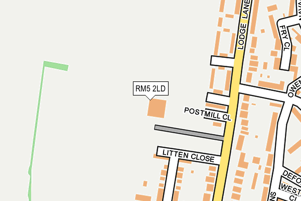
RM5 2LD is located in the Havering-atte-Bower electoral ward, within the London borough of Havering and the English Parliamentary constituency of Romford. The Sub Integrated Care Board (ICB) Location is NHS North East London ICB - A3A8R and the police force is Metropolitan Police. This postcode has been in use since June 1996.


GetTheData
Source: OS OpenMap – Local (Ordnance Survey)
Source: OS VectorMap District (Ordnance Survey)
Licence: Open Government Licence (requires attribution)
| Easting | 549226 |
| Northing | 191825 |
| Latitude | 51.605497 |
| Longitude | 0.153498 |
GetTheData
Source: Open Postcode Geo
Licence: Open Government Licence
| Country | England |
| Postcode District | RM5 |
| ➜ RM5 open data dashboard ➜ See where RM5 is on a map ➜ Where is London? | |
GetTheData
Source: Land Registry Price Paid Data
Licence: Open Government Licence
Elevation or altitude of RM5 2LD as distance above sea level:
| Metres | Feet | |
|---|---|---|
| Elevation | 40m | 131ft |
Elevation is measured from the approximate centre of the postcode, to the nearest point on an OS contour line from OS Terrain 50, which has contour spacing of ten vertical metres.
➜ How high above sea level am I? Find the elevation of your current position using your device's GPS.
GetTheData
Source: Open Postcode Elevation
Licence: Open Government Licence
| Ward | Havering-atte-bower |
| Constituency | Romford |
GetTheData
Source: ONS Postcode Database
Licence: Open Government Licence
| January 2024 | Drugs | On or near Fry Close | 288m |
| October 2023 | Public order | On or near Fry Close | 288m |
| July 2023 | Vehicle crime | On or near Owen Close | 290m |
| ➜ Get more crime data in our Crime section | |||
GetTheData
Source: data.police.uk
Licence: Open Government Licence
| Stapleford Gardens (Lodge Lane) | Collier Row | 153m |
| Stapleford Gardens (Lodge Lane) | Collier Row | 155m |
| Portmore Gardens (Lodge Lane) | Collier Row | 295m |
| Portmore Gardens | Collier Row | 340m |
| Frinton Road (Rm5) (Lodge Lane) | Collier Row | 387m |
| Romford Station | 4km |
| Gidea Park Station | 4.5km |
| Chadwell Heath Station | 4.5km |
GetTheData
Source: NaPTAN
Licence: Open Government Licence
GetTheData
Source: ONS Postcode Database
Licence: Open Government Licence


➜ Get more ratings from the Food Standards Agency
GetTheData
Source: Food Standards Agency
Licence: FSA terms & conditions
| Last Collection | |||
|---|---|---|---|
| Location | Mon-Fri | Sat | Distance |
| Carter Drive | 17:00 | 11:30 | 654m |
| Lynwood Drive | 17:00 | 11:30 | 727m |
| Chase Cross Road | 17:00 | 12:45 | 879m |
GetTheData
Source: Dracos
Licence: Creative Commons Attribution-ShareAlike
| Facility | Distance |
|---|---|
| The Forest Row Centre Lodge Lane, Romford Grass Pitches, Artificial Grass Pitch | 16m |
| North Romford Community Centre Clockhouse Lane, Romford Sports Hall | 890m |
| Oasis Academy Pinewood Thistledene Avenue, Romford Grass Pitches | 923m |
GetTheData
Source: Active Places
Licence: Open Government Licence
| School | Phase of Education | Distance |
|---|---|---|
| Oasis Academy Pinewood Thistledene Avenue, Collier Row, Romford, RM5 2TX | Primary | 817m |
| Clockhouse Primary School Clockhouse Lane, Collier Row, Romford, RM5 3QR | Primary | 839m |
| St Patrick's Catholic Primary School Lowshoe Lane, Collier Row, Romford, RM5 2AP | Primary | 1.1km |
GetTheData
Source: Edubase
Licence: Open Government Licence
The below table lists the International Territorial Level (ITL) codes (formerly Nomenclature of Territorial Units for Statistics (NUTS) codes) and Local Administrative Units (LAU) codes for RM5 2LD:
| ITL 1 Code | Name |
|---|---|
| TLI | London |
| ITL 2 Code | Name |
| TLI5 | Outer London - East and North East |
| ITL 3 Code | Name |
| TLI52 | Barking & Dagenham and Havering |
| LAU 1 Code | Name |
| E09000016 | Havering |
GetTheData
Source: ONS Postcode Directory
Licence: Open Government Licence
The below table lists the Census Output Area (OA), Lower Layer Super Output Area (LSOA), and Middle Layer Super Output Area (MSOA) for RM5 2LD:
| Code | Name | |
|---|---|---|
| OA | E00011508 | |
| LSOA | E01002308 | Havering 005C |
| MSOA | E02000468 | Havering 005 |
GetTheData
Source: ONS Postcode Directory
Licence: Open Government Licence
| RM5 2JT | Stapleford Gardens | 113m |
| RM5 2LG | Litten Close | 133m |
| RM5 2JS | Abridge Gardens | 153m |
| RM5 2JP | Pennington Close | 216m |
| RM5 2EU | Lodge Lane | 223m |
| RM5 2LB | Lodge Lane | 234m |
| RM5 2JX | Udall Gardens | 236m |
| RM5 2QE | Fry Close | 275m |
| RM5 2JU | Turpin Avenue | 296m |
| RM5 2ET | Lodge Lane | 299m |
GetTheData
Source: Open Postcode Geo; Land Registry Price Paid Data
Licence: Open Government Licence